Compare surveys
In survey tools, the function compare points is used to compare topographic points between two survey subprojects. This utility can be used for example to compare coordinates measured in different days, or after different survey calculations.
Click Survey.
Click Tools to open the menu.

Click Compare surveys.
This utility opens a new window.
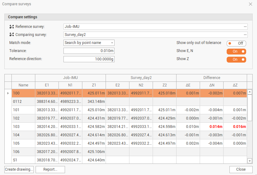
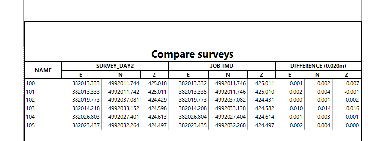
The window shows the comparison between the 2 surveys, and the differences.
Reference survey: the reference survey subproject.
Comparing survey: the survey subproject to compare.
Match point: the method to compare the points.
Search by point name: compares the points with same point name.
Search by distance: compares the points within a radius we have to define.
Tolerance: the tolerance to identify the outliers.
Reference direction: the reference direction for E and N axis.
Show only out of tolerance: shows/hides only points that are out of the tolerance.
Show E,N: shows/hides the coordinates and differences in east and north.
Show Z: shows/hides the coordinate and difference in elevation.
The table shows for each point the coordinates and the differences. Differences out of tolerance are in red.
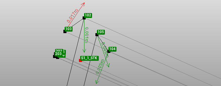
Click Create drawing to create a drawing with differences as vectors.
Click Report to create a report with the differences.