Export data in instrument format
It is possible to export the topographic points of the active survey subproject in the instrument format of different brands which can then be loaded into the controller.
Click File.
Click Create instrument file.
Click Export.
The command opens a new window.
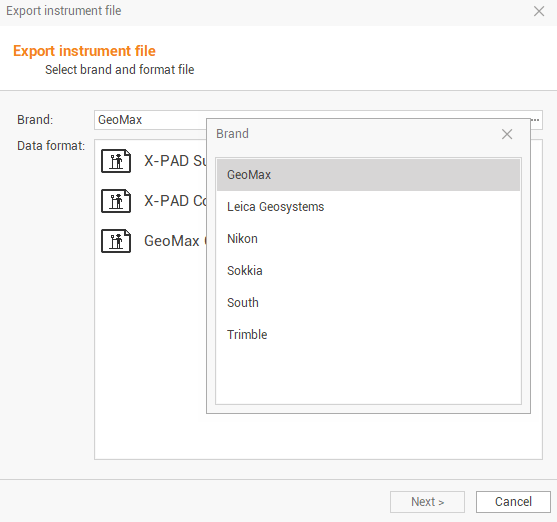
The command requires the following settings:
Brand: to select the instrument brand from a list.
Data format: to select the format of the file to export from a list.
Click Next.
Enter the filename and the export location. Click on
 to select have more export options.
Select if to export Topographic points or Reference points.
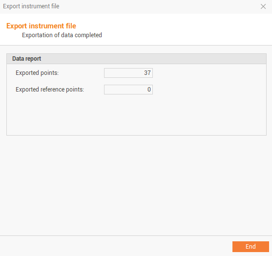
Click Next to confirm and export the points.