GIS data labels
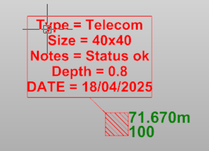
Use the command GIS data labels to create labels on points or position with the GIS features recorded in the field with X-PAD Ultimate GIS module.
These attributes can be included in the final drawing as labels that can be placed close to the corresponding points. Specific GIS label styles can be defined to control how this information is displayed in the drawing.
Click Draw.
Click GIS data.

The command opens a panel on the right.
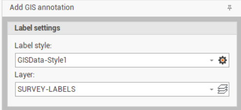
Change the settings in the Label settings panel:
Label style: to select the style from the drop-down menu. Click on the gear icon to open the style settings.
Layer: to select on which layer create the label, in case the label is a Label position.
Click on a point to create a Label point or in a position on CAD to create a Label position.