Inverse
Inverse command is used to calculate azimuth, distance and other topographic information between two points.
Click Survey.
Click Inverse.

Select the distance mode:
2 points: the distance is calculated between 2 points.
Sequential: the distance is calculated between couples of points. The cumulative distance is calculated.
Radial: the distance is calculated between a reference point and a second point. The reference point is not changed.
Select the first point from the CAD.
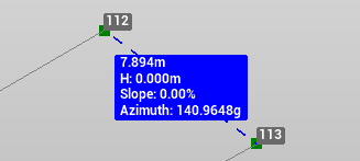
The information about the distance are visualized in real time in CAD.
Select the second point. The annotation shows the distance between the points.
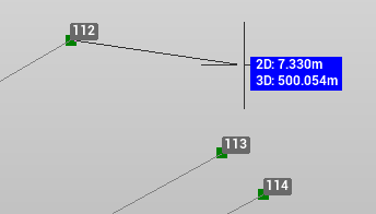
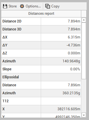
On the Distance panel you can visualize additional information.
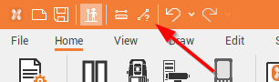
The Inverse function can also be opened from the shortcut in the top bar.
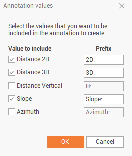
Store annotation values
It is possible to store annotations.
After a distance has been measured with Inverse function, the Inverse panel is opened
Click on Options

Select the values to include in the annotation and click OK
Click on Store to store the annotation label