Level data manager
X-Pad Office Fusion has a complete workspace for the management of leveling data.
Click Survey.
Click Level data manager.

The command opens a new window.
The workspace is divided in the following way:
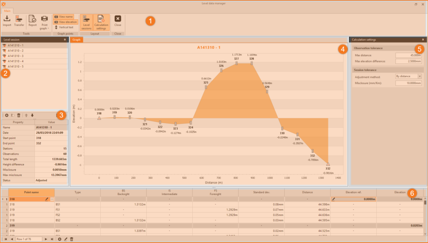
Top bar: menu and main window commands.
Top left panel: contains the list of leveling sessions.
Bottom left panel: contains summary data of the selected leveling session.
Central graphic window: reports the graph of leveling processing.
Right side panel: reports the calculation settings that the program applies.
Bottom panel: reports the leveling data table and allows you to modify the values.
Main menu and commands
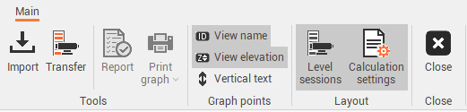
The toolbar is divided into several groups of commands that contain several commands:
Import: import leveling data from an instrument file.
Transfer: transfers data from a digital level.
Report: prints the measurements of the selected session.
Print graph: prints the graph of the selected level session, the print can be done in PDF or sent to the printer. The PDF file is saved in the folder Export of the Document path.
View name: toggles the display of the leveling point name.
View elevation: toggles the display of the leveling point elevation.
Vertical text: toggles the vertical view of point information.
Level sessions: toggles the display of Level sessions panel.
Calculation settings: toggles the display of Calculation settings panel.
Close: closes the Level data manager window.
Level sessions
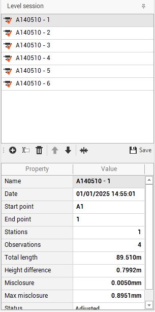
The panel as well as the list of leveling sessions has tools in the lower toolbar that are as follows:
Enter the requested parameters:
Add: adds a level session.
Rename: renames the selected level session.
Delete: deletes the selected level session.
Move: moves the order of level data session.
Merge sessions: if the last point of the current session matches the first point of the next session, it is possible to merge the two sessions in one.
Save: applies the result of the leveling calculation to the elevations of the points in the survey subproject.
Calculation settings
In this panel you can set the parameters that the program applies for the calculation of leveling, the changes to these parameters update in real time the calculation of the leveling.
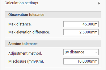
You can manage the following parameters:
Max distance: sets maximum distance for observations, if this is exceeded the program signals it with an icon in the column Distance of the table of observations.
Max elevation difference: sets the maximum allowable elevation difference.
Adjustment method: sets the calculation method that can be run with the following options:
By distance: Distributes proportionally to the length of the leveling sections.
By observation: Distributes the error equally for each leveling section.
Misclosure: sets the maximum error for leveling closure expressed in mm/km.
Leveling data table
The bottom of the Level data manager window is fully occupied by the Leveling data table, as each table in the program can perform editing, inserting, and deleting rows.
Using the edit command, you can also enable or disable the use of the second measure.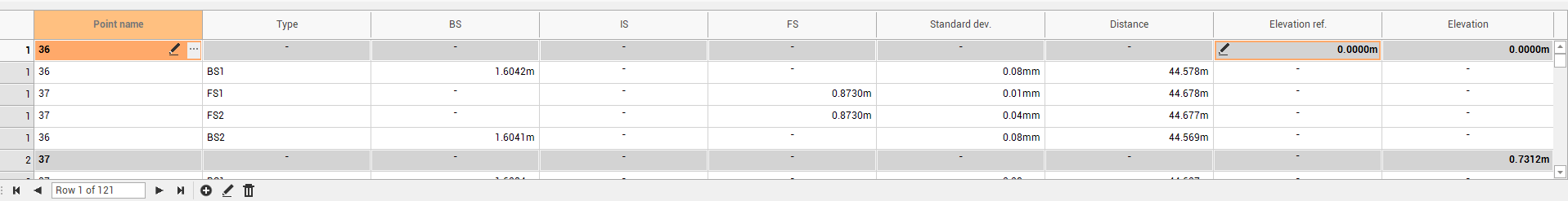
The table contains the following fields:
Point name: the name of the measured point.
Type: the type of measure.
BS Backsight: the difference in altitude between the leveling station and the back point.
IS Intermediate: the difference in altitude between the leveling station and an intermediate point.
FS Foresight: the difference in altitude between the leveling station and the next point.
Standard deviation: the standard deviation with which the instrument has performed the measurement.
Distance: the distance between the station and the measured point.
Elevation ref.: reference dimension for backsight and foresight measurements.
Elevation: the elevation of the point calculated by the adjustment.