Surface settings
The surfaces subproject has several properties and parameters.
Click Surfaces.
Click Settings.

This command opens a new window.
Surface properties allows to change the properties of the active surface subproject.
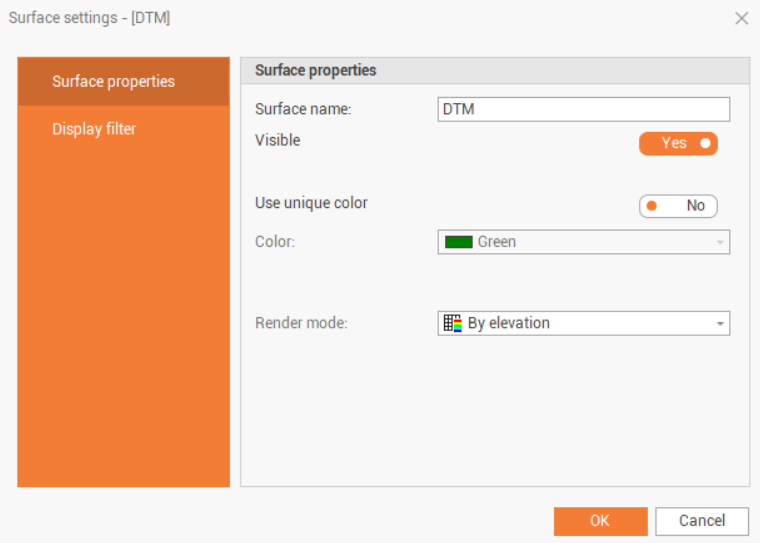
Surface name: the name of the current surface subproject.
Visible: toggles display of subproject entities.
Use unique color: toggles the display of all subproject entities with a chosen color.
Color: sets the color for the displaying of entities.
Render mode: sets the method by which the program should associate the color with triangles. The options are:
Fixed color: applies the standard color settings for the entity.
By elevation: applies the color gradation according to the Elevation colors setting.
True color: if the surface has been colored by texture or by Point clouds you can see the original color.
Texture: applies a texture (raster) to the surface of triangles.
Display filters allow you to show or hide subproject entities without having to turn layers on or off, and unlike layers, they only act on entities of the selected type.
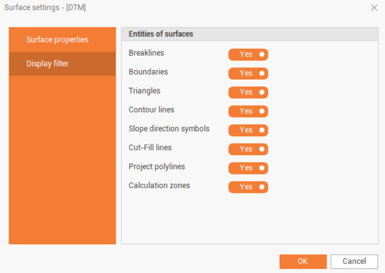
Breaklines: toggles the display of breaklines.
Boundaries: toggles the display of boundary lines.
Triangles: toggles the display of surface triangles.
Contour lines: toggles the display of contour lines.
Slope direction symbols: toggles the display of slope symbols.
Cut-Fill lines: toggles the display of cut-fill lines.
Project polylines: toggles the display of the design polylines.
Calculation zones: toggles the display of the calculation zones.