TPS measurements
The TPS measurements are listed in the Measurements table under TPS. They are grouped by station name.
TPS measurements table
The table contains information on TPS measurements, grouped by station name.
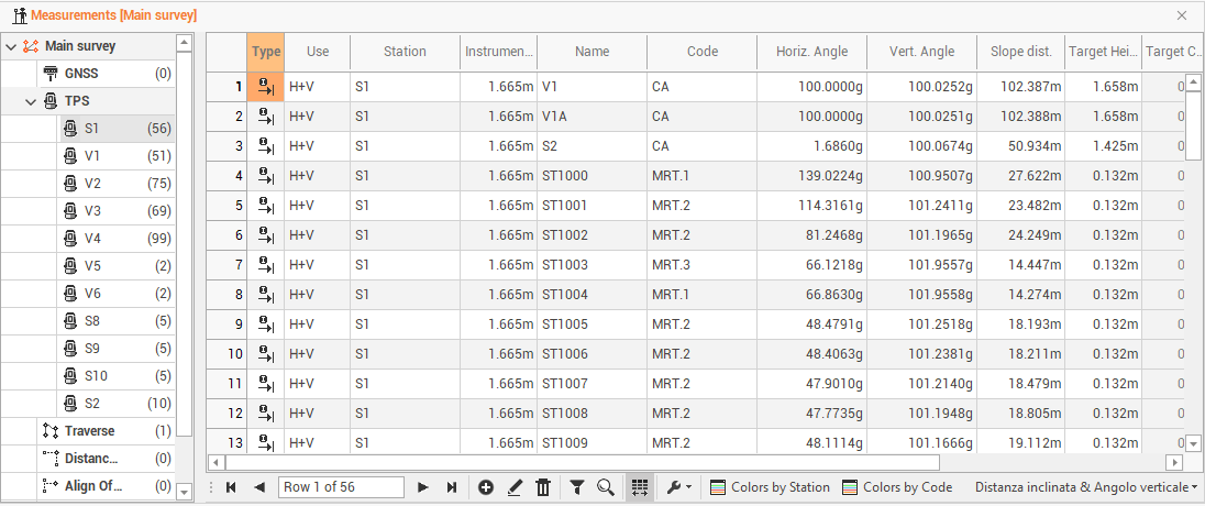
The information available are the following:
Type: the type of measure.
Use: to set the mode in which the program uses the measurement in the calculation of the survey. The option H + V allows the program to use both the horizontal and vertical component of the measurement. The option Only H or Only V They set the use of the measure only as a horizontal measure or only as a vertical one.
Station: the name of the station.
Instrument height: the station’s height.
Name: the name of the point.
Code: the survey code associated with the point surveyed.
Horizontal angle: the horizontal angle of the measure.
Vertical angle: the vertical angle of the measure.
Slope distance: the slope distance of the measure.
Horizontal distance: the horizontal distance of the measure.
Vertical distance: the vertical distance of the measure.
Height target: the target’s height.
Target constant: the target constant used.
Description: the point description.
Date/time: the date and time when the point was measured.
Recording: this box shows if there are voice notes related to the measurement.
In the column Type you can find the following values:
Direct measure: a direct measure to the point.
Offset HA: measurement with angular horizontal offset. Shows the measurements recorded with the angles of the center of the object and the distance measured on the prism. This mode allows to perform a measure to an object for which it’s not possible to position the prism in the point to measure
Offset VA: measure with vertical angle offset. Shows the measurements recorded with the vertical angle of the object center and the distance measured on the prism. This mode allows to perform a measure to a point not accessible by the prism but finding over or under it.
Offset distance: indicates the measurements to which the prism position has been added 3 offsets, for example when you need to perform a measure to a point not accessible by the prism but finding to a certain distance referring to it along the direction station-prism.
Only angle: it specifies measures that have only horizontal and vertical angles and not distance.
F1/F2: it specifies the measures with the two faces and performs the average of the measures.
It is possible to change the display layout of the table from the bottom right button, which allows you to view other data related to TPS measurements.
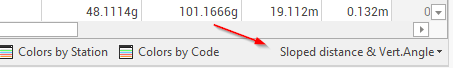
The following options are available:
Slope distance & Vertical angle: to enables the display of the data horizontal angle, vertical angle and slope distance.
Horizontal & Vertical distance: to enable data display horizontal angle, horizontal distance, vertical distance.
Save Layouts as default: to save table layout as default. It means that the settings applied to the layout (position of columns, display of columns etc...) will be applied as default to open tables later.
Restore default Layouts: to allow to undo the changes applied to the table layouts and restore the standard display.
If there are multiple bases, you can view the measurements of each base by expanding the tree node.
The bottom toolbar of the table presents the following commands in addition to the basic commands:
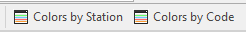
Colors by Station: to set a color to the baselines according to the base name.
Colors by Code: to set a color to the baselines according to the survey code.
Edit TPS measurements
Double-click on a measure or click on Edit to access a specific window that allows the measurement data changing.
The TPS measurement page shows information on the TPS measurement.
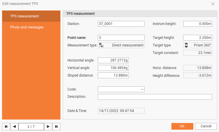
Station: the name of the station.
Instrument height: the station’s height.
Point name: the name of the point.
Target height: the target’s height.
Measurement type: the type of measure.
Target type: the type of target used for the measure.
Target constant: the target constant used.
Horizontal angle: the horizontal angle of the measure.
Vertical angle: the vertical angle of the measure.
Slope distance: the slope distance of the measure.
Horizontal distance: the horizontal distance of the measure.
Height difference: the vertical distance of the measure.
Code: the survey code associated with the measured point.
Description: the point description.
Date/time: the date and time when the point was measured.
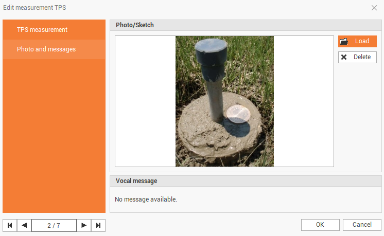
The Photo and messages page shows the photo and vocal message assigned to the point.