Bathymetric survey
 + BATHYMETRY
Bathymetry is a module of X-PAD Ultimate software that enables bathymetric survey by using an echosounder in combination with a GPS receiver or TPS 360° prism.
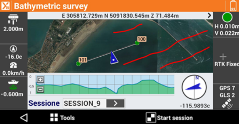
The software is able to connect to the echosounder through Bluetooth or serial cable and receive in real-time the depths. At the same time, the accurate positions are given by the GPS receiver or TPS 360° prism placed just over the echosounder. For TPS, the software keeps the prism locked and stores the points in bathymetric sessions continuously.
It is possible to record automatically positions and depth by defining a time interval, a distance or a depth interval. Current depth and the longitudinal profile of the bottom are displayed in real-time through a specific panel. To be sure to cover the whole area without missing any detail, it is possible to define routes and have all necessary information on the screen to keep the right direction. A route can be a line or a polyline that can be selected on the screen. Another way to define a route is to enter an azimuth value as reference direction to follow.
Collected data can be exported in customisable ASCII format or AutoCAD DXF drawing.