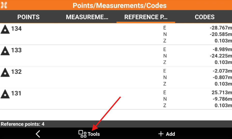
Change reference points visualization
 |
|  |
| 
From the Reference points list page it is possible to change how points are visualized.
Click Job.
Click Points/Measurements/Codes.
Open the Reference points tab.
Click Tools to open the list of available tools.
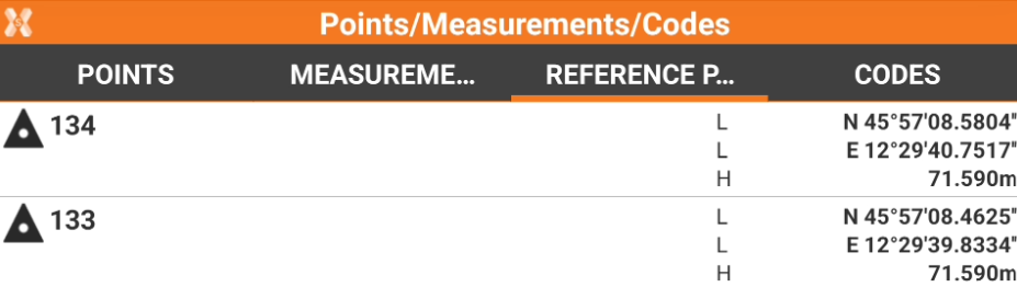
Visualize latitude, longitude and elevation
Click Tools from the Reference points list page.
Click View LLH.
Every point is displayed with geodetic coordinates, if available.
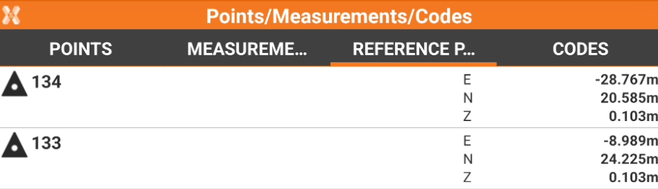
Visualize east, north and elevation
Click Tools from the Reference points list page.
Click View ENZ.
Every point is displayed with plane coordinates., if available.
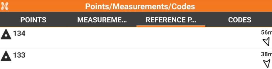
Visualize distance and direction
Click Tools from the Reference points list page.
Click View Distance & Direction.
Every point is displayed with the distance and direction from the current position. For the calculation, the software can use the GPS receiver connected or the GPS inside the TPS.