Creating maps to use in off-line mode
 |
| 
The software allows to save the reference map and the WMS maps visible offline, when an internet connection is not available.
Download maps to be used offline
Select the online map and the WMS to display.
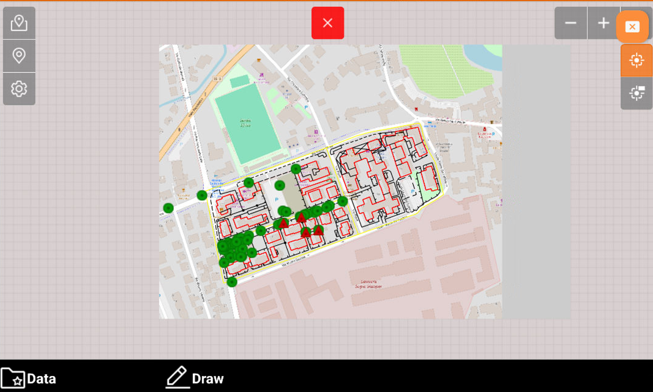
While the maps are visualized in CAD, click Data.
Select Save off-line map.

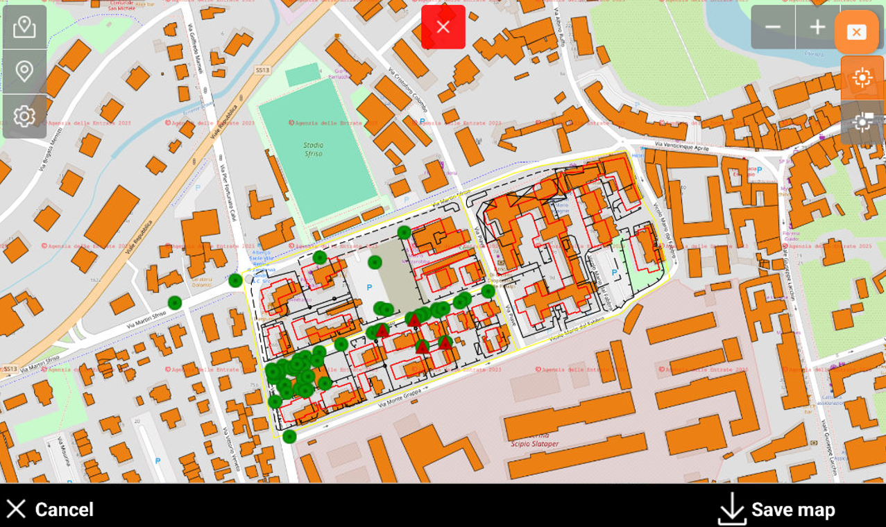
Adjust map area and press Save map button to save the offline map.
Enter the information:

Map name: name for the off-line map.
Zoom Min: minimum zoom level.
Zoom Max: maximum zoom level.
Tiles count: based on the limits of the zone and of the zoom, the number of tiles to be downloaded is calculated.
Create off-line WMS: enables to save the available WFS offline.
The number of tiles can be great and request much time to complete downloading and take up much space on the disk. It is recommended to not exceed in the extension of the required zone and to save only the necessary levels of zoom
The software download the map for the offline use. The download time depends on the number of tiles.
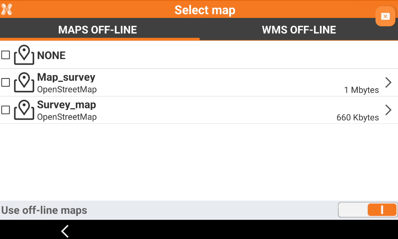
Use an offline map
To use an offline saved map click Map
 to open the map view.
Enables Use off-line maps to visualize available offline maps.
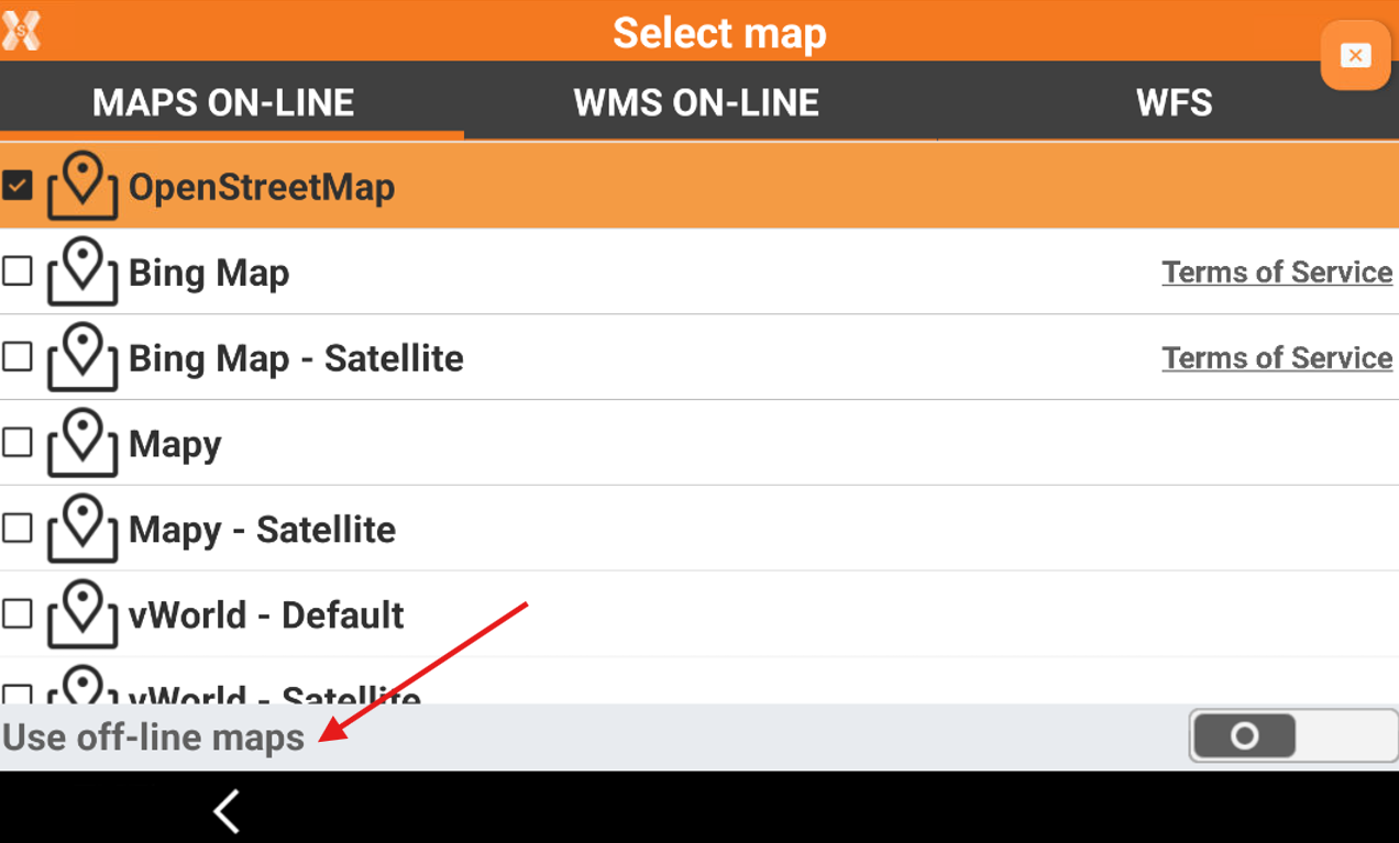
The windows shows the available offline maps and WMS. Click to enable them.
The selected map is visualized in the CAD view.