Edit a measurement
 |
|  |
| 
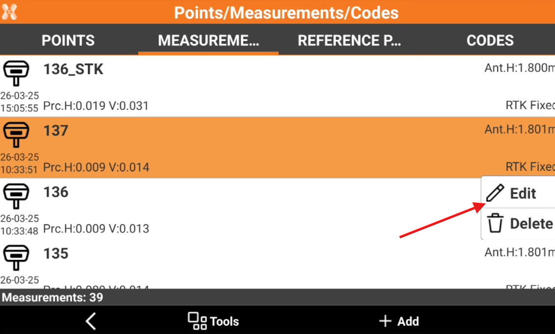
Stored measurements can be edited from the Measurements list.
Click Job.
Click Points/Measurements/Codes.
Open the Measurements tab.
Click on a point and select Edit.
The data of the point is organised in pages.
Point page
Point page include coordinate information of measured point.
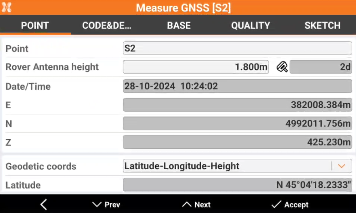
Point: name of the point.
Rover antenna height: GNSS antenna elevation. When the antenna elevation is changed, the corresponding point coordinates are recalculated.
Tilt: in case of use of GNSS receivers with IMU, this field displays the GNSS pole tilt.
Target height: TPS target elevation. When the antenna elevation is changed, the corresponding point coordinates are recalculated.
Date/Time: date and time when the measurement has been performed.
E, N, Z: plane coordinates of the point.
Depth: in case of measure with a vertical offset, the depth shows the vertical offset.
Geodetic coords: allows to choose the format for the WGS84 coordinate.
Latitude, longitude and height: the coordinate is visualized as latitude, longitude and height.
ECEF XYZ: the coordinate is visualized as earth centered coordinate.
Code page
Code & description page shows the properties, as code, description and GIS features.
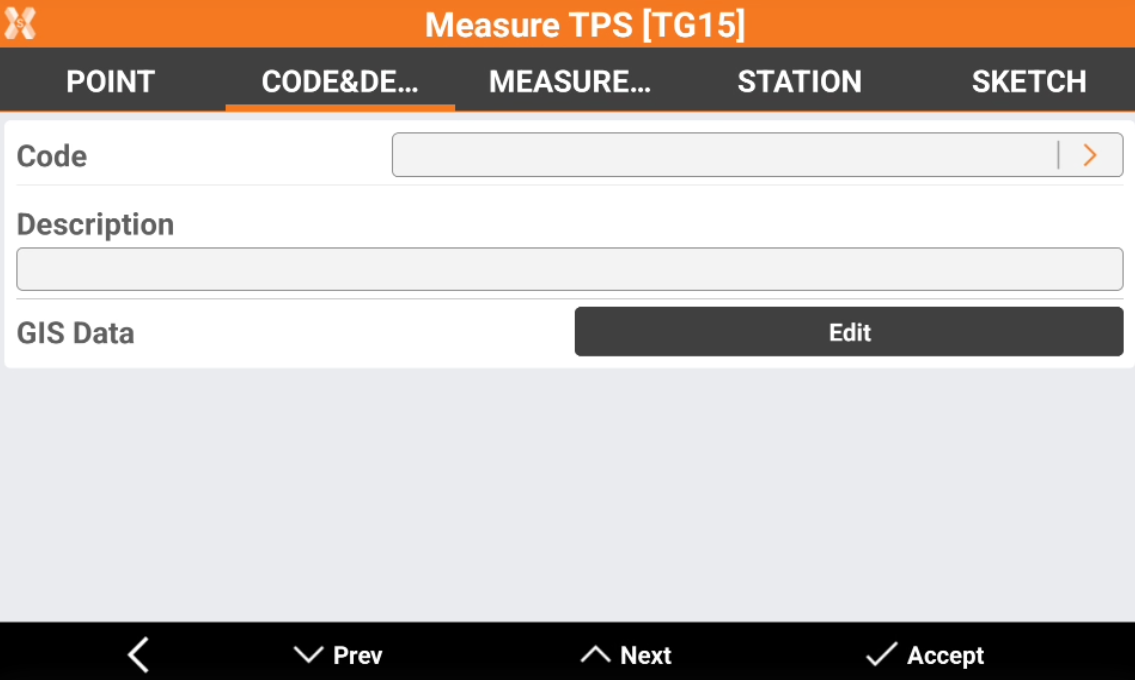
Code: survey code of the point. The icon allows to access the codes library and to select a code from the list.
Description: extended description of the point.
Date: date and time of storing the point.
GIS Data: if the GIS module is activated and one or more codes with GIS information has been associated to the point, the Edit button can be used to insert and modify the corresponding GIS properties.
Station (TPS only)
Station page shows information on the station of the selected TPS measurement.
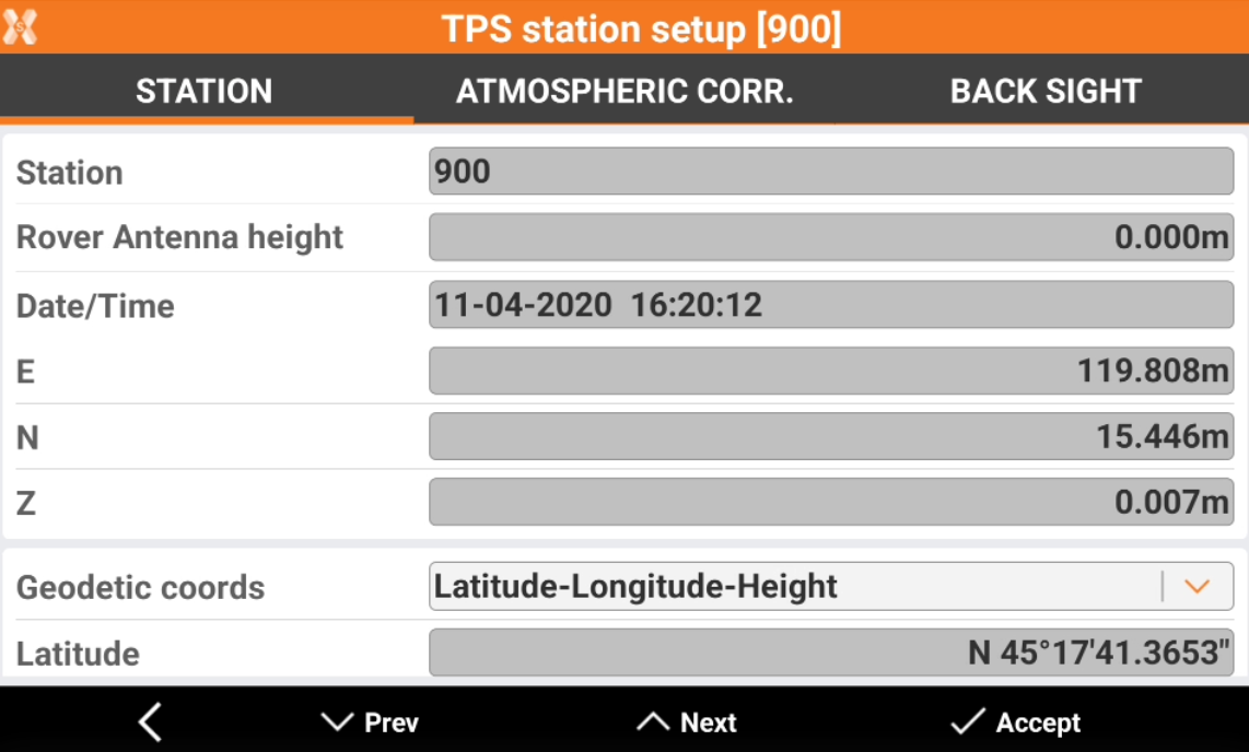
Point: name of the station.
Station height: station elevation.
Date/Time: date and time when the measurement has been performed.
E, N, Z: plane coordinates of the station.
Geodetic coords: allows to choose the format for the WGS84 coordinate.
Latitude, longitude and height: the coordinate is visualized as latitude, longitude and height.
ECEF XYZ: the coordinate is visualized as earth centered coordinate.
Measurement page (TPS only)
Measurement page shows the properties of the measure. The page is available if a measure has been done with a total station.
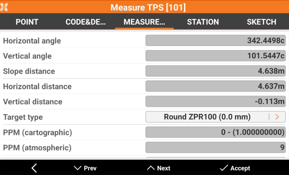
Horizontal angle: the measured horizontal angle.
Vertical angle: the measured vertical angle.
Slope distance: the measured slope distance.
Horizontal distance: the measured horizontal distance.
Vertical distance: the measured vertical distance.
Target type: the type of target used in the measure. Click on the arrow to change the target type used: this operation recalculates the point coordinate.
PPM (cartographic): the combined scale factor for ground to grid reduction used for the measure.
PPM (atmospheric): the atmospheric scale factor used for the measure.
Prism aim mode: the mode used to aim the target.
F1/F2 (TPS only)
This page is available in case of TPS measurements in face I and face II.
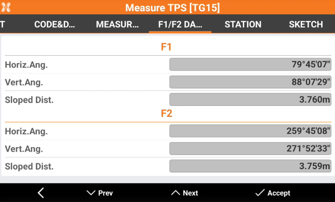
Horiz.Ang.: the horizontal angle measured in face I and in face II.
Vert.Ang.: the vertical angle measured in face I and in face II.
Sloped Dist.: the sloped distance measured in face I and in face II.
Base page (GNSS only)
Base page shows the properties of the GNSS base used for the selected measure.
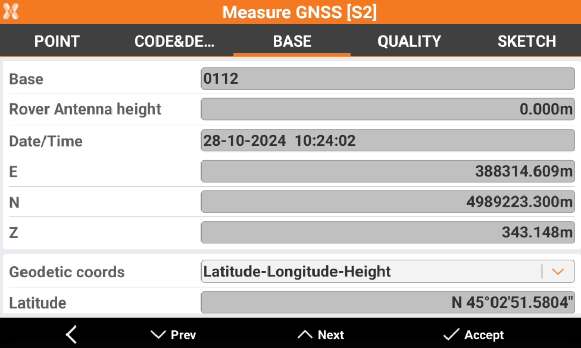
Base: the ID of the base.
Rover Antenna height: the base height from ground point to ARP.
Date/Time: date and time when the measurement has been performed.
E, N, Z: plane coordinates of the coordinate of the base.
Geodetic coords: allows to choose the format for the WGS84 coordinates of the base.
Latitude, longitude and height: the coordinate is visualized as latitude, longitude and height.
ECEF XYZ: the coordinate is visualized as earth centered coordinate.
Quality page (GNSS only)
Quality page shows information on the quality of the GNSS measure.
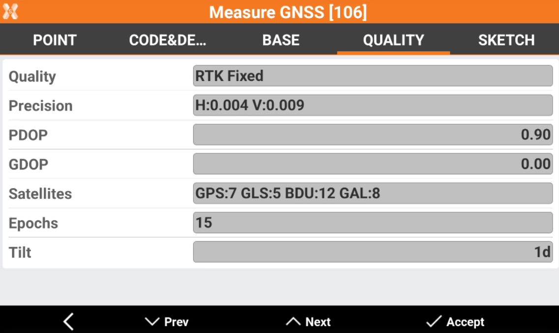
Quality: the quality of the GNSS positioning (RTK fixed, Mobile, Autonomous)
Precision: the estimated positioning error in planimetry and elevation.
PDOP: the calculated PDOP (positional dilution of precision).
GDOP: the calculated GDOP (geometric dilution of precision)
Satellites: the used satellites. The number of satellites is subdivided by GNSS constellation (GPS, GLONASS, Beidou, Galileo).
Epochs: the number of epochs.
Tilt: in case of measure with IMU receiver, this field shows the pole tilt in degrees.
Offset distance (TPS only)
If a point has been measured with distance offset measure, this page is available.
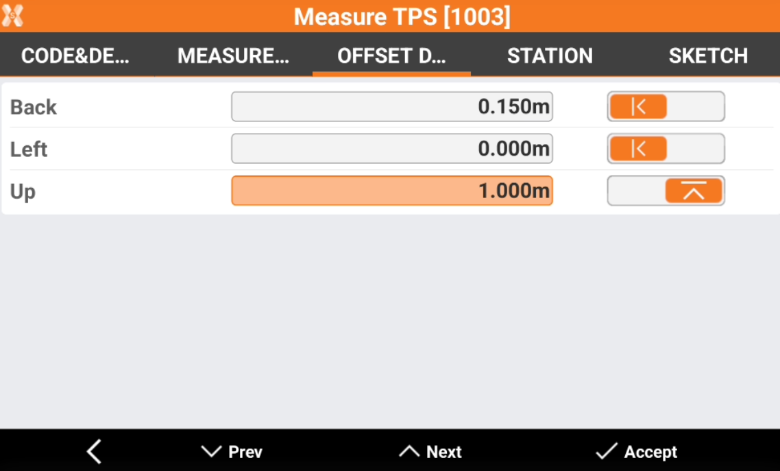
Back/forward: the offset back or forward. Click on the arrow to define if the offset is back or forward.
Left/right: the offset left or right. Click on the arrow to define if the offset is left or right.
Up/down: the offset up or down. Click on the arrow to define if the offset is up or down.
It is possible to change the offset values to recalculate the point coordinate.
Offset (TPS only)
This page is available in case the measurement is a TPS measurement with an angular offset.
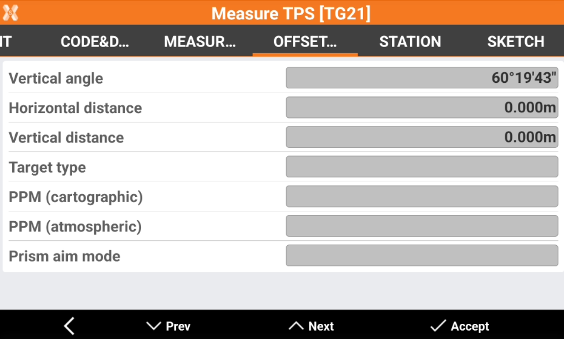
Vertical angle: in case of measurement with vertical angle offset, this field shows the vertical angle measured.
Horizontal angle: in case of measurement with horizontal angle offset, this field shows the vertical angle measured.
Reference (GPS only)
If a point has been measured with offset measurements (for example distance and alignment, or distance-distance), this page is available and shows the information regarding the used reference points.
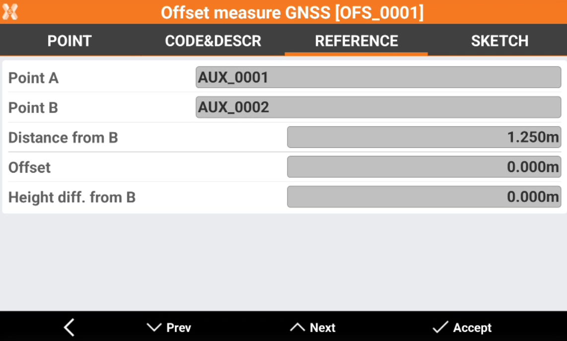
Point A/B: the ID of the auxiliary points used.
Distance from: depending on the method used, the distance from the used auxiliary point.
Offset: depending on the method used, the offset from the used auxiliary point.
Atmospheric corrections (TPS only)
This page is available for TPS stations. It shows the atmospheric corrections used for the measurements from this station and the refraction and sphericity parameters.
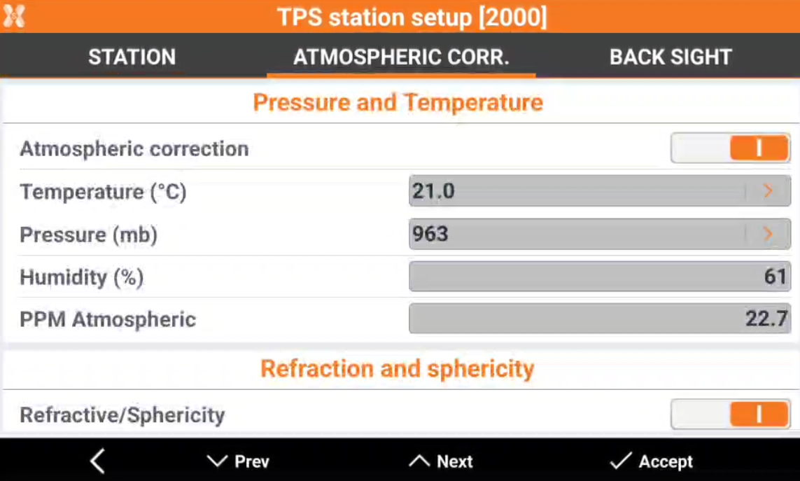
Atmospheric correction: shows if atmospheric corrections was activated or not.
Temperature (°C): value for the temperature in degrees Celsius.
Pressure (mb): value for the pressure in millibar.
Humidity (%): value for humidity in percent.
Atmospheric PPM: the calculated PPM considering all parameters is displayed.
Refraction and sphericity: shows if refraction and sphericity parameters was activated or not.
Refraction coeff.: value for the refraction.
Back sight (TPS only)
This page is available for TPS stations. It shows the used back sight for the orientation.
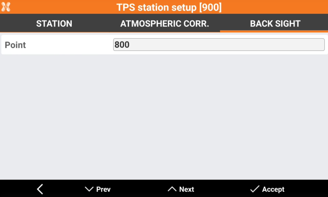
Point: the point ID of the back sight point.
Free station (TPS only)
This page is available for TPS stations in case orientation is a free station. It shows the free station results.
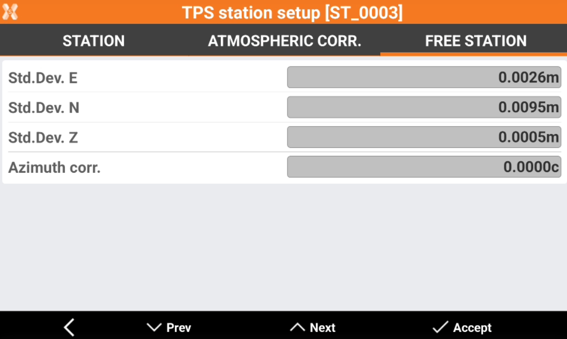
Standard deviation E,N,Z: the value of the standard deviation in east, north and elevation.
Azimuth corr.: the applied azimuth correction.
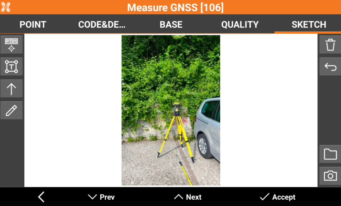
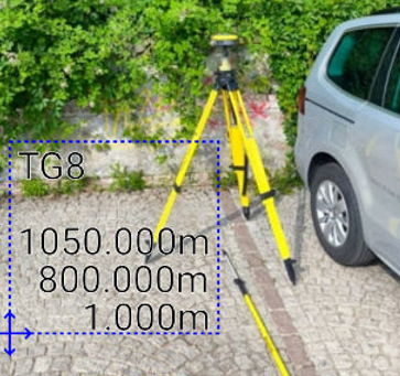
Sketch
Sketch page allows to view the photo assigned to a point, load or take a new photo or draw on the image to have a picture of the topographic point.
: creates a text box with point name, coordinates and codes on the picture. Select and drag
to move the text box.
 : creates a text box with free text. Select and drag
  : creates an arrow. Select and drag
  to rotate the arrow.
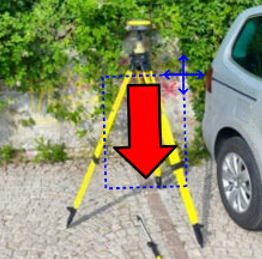
 : enables the free drawing mode.
 : deletes sketch and photo.
 : restores original content
 : loads a photo from the controller internal memory. The image must be in the Images folder and has to be in .jpg or .jpeg format.
 : starts the application allowing to shoot a photo and save it.