GNSS Mock location
 + GNSS MOCK
A mock location is a GNSS location that replaces your device's actual physical location, allowing to use the accurate position from a GNSS receiver in third-party app.
The software, when working with a GNSS receiver, allows to use the actual GNSS receiver as mock location, in order to give access to the precise coordinate to other Android applications.
Select X-PAD Ultimate as mock application in Android
The first step is to select X-PAD Ultimate as mock application in Android developer options.
Verify you are a Developer in Android.
To enable the Developer options in Android, you must be a developer. In most of Android devices this is done clicking 5 times on Build number field in About tablet.
For IMU receivers, the mock location is corrected by the IMU.
In Android Settings select Developer options.
Click Select mock location app.
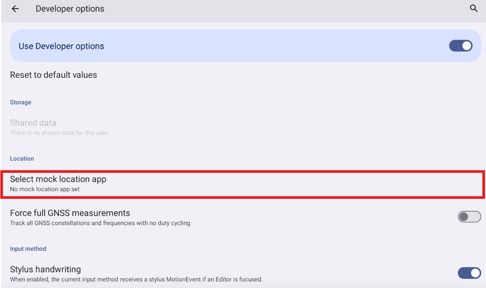
Select X-PAD as mock location app.

Start GNSS Mock location in X-PAD
Configure a GNSS receiver in the X-PAD software.
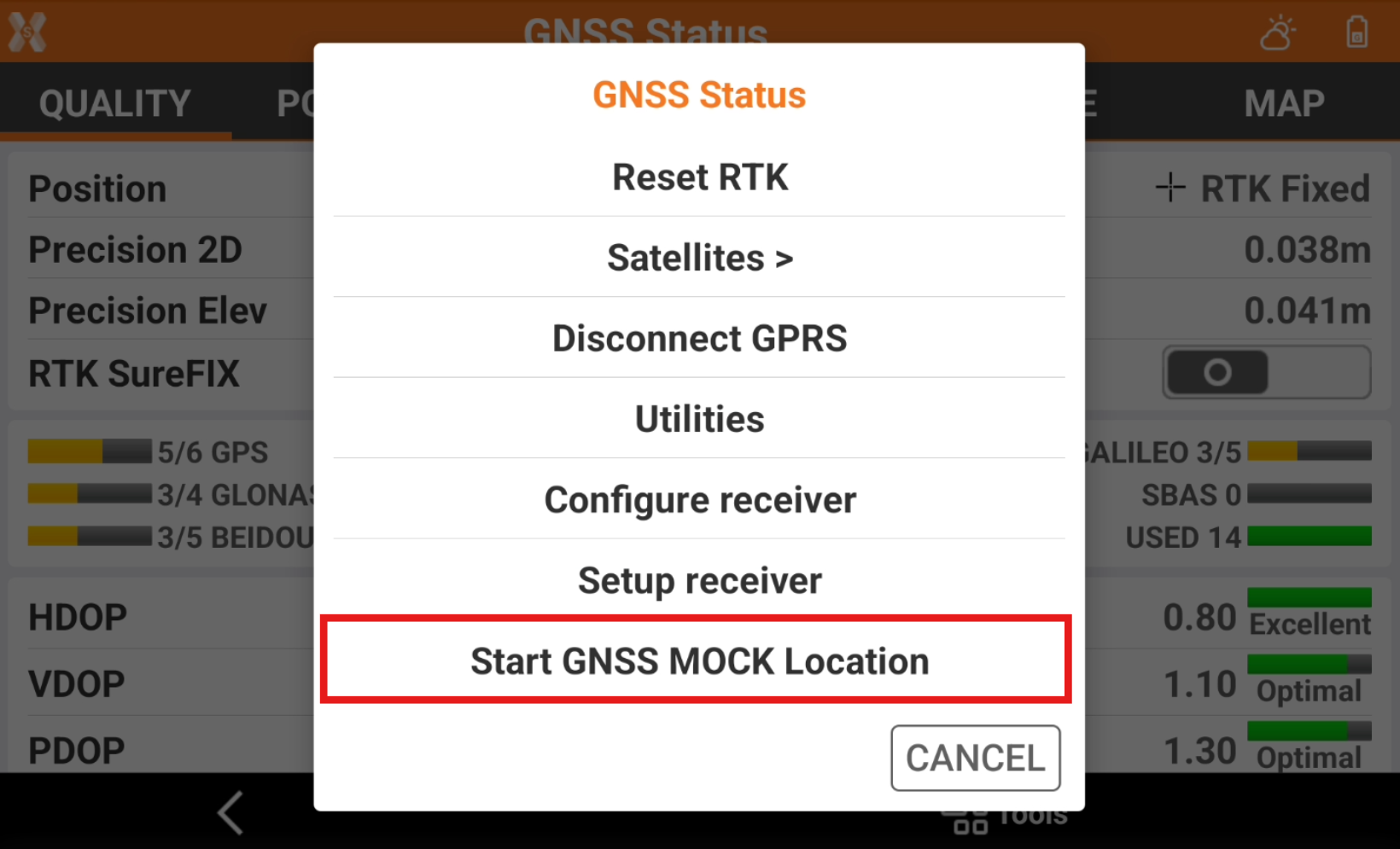
Open the GNSS Status page.
Click Tools to open the list of available tools.
Select Start GNSS Mock location.
Select what elevation to use in mock location.
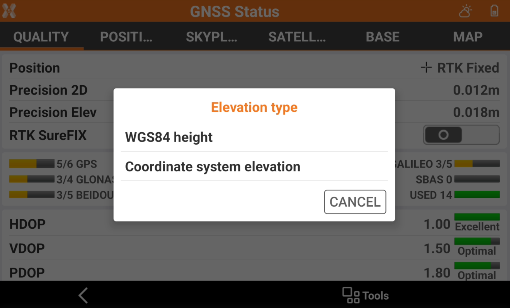
WGS84 height: the mock location elevation is the elevation over the WGS84 ellipsoid.
Coordinate system elevation: the mock location elevation is the elevation configured in Coordinate system, for example over the selected geoid.
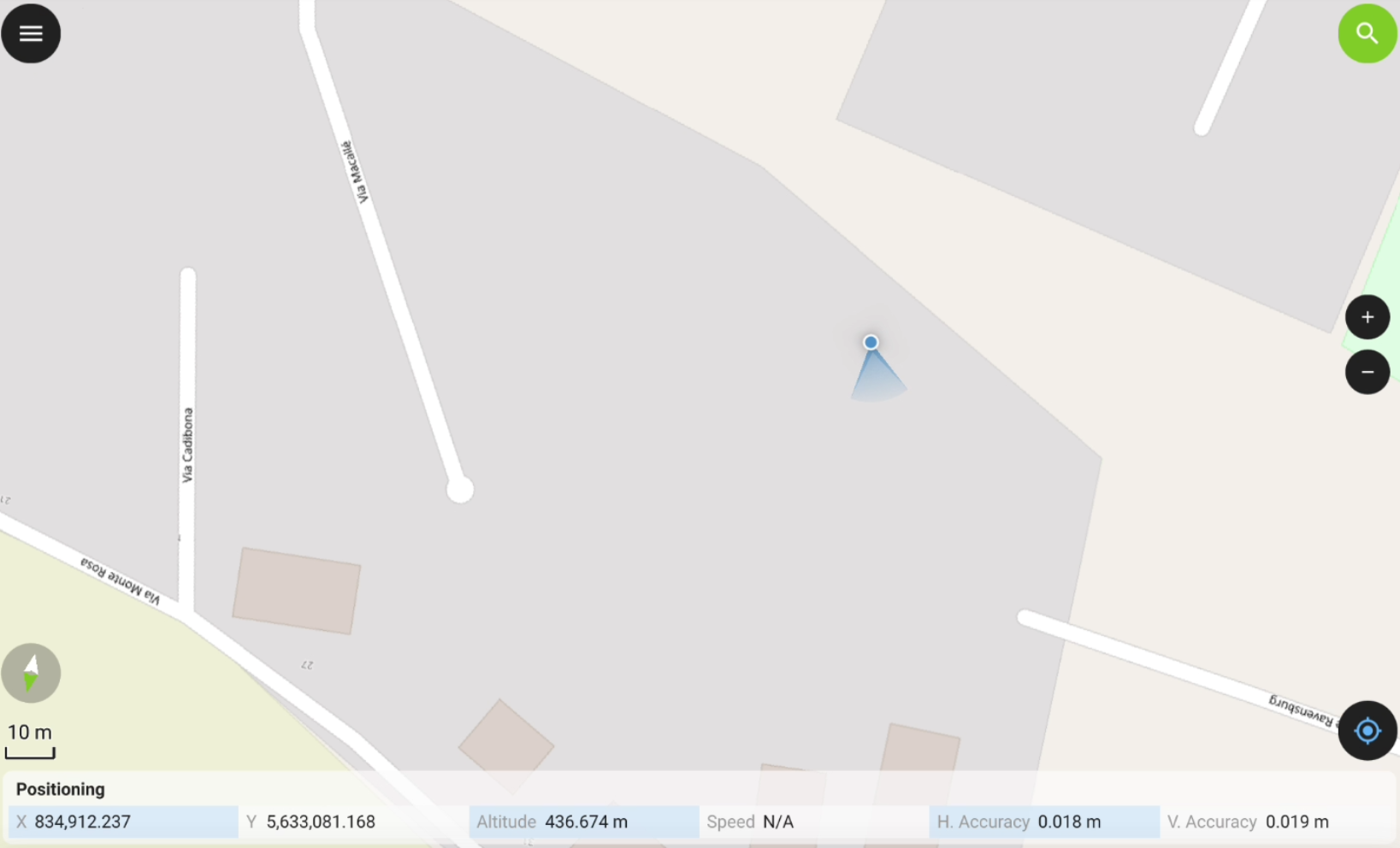
Do not close X- PAD software but reduce it.
Open the third-party app.
The app is using the position from the topographic instrument.