GPS Status page
 |
|  |
| 
The GPS Status page allows to display different information on the GNSS receiver connected:
Quality of the signal.
Number and position of satellites.
Current coordinate.
Information about the base and the .
Position in a map.
Quality page
Quality page shows information on the current quality of the GNSS receiver.
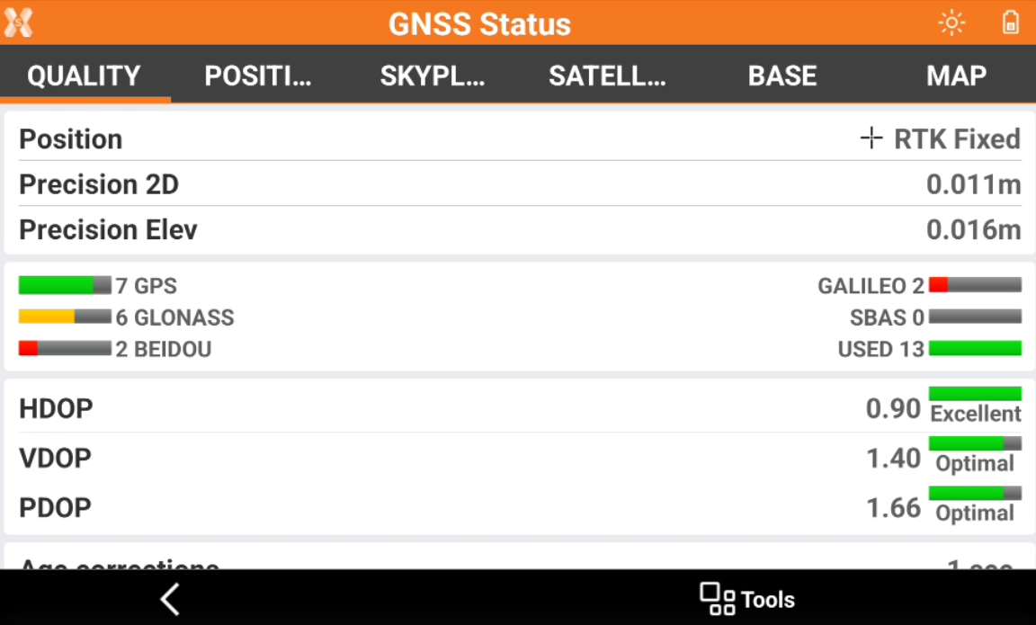
Position: displays the RTK quality of position.
RTK Extra-Safe / RTK SureFix: available for some GNSS receiver models. The receiver gets corrections from a source and has fixed the ambiguities in RTK Extra-Safe / RTK SureFix.
RTK Fixed: the receiver gets corrections from a source and has fixed the ambiguities with maximum precision.
Quick-Fix: available for some GNSS receiver models. The receiver has fixed the ambiguities but has not reached the maximum precision level yet.
RTK Float: the receiver gets corrections from a source but it has not yet fixed ambiguities.
DGPS: the receiver gets differential corrections in DGPS mode.
Autonomous: the receiver gets positions without receiving corrections from any source in minimum precision.
PPP-Fixed: the receiver is receiving corrections using PPP service and ambiguity is fixed.
PPP-Float: the receiver is receiving corrections using PPP service and ambiguity is still not fixed.
Precision 2D: precision of the current position regarding coordinates.
Precision Elev: precision of the current position regarding elevation.
RTK Extra-Safe / RTK SureFix: available for Zenith 35/Zenith 60/ Zenith 60 Pro. Using this option in environments with signal partially blocked allows to have a solution slower getting the fix status but likely less to be erroneous.
Satellites: number of satellites of the different constellations.
HDOP: Horizontal Dilution of Precision.
VDOP: Vertical Dilution of Precision.
PDOP: General Dilution of Precision related to the satellites position.
Age corrections: delay in receiving corrections in seconds. A high value indicates missing reception of corrections.
GSM Signal: level of GSM signal.
NTRIP Server: name of the used NTRIP server.
Mountpoint: name of the mountpoint with available access. Click on the mountpoint to change mountpoint.
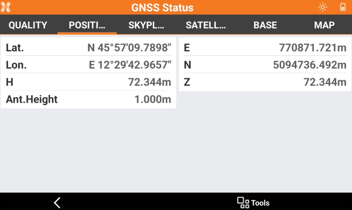
Position page
The Position page shows the current GNSS receiver position with its geodetic coordinate and local coordinate based on the defined GNSS localization method.
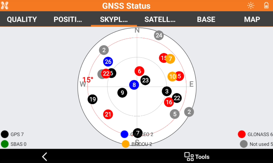
Skyplot page
Displays position and elevation of the tracked satellites. Click a satellite open a window showing all related information.
Satellite page
Displays a list of all tracked satellites including related information.
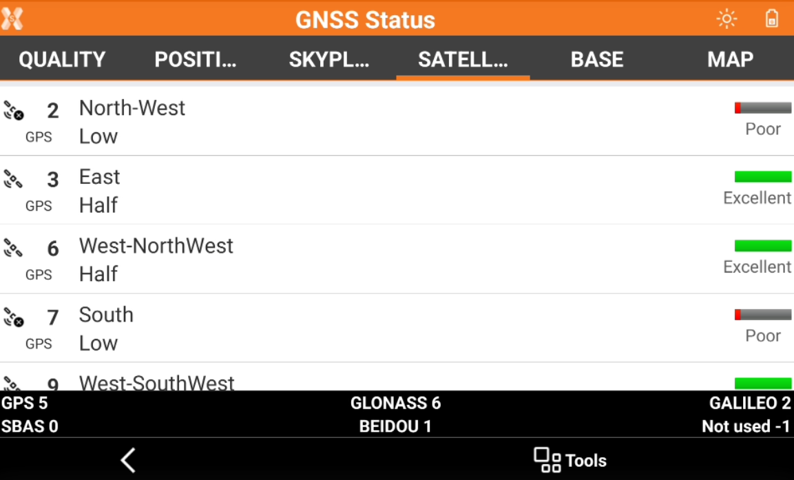
 : satellite contributing to the position calculation.
  : satellite ignored.
  : number of the satellite, constellation and satellite position and elevation.
  : signal quality.
Base page
Displays information related to the reference base.
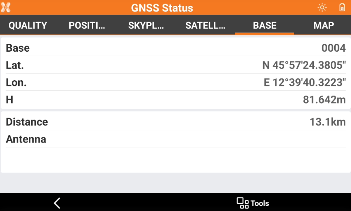
Base: name of the base.
Lat., Lon., Elevation: coordinates of the base.
Distance: distance between base and current position.
Antenna: antenna model of the base.
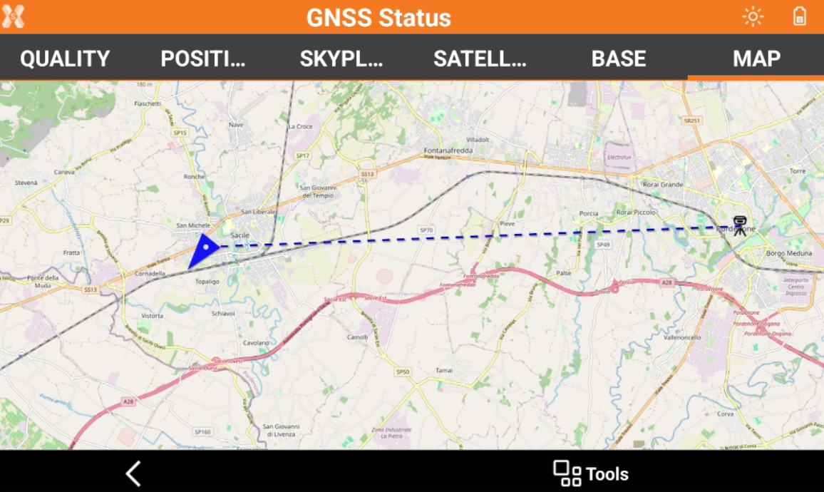
Map page
Displays the current position in a map.