Local system – single point
 |
|  |
| 
The system is created based on a local projection referred to one origin point.
From GNSS localization select Local - Single point.
Click Next or Details.
Specify the geographic coordinates of the reference point.
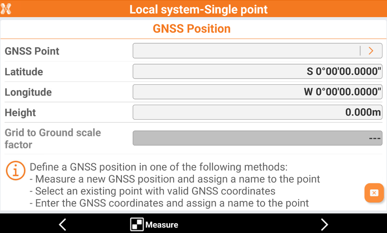
The GNSS reference point can be selected using different methods:
Measure a new GNSS position and assign a name to the point. Click Measure to connect to GNSS receiver and measure the point.
Select an existing point from the job by typing the name or selecting it from the graphic or selecting it from a table. Click on the arrow on the GNSS Point field to open the selection page.
Enter the GNSS coordinates and assign a name to the point.
If a cartographic system is assigned to the job, the grid to ground scale factor is calculated based on the cartographic system assigned. Please check that the cartographic system is coherent with the measured GNSS position to calculated a valid grid to ground scale factor. Otherwise remove the cartographic system from the job.
Click Next.
Specify the local coordinates of the reference point:
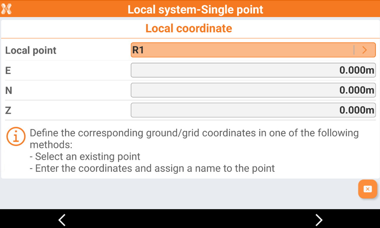
The local point can be selected using different methods:
Select an existing point from the job by typing the name, selecting it from the graphic or selecting it from a table. Click on the arrow on the Local Point field to open the selection page.
Type in the local coordinates.
Click Next.
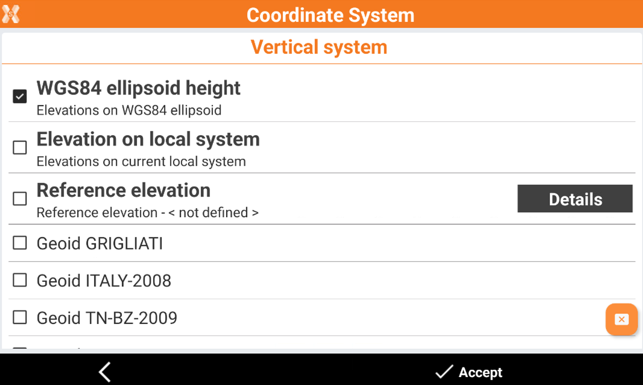
Specify the mode for the calculation to use for elevations.
Click Accept to accept the system.