Start a GNSS base on known position
 |
|  |
| 
Use this mode when the base is positioned on a position with known geographic coordinates.
If only plane coordinates are available, define the coordinate system that allows to calculate the geographic coordinates.
Open the Start base page.
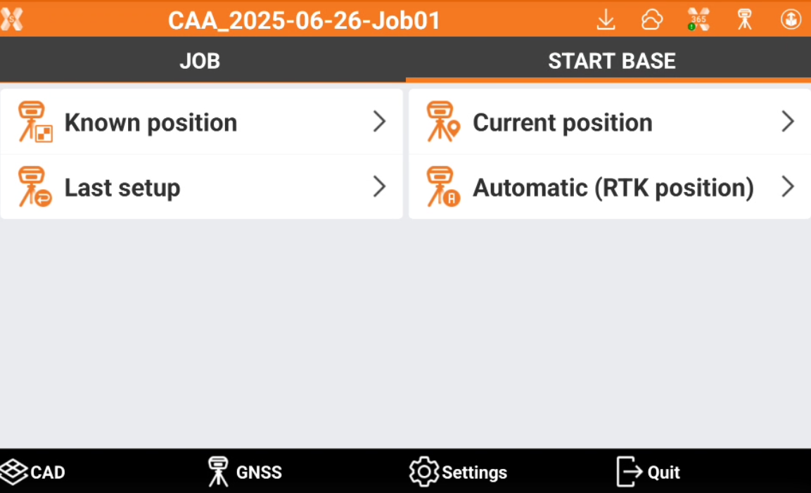
Click Known position. This opens the Start base page.
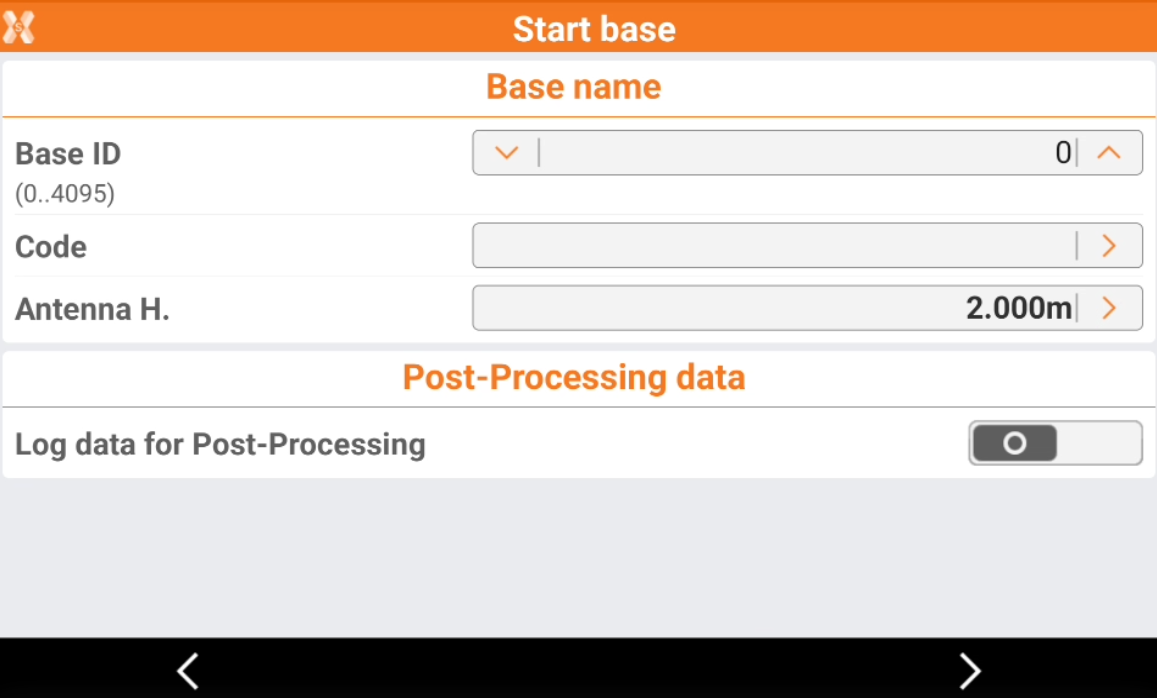
Base ID: the name of the base. The name of the base is displayed on the rover. The rover can be set so that it only accepts corrections coming from the base with a certain ID.
Code: code to assign to the point that is created in correspondence of the position of the base.
Antenna height: the antenna elevation from the Antenna Reference Point (ARP) to the ground. Click on arrow to open the Calculate antenna height page.
Log data for PostProcessing: activates the recording of raw data on the base. Recorded raw data can be used for data post-processing.
Logging rate: frequency for recording raw data.
File for PP: name of file where to save raw data.
File type: the raw data file type to store.
Click Next to open the next page.
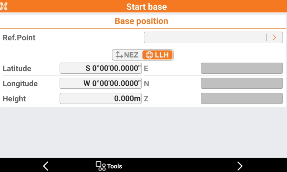
Reference point: assign coordinates to base with one of the options:
Select a point from a table, from a graphic or enter a point. Coordinates of the point are displayed. Click on the arrow to select the point.
Enter the geographic coordinates of the base. Click LLH to enable this option.
Enter the plane coordinates of the base In every case, if only plane coordinates are available, define a coordinate system first so that the corresponding geographic coordinates can be calculated. Click NEZ to enable this option.
Click Next when the known base coordinate has been defined and open the next page.
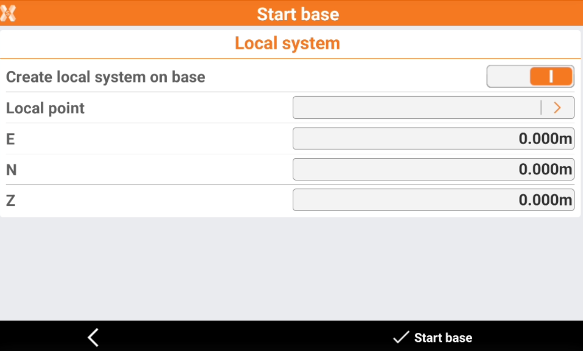
This page allows to create, simultaneously to configuring the base, a local coordinate system on one point having just the base as reference point. If the option is activated, the local coordinates can be specified to the position of the base.
Click Start base to start the GNSS base.