Two reference axis
 +BUILD |
The system is created based on the measurement of a point of origin and the measurement of a two points which defines the direction of the two axis.
From GNSS localization select Two reference axis.
The procedure requires to measure 2 points on the 2 reference axis, and then identify these 2 axis in CAD.
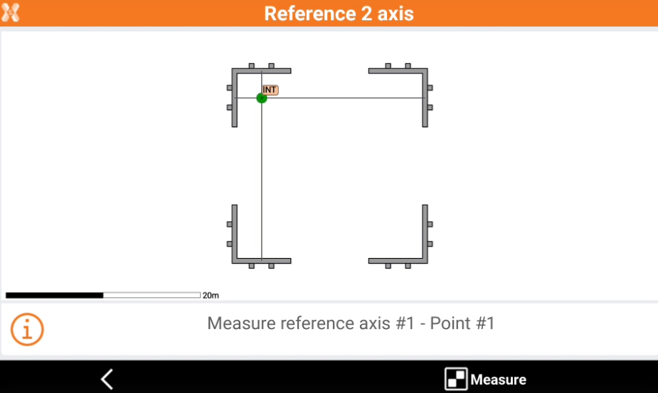
Click Measure to measure the first point on the first reference axis.
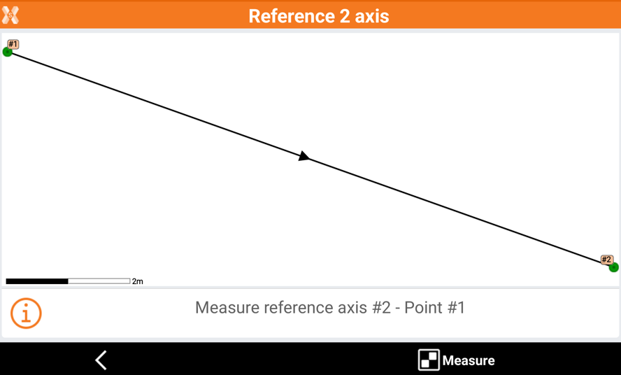
Click Measure again to measure the second point of the first reference axis.
The software shows on video the first measured reference axis.
Click Measure and proceed to measure 2 points on the second reference axis.
The software shows the 2 measured reference axis.
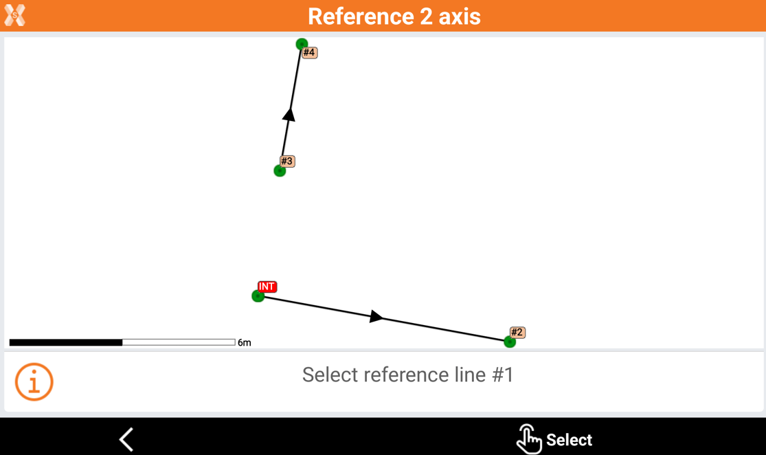
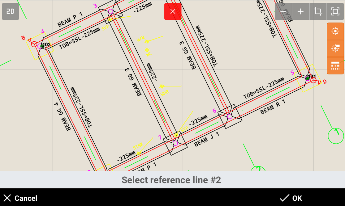
Click Select to select the 2 measured reference axis in CAD, selecting reference line 1 and reference line 2.
Click OK to calculate the local system.
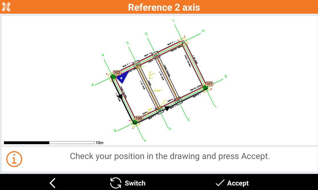
Check the GNSS position in the drawing, if it is correct.
Click Switch in case position in not correct, to switch the axis, or click Accept to accept the system.
Select the calculation method to be used for elevation and click Accept.