Working with instrument simulators
 |
|  |
| 
For demo or testing purpose it is possible to work with a simulator profile for GNSS receiver and total station.
In this page we will see how to create, configure and use a GNSS and a total station simulator.
Working with a GNSS simulator
Setup the GNSS simulator profile
To work with a GNSS simulator the first step is to activate and setup a GNSS simulator profile.
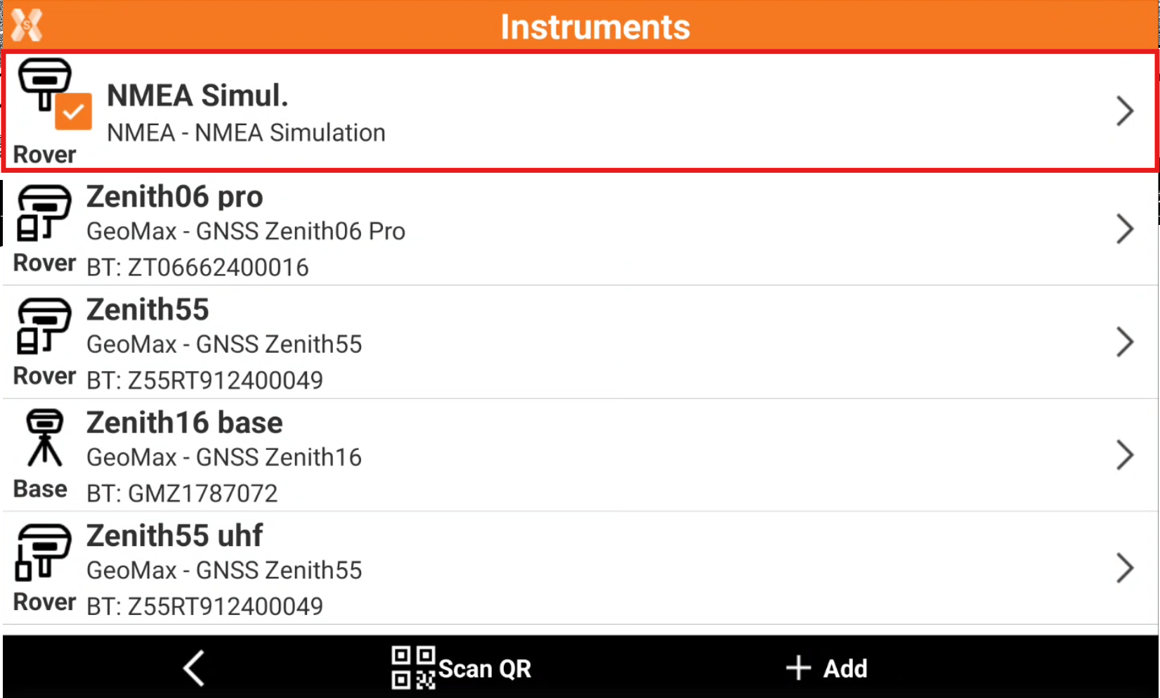
Click Settings.
Click GNSS & Total stations.
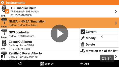
Click the NMEA Simulator profile and make it as current profile.
By default the simulator is localized at the center of defined cartographic system. To change the default GNSS position Modify the profile.
Open the Parameters page and enable Set coordinates.
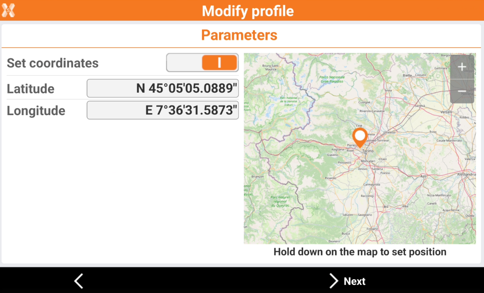
Enter manually the simulator position, or tap on the map to change position and zoom level. Hold down on the map to set the position.
Click Next and Accept to save the simulator position.
Work with GNSS simulator in the software applications
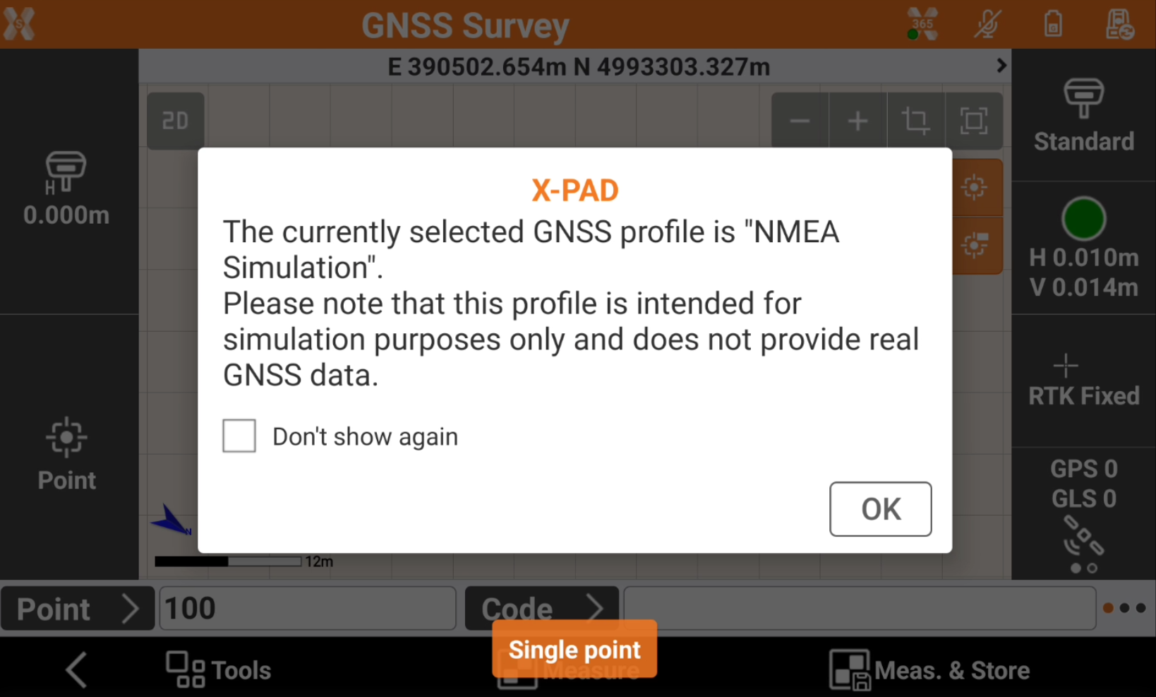
When working with the simulator, the software shows a warning.
By default the simulator position changes according to a defined path.
To change the simulator position in any software application with CAD, long-press on the screen to change the simulator position. This allows to simulate more precisely survey and stakeout operations.
Video tutorials | |
|---|---|
 How to configure the GNSS simulator How to configure the GNSS simulator to experience the software without a real instrument connected. | |
Working with a TPS simulator
To work with a total station simulator the first step is to activate a total station manual profile.
This profile can also be used to manually input angles and coordinates.
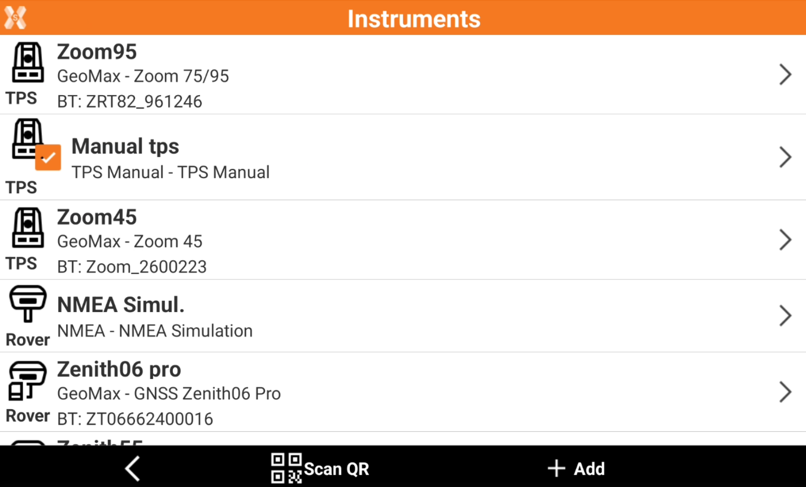
Click Settings.
Click GNSS & Total stations.
Click the Manual tps profile and make it as current profile.
Work with total station simulator in the software applications
When using the manual total station profile, in software applications, click Measure or Measure & Store.
Enter manually the angles and distance.
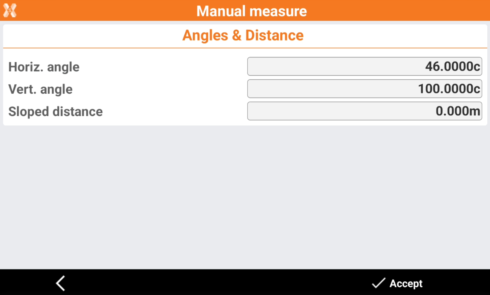
Horiz. angle: the horizontal angle.
Vert. angle: the vertical angle.
Sloped distance: the value of the sloped distance.