Calculation
The calculation procedure of the survey processes the data of the measurements and calculates the corresponding coordinates of the topographic points.
This allows to process both data from TPS and GNSS instruments at the same time; it also gets the coordinates coherent with the set coordinate system.
The procedure allows to manage different types of topographic calculation, by use of adjustment options for traverses and datum points.
All the settings for the calculation of the survey are grouped in a specific window, in this way their setting is easy and immediate.
Click Survey.
Click Calculate.

The command opens a new panel on the right.
The panel allows to define how the calculation is performed.
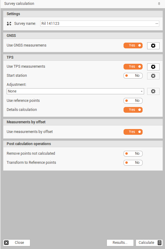
Settings
Survey name: to set the subproject for which to perform the calculation, by default is the active one.
GNSS
Use GNSS measure: to use or not to use in the calculation of the survey the GNSS measurements available in the selected subproject.
GNSS measure settings: access the coordinate system settings of the survey subproject. See Coordinate system .
TPS
Use TPS measure: to use or not to use in the calculation of the survey the TPS measurements available in the selected subproject.
Start station: enable/disable the use of the data of the starting station in the calculation procedure.
Adjustment: allows you to choose the method of traverse adjustment. The adjustment options are as follows:
None: does not perform any adjustment.
Traverse adjustment: activates the calculation of the traverse using the formula of the empirical adjustment.
Network adjustment - only stations: activates the calculation of the traverse using the least-squares adjustment formula for calculating the stations.
Network adjustment - all points: activates the polygonal calculation using the least-squares adjustment formula for calculating stations and points.
User reference points: enables/disables the use of the datum points inserted in the table Reference points, in the survey calculation procedure. These points can be used for the use of topographic tricks or the calculation of orientation.
Details calculation: Enable/Disable the calculation of topographic points. If the option is off, only the stations will be calculated.
Click on Setting icon
 to open the Survey calculation settings window.
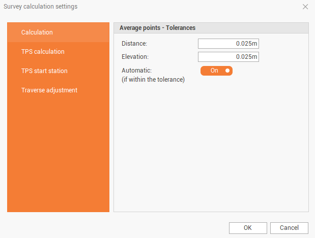
Distance: sets the maximum value of distance between 2 or more points within which to perform the average. If there are 2 points with a distance less than the set value, the program performs the average of the 2 points.
Elevation: sets the maximum elevation difference value between 2 or more points within which to perform the average. Points must also comply with the policy set in the Distances.
Automatic (if within the tolerance): activate/deactivate the automatic average, if it is deactivated the program will stop the calculation of the survey and will require instructions.
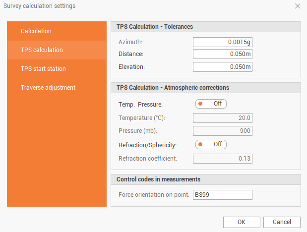
Azimuth: sets the value of the maximum difference of the horizontal angle between the measurements, in the case of multiple measures.
Distance: sets the maximum difference between distances in the case of multiple measures or in the case of measures between stations.
Elevation: sets the maximum elevation difference if the point is measured from multiple stations.
Temp. Pressure: enables/disables the use of temperature and pressure values to be used to perform atmospheric correction.
Temperature (°C): sets the temperature value to perform the atmospheric correction.
Pressure (mb): sets the atmospheric pressure value to perform atmospheric correction.
Refraction/Sphericity: enables/disables the use of the refraction coefficient value for correcting measurements.
Refraction coefficient: sets the value of the refraction coefficient to be used for measurement correction.
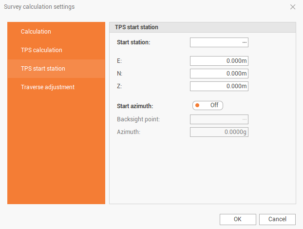
Start station: to set the starting station of the survey.
E: to set a known value to the E-coordinate of the starting station.
N: to set a known value to the N-coordinate of the starting station.
Z: to set a known value to the Z-coordinate of the starting station.
Start azimuth: enables/disables the use of parameters for setting the Azimuth starting.
Backsight point: to set the name of the measured point for the calculation of the Azimuth. The point can be present in the table of topographic points or in the table of reference points.
Azimuth: to set a known value for the correction of the Azimuth.
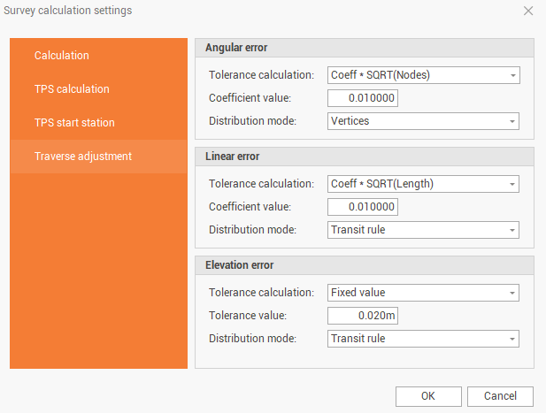
Tolerance calculation: sets the way to calculate the angular and linear misclosure of the traverse, and the error at the traverse’s elevation.
Coefficient value: sets the tolerance value for the angular closure, linear closure and elevation error.
Distribution mode: sets the distribution method of the error.
Measurements by offset
Use measure by offset: enables/disables the calculation of measured points by distance or alignment and offset intersections.
Transform to reference points
Transform to Reference points: enables/disables the rototranslation procedure based on the reference points. If there are points in the calculated points for which the coordinates are known (reference point) the procedure proposes the georeferencing of the entire survey.
After the calculation parameters have been defined, click on Calculate to calculate the selected subproject.
Depending on the settings, the software may interrupt the calculation to show calculation steps, like free station, average points, transformation to reference points, traverse adjustment or station calculations.
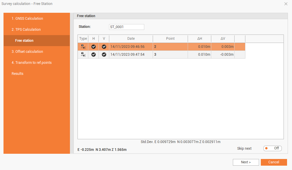
It is possible to enable the option Skip next to automatically accept similar calculations during the process.
At the end of the calculation it is possible to scroll within the calculation results.
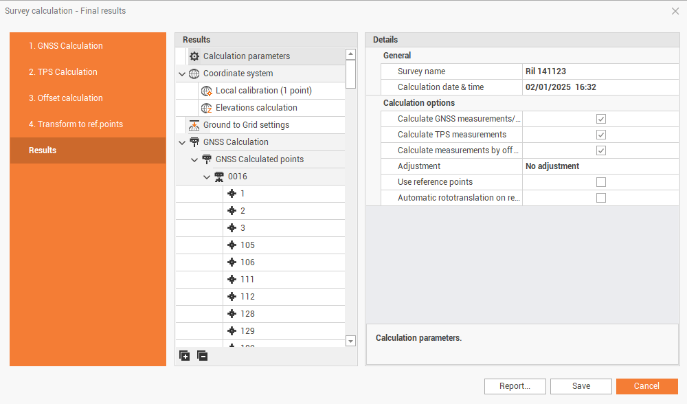
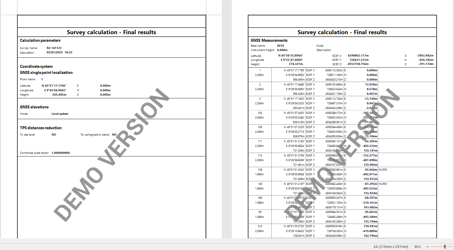
Click on Report to save a calculation report.
Click Save to save the calculation and update points coordinates.
Click Cancel to cancel the calculation.