Create a raster map from the web map view
This function allows to download and save the web map view as a raster image, to be used in the survey graphic view.
Shift+click on the map area to define the area to download.
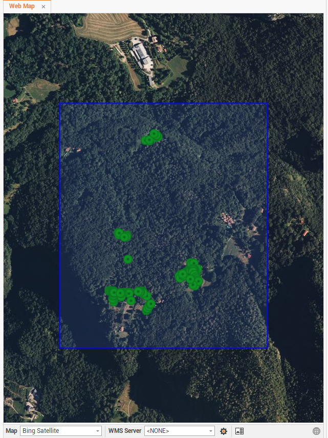
Click on Extract data
 .
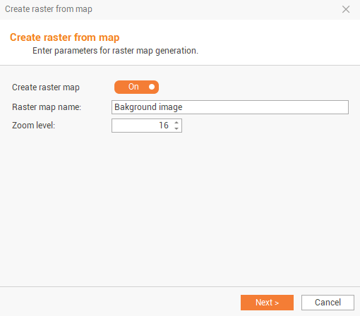
.Enable the Create raster map option, to create the raster map.
Enter the raster map image name, as it will be saved in the Project manager, and change the zoom level of the map. The zoom level indicates the resolution of the raster image.
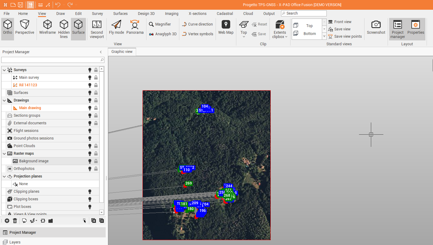
Click on Next to save the raster in the Project manager under Raster Maps. The raster will be displayed in the graphic view.