External grid
The External grid method allows you to enter the X,Y coordinate of the first point of the external grid (ticks of the external map), select the step, and then Fusion will guide you on selecting the next grid points.
The external grid method is used when the map has a full grid
Click Georeference,
From the Raster Map menu, select External Grid,
From the new External grid panel, define the Origin and Grid’s step.
In the right panel , you can enter the coordinates of the origin and the step of the grid:
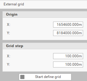
Origin X: Sets the X coordinate of the map's origin.
Origin Y: Sets the Y coordinate of the map's origin.
Grid step X: Sets the distance along the X axis of the map references in meters.
Grid step Y: Sets the distance along the Y axis of the map references in meters.
Start define grid: Starts the input of reference points using the map's graphic references. Begin by specifying the first control point, followed by the second control point. The program will then position and automatically zoom to the location of the next control point.
Stop define grid: Ends the operation of inserting the control points.
Close: Closes the window and exits the command.
click on the Start define grid button.
Select the first tick of the external grid.
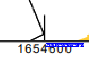
Define the grid by selecting points on each side by going clockwise or counterclockwise.
After each 2 points, Fusion automatically zooms on the next one.
Repeat this operation for all the axes of the grid.
When you finish selecting the points.
Select the transformation method:
Conformal: applies a conformal or affine barycentric transformation when there are more than three control points
Localized: applies a localized transformation to control points, which is useful when the raster file originates from scanning a damaged physical medium
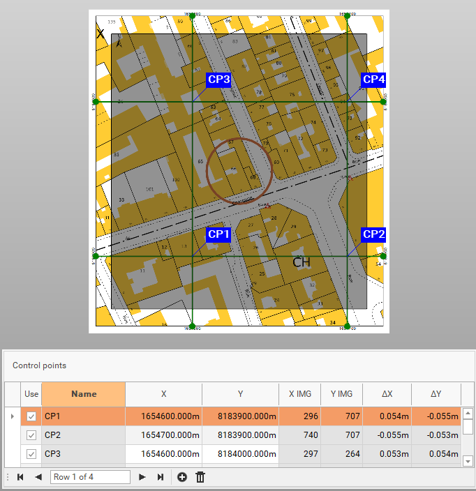
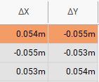
Check the residuals.
click Accept.
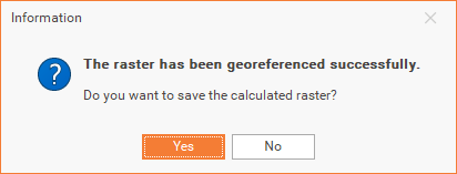
Choose if you want to save the calculated raster. A georeferenced copy of the raster map is saved.