GNSS Post processing Tools
GNSS Post processing has tools to manage:
The coordinate system of the project.
The antenna calibration sets.
The precise ephemeris.
Coordinate system
Coordinate system tool allows to define the coordinate system of the project.
Click Coordinate system.

Refer to Coordinate system.
Antenna manager
Antenna manager allows to manage the phase center calibration from different agencies.
Click Antenna manager.

This command opens a new window.
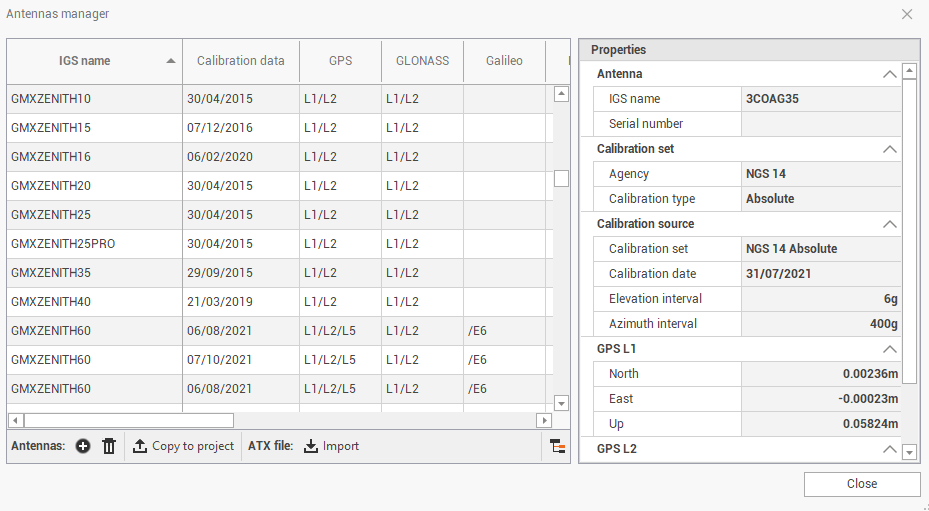
The table shows the available calibration for GNSS antennas from different brands.
It is usually not necessary to perform any operation on this database, since all calibrations are preloaded.
In the table there are information on the calibration file.
IGS name: the IGS name of the antenna point.
Calibration data: the date of the calibration for selected antenna from a specific agency.
GPS/GLONASS/Galileo/Beidou/QZSS/SBAS: shows if calibration is specific for a constellation.
Calibration set: the agency for the calibration.
Click Group antennas
 to group the antennas by calibration agency.
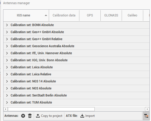
On the bottom bar there are some commands to manage the calibrations:
Import ATX
 : allows to import ATX files. These files are available from various agencies including the International GNSS Service (IGS) or National Geodetic Survey (NGS) and have a list of antenna types by manufacturer with their respective offsets and eccentricities.
Add
 : to manually create an antenna entering the phase center offsets and the antenna name.
Delete
 : to delete an antenna calibration.
Copy to project
 : to copy selected antenna models to the current project, within the Antennas page.
Precise ephemeris
The Precise ephemeris command allows to import and use precise ephemeris in SP3-P format to be used in the GNSS processing. The SP3-P format is an internationally accepted standard ASCII format for precise ephemeris.
There are several services that provide precise ephemeris data, like for example:
IGN Global Data Center.
IGS International GPS Service for Geodynamics.
Click Precise ephemeris.

This command opens a new window.
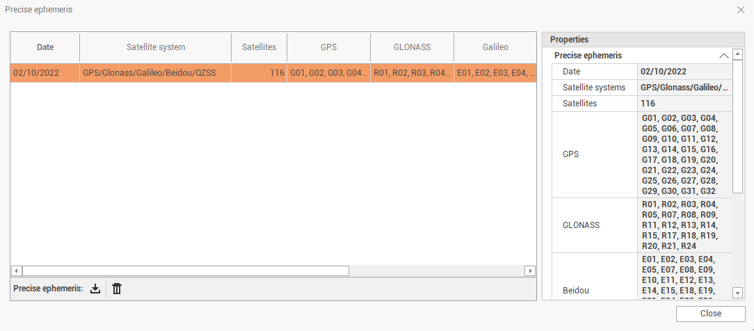
The table shows the list of available precise ephemeris that was previously imported.
Import: to import a file in SP3-P format.
Delete: to delete imported file.