Import data from ESRI shape file
From ESRI shape format, points, polylines and polygons can be imported.
Click File.
Click Import.
Select Import Esri Shape (SHP) files.
Click Import.

This command opens the following window:
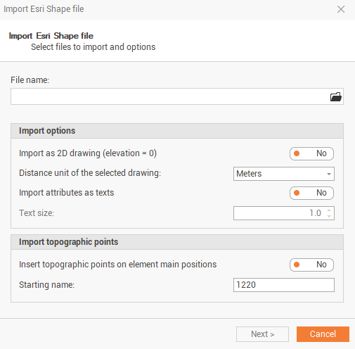
File name: selects the file to import.
Import as 2D drawing (elevation = 0): the imported shape file is imported considering all elevations = 0.
Distance unit of the selected drawing: select the distance unit of the drawing.
Import attributes as texts: enables/disables the shape file attributes as texts.
Text size: the text size of the attributes imported.
Insert topographic points on element main positions: automatically creates topographic points on imported elements main positions.
Starting name: the starting point name of created topographic points
Click Next to import the file.