Topographic points
Topographical points are the main entity of the survey subproject; they can be obtained from importing from files (survey data, ASCII files, DWG/DXG files), as a result of the survey calculation procedure or from a direct input.
The point of survey entity can be managed by a specific table or in the graphics window, the two workspaces provide specific functions for its management and modification.
It is possible change the point data from the table or deleting the point from this is equivalent to performing the same actions from the graphics window and vice versa.
The topographic point is a univocal entity, there can be no two points with the same name in the same subproject of survey.
The Points command group contains all the tools for managing the topographic points, the reference points and the photos linked to the points.
Refer to Point commands for the insert commands of points
Topographic point's table
X-PAD Office Fusion can manage topographical points from a specific table where all the attributes of the topographical points are arranged in columns.

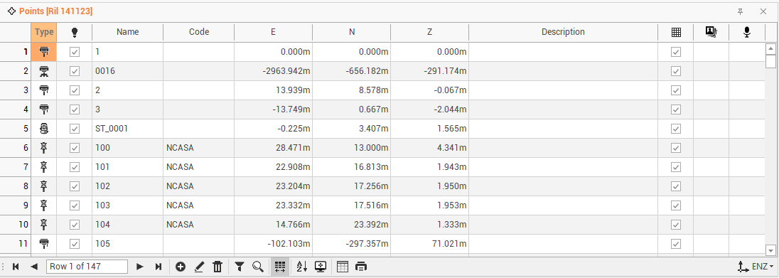
The table is sorted according to the order of insertion of points. From the table you can perform several operations.
The table of topographical points contains the following columns:
Point type: shows the type of point.
Visible: shows/hides the point.
Name: to change the name of the point.
Code: to change or set a survey code to the point.
E: to change the East coordinate.
N: to change the North coordinate.
Z: to change the elevation.
Description: to change or enter the point description.
Use in surface: toggles the use of the point as vertex of the triangles in surface creation.
Sketch/photo: displays the photo or sketch linked to the point.
Message: displays the audio file linked to the point.
At the bottom of the table by pressing the icon
you can change the layout of the table:
LLH: displays coordinates latitude, longitude and ellipsoidal height.
ENZ: display the coordinates East, North and elevation.
2nd elevation: toggles the display of the 2nd elevation of the point.
ECEF: display the geocentric coordinate (earth centered, earth fixed).
Save layouts as default: saves the current layout of the tables as the default. It means that the settings applied to the layout (position of columns, display of columns etc...) will be applied as default to open tables later.
Restore default layouts: allows you to undo the changes applied to the table layouts and restore the standard display.
Edit topographic points
Double-click on a topographic point or click on Edit to access a specific window that allows to edit the point.
The Point data page shows information on the point coordinate and code.
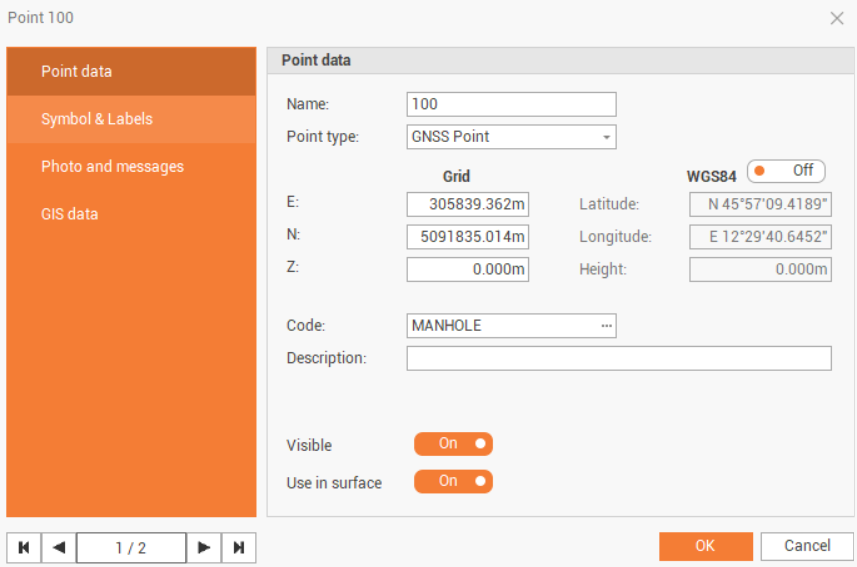
Name: name of the point.
Point type: the type of topographic point.
E, N, Z: plane coordinates of the point.
WGS84: enabled if the point has geographic coordinates.
Latitude, longitude and height: the coordinate latitude, longitude and height.
Code: survey code of the point. The icon allows to access the codes library and to select a code from the list.
Description: extended description of the point.
Visible: enables/disables the visibility of the point in CAD.
Use in surface: enables/disables the use of this specific point when calculating a surface.
The Symbol & Labels page shows information about the point symbol and labels.
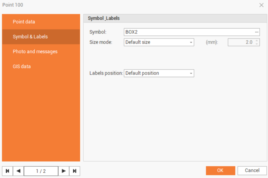
Symbol: the symbol used for the point.
Size mode: the symbol size mode.
Default size: the symbol size as defined in the Survey settings. See Survey settings .
Custom size: allows to customize the size of this specific point symbol.
Labels position: the position of point labels.
Default position: the label position as defined in the Labels style. See Labels commands.
Custom position: allows to customize the label position.
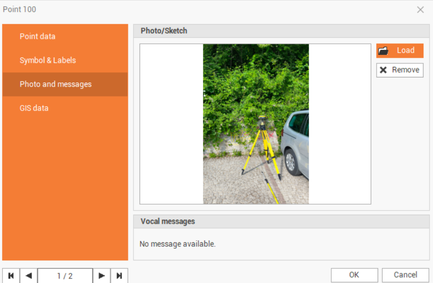
The Photo and messages page displays the photos and vocal messages assigned to this point.
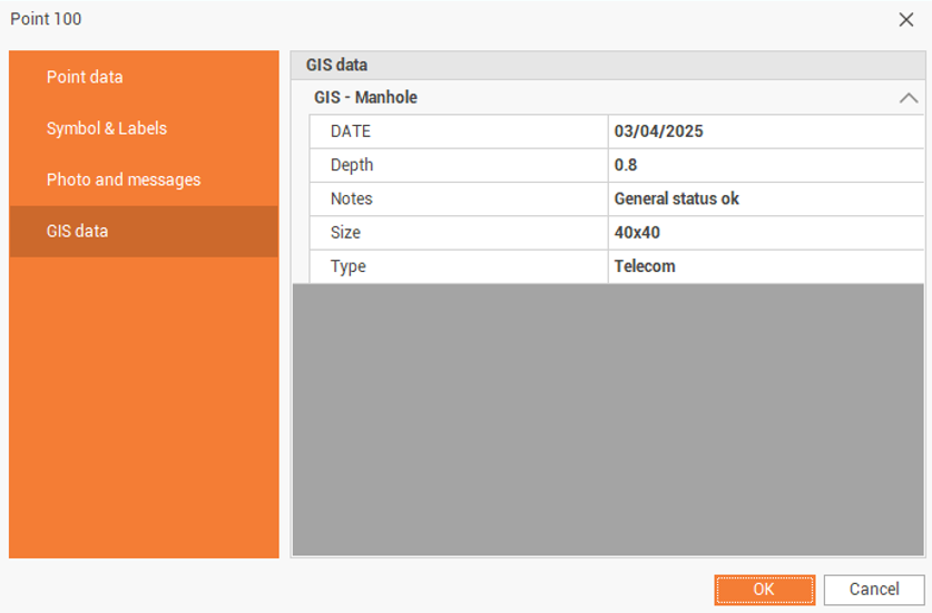
The GIS data page shows the GIS data that was recorded in the field using X-PAD Ultimate field software.