WFS (Web Feature Service)
Shows/hides an online WFS (Web Feature Service) where CAD entities can be overlaid.
WFS (Web Feature Service) are cartographic services accessible through internet.
They can provide both spatial (vectorial) and not spatial data on different layers.
Governing entities are increasingly publishing information in this format. Accessing this information is extremely useful in situations where users need to work with public datasets such as cadastral parcels, reference points, utilities, and more.
Create a WFS (Web Feature Service)
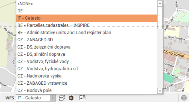
Several WFS are already created in Fusion for different countries.
Click on the Settings icon to open the list of WFS

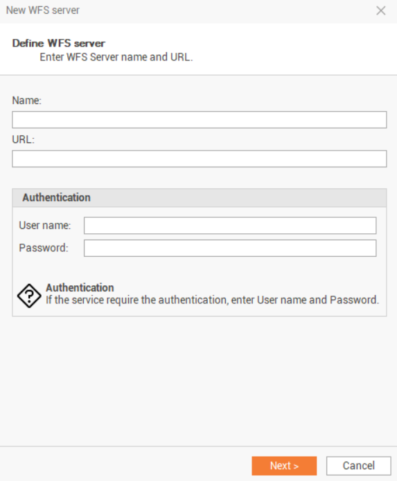
Click on Edit, then Add to create a new WFS server.
Enter the name and the URL of the WMS server. If required, also enter the Username and the Password.
If the login information are correct, select the layers to display and the correct reference System (in general it is EPSG:4326, WGS84).
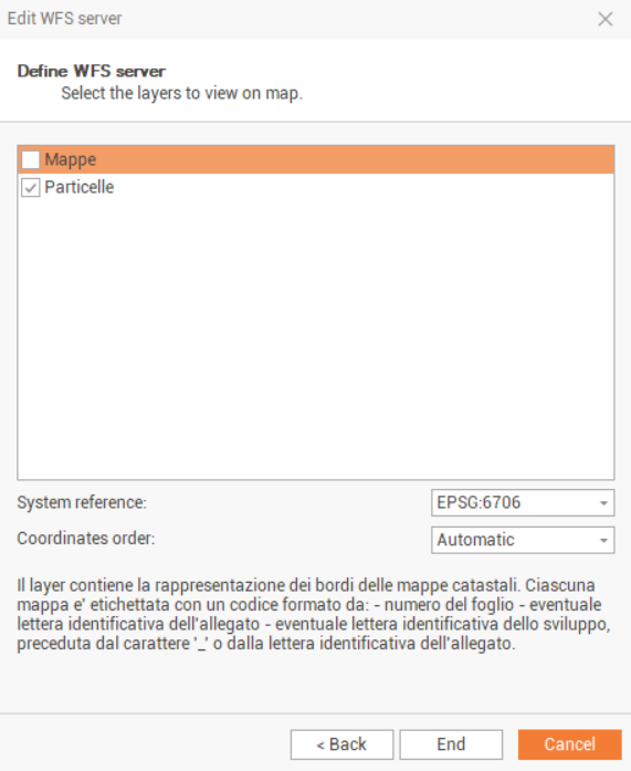
Click on End to save the WFS. The newly created WFS can now be selected from the WFS Server drop-down list.
Display a WFS
Click on View.
Click on the Web Map icon to display the web map view, as a second view in the CAD.

The measured points, with valid WGS84 coordinates, are displayed over the map.
Click on the Map drop-down menu to choose a WFS from the list of available WFS.
The WFS is visualized on the web map.

If the WFS is not visualized, try to change the zoom level.
Extract WFS features
After a WFS is visualized it is possible to extract WFS features to CAD.
Shift-click on the map to define the boundaries of the area to extract data.
Click Extract data icon
 .
.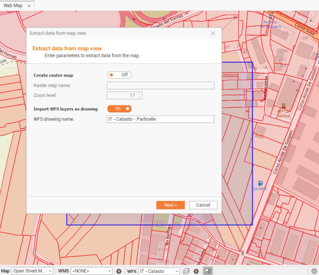
Enables Import WFS layers as drawing and select the name of the new drawing subproject.
Click Next to safe the WFS data.
The data is stored in a new drawing subproject.
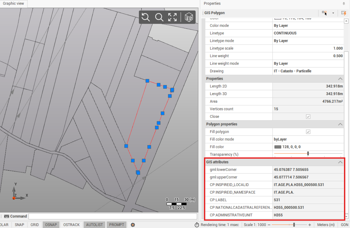
It is possible to select an entity to visualize the attributes.