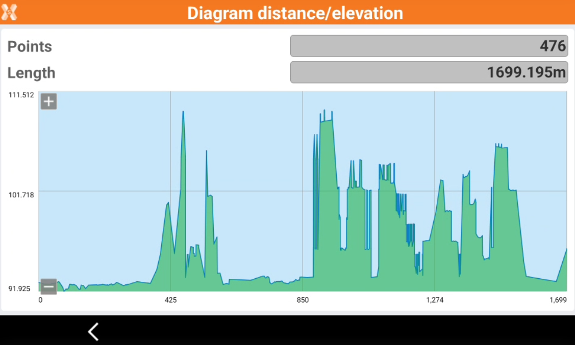
Diagram of distance and elevation
 |
| 
The commands allows to display points on a diagram with the distances on the horizontal axis and the elevation on the ordinate axis.
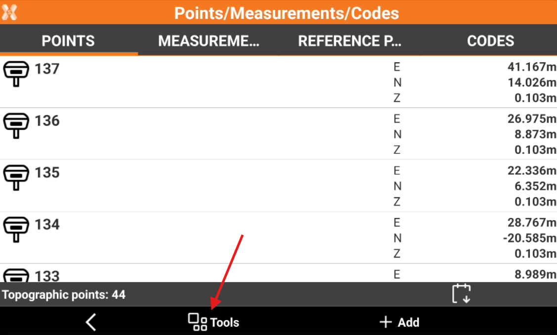
Click Job.
Click Points/Measurements/Codes.
Open the Points tab.
Click Tools to open the list of available tools.
Click Diagram distance/elevation.