Edit a point
 |
|  |
| 
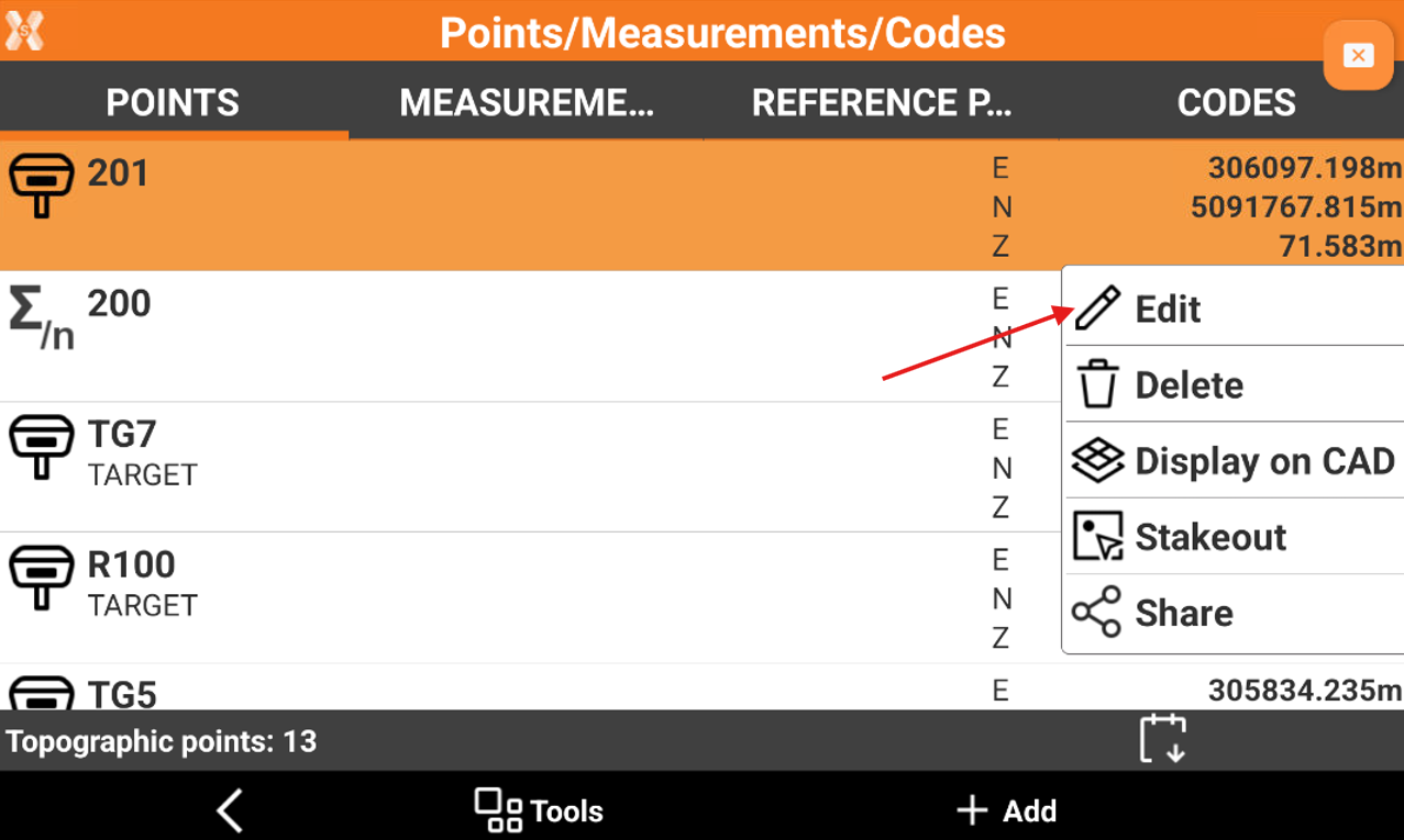
To edit a topographic point click Job.
Click Points/Measurements/Codes.
Open the Points tab.
Click on a point and select Edit.
The data of the point is organised in pages.
Coordinates page
Coordinates page include coordinate information of the topographic point. A topographic point may have plane coordinates and WGS84 coordinates.
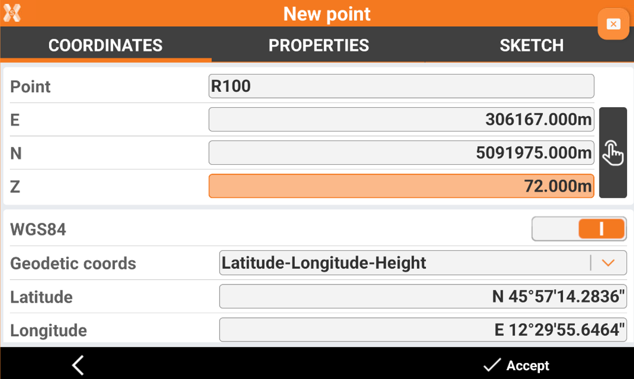
Point: name of the point.
E, N, Z: plane coordinates of the point.
WGS84: enabled if the point has geographic coordinates.
Geodetic coords: allows to choose the input method for the WGS84 coordinate.
Latitude, longitude and height: the coordinate is entered from its latitude, longitude and height.
ECEF XYZ: the coordinate is entered from its earth centered coordinate.
If a point was measured several times, it appears also the Average page.
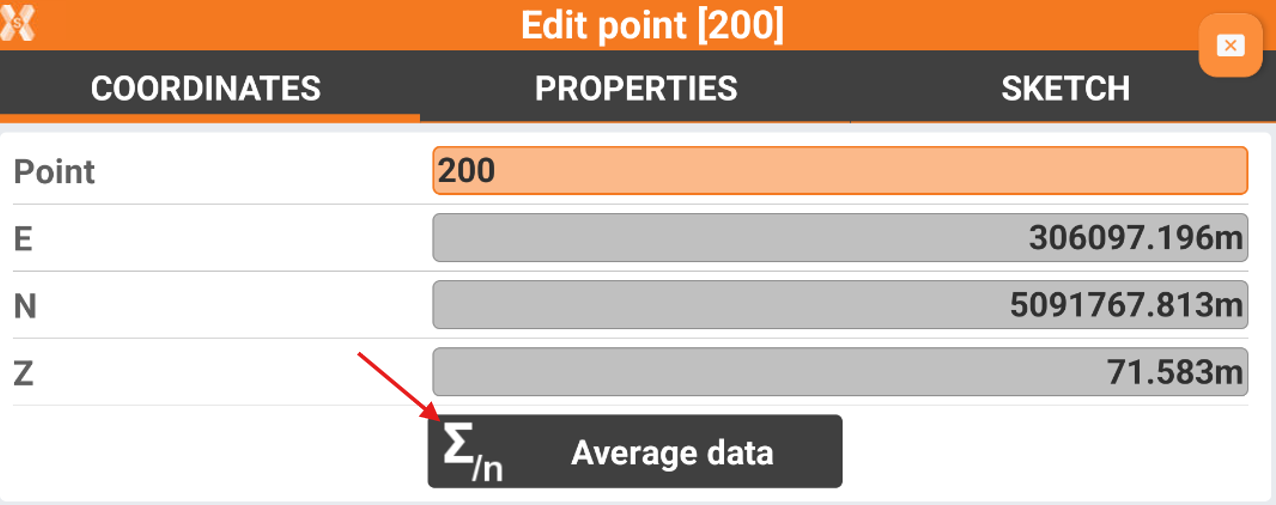
Click Average data to open the list of measurements for the selected point.
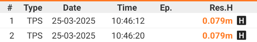
Average data page
If a point was measured several times it is possible to check the single measurements for the point, opening for the point the Average data page.
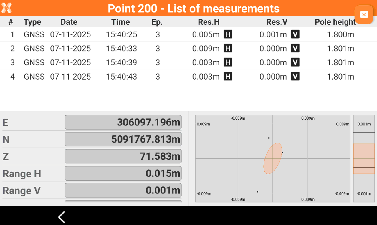
The page shows the lists of measurements and the averaged coordinates.
Type: the type of measurement done (GNSS or TPS).
Date: the date when the measurement has been done.
Time: the time when the measurement has been done.
Ep: in case of GNSS measurement, the number of epochs.
Res.H: the residuals in planimetry.
ResV: the residuals in elevation.
Pole height: the pole height of the measurement.
E,N,Z: the averaged coordinate.
Range H: the range of coordinates in planimetry. Shows the difference between the two more distance coordinates.
Range V: the range of coordinates in elevation. Shows the difference between the two more distance coordinates.
Std.Dev.H: the standard deviation of calculated coordinates in planimetry.
Std:Dev.V; the standard deviation of calculated coordinates in elevation.
If residuals or other calculated values are out of tolerance they are highlighted in orange.
Click H and V icons, close to the residuals for each measurement, to activate/deactivate the use of the measurement in the coordinate final calculation.
Properties page
Properties page allows to enter or edit the point properties, as code, description and GIS features.
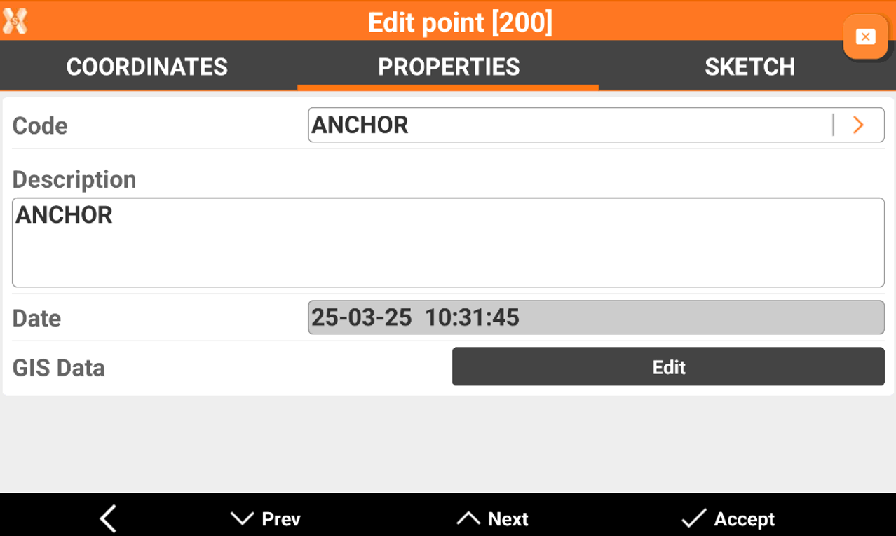
Code: survey code of the point. The icon allows to access the codes library and to select a code from the list.
Description: extended description of the point.
Date: date and time of storing the point.
GIS Data: if the GIS module is activated and one or more codes with GIS information has been associated to the point, the Edit button can be used to insert and modify the corresponding GIS properties.
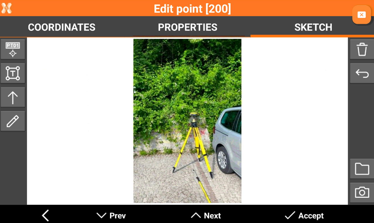
Sketch page
Sketch page allows to view the photo assigned to a point, load or take a new photo or draw on the image to have a picture of the topographic point.
 : creates a text box with point name, coordinates and codes on the picture. Select and drag
  to move the text box.
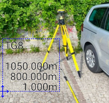
 : creates a text box with free text. Select and drag to move the text box.
 : creates an arrow. Select and drag to move the arrow. Click on to change icon to rotation
  to rotate the arrow.
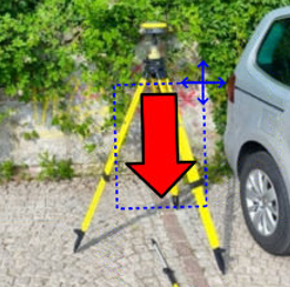
 : enables the free drawing mode.
 : deletes sketch and photo.
  : restores original content
  : loads a photo from the controller internal memory. The image must be in the Images folder and has to be in .jpg or .jpeg format.
 : starts the application allowing to shoot a photo and save it.