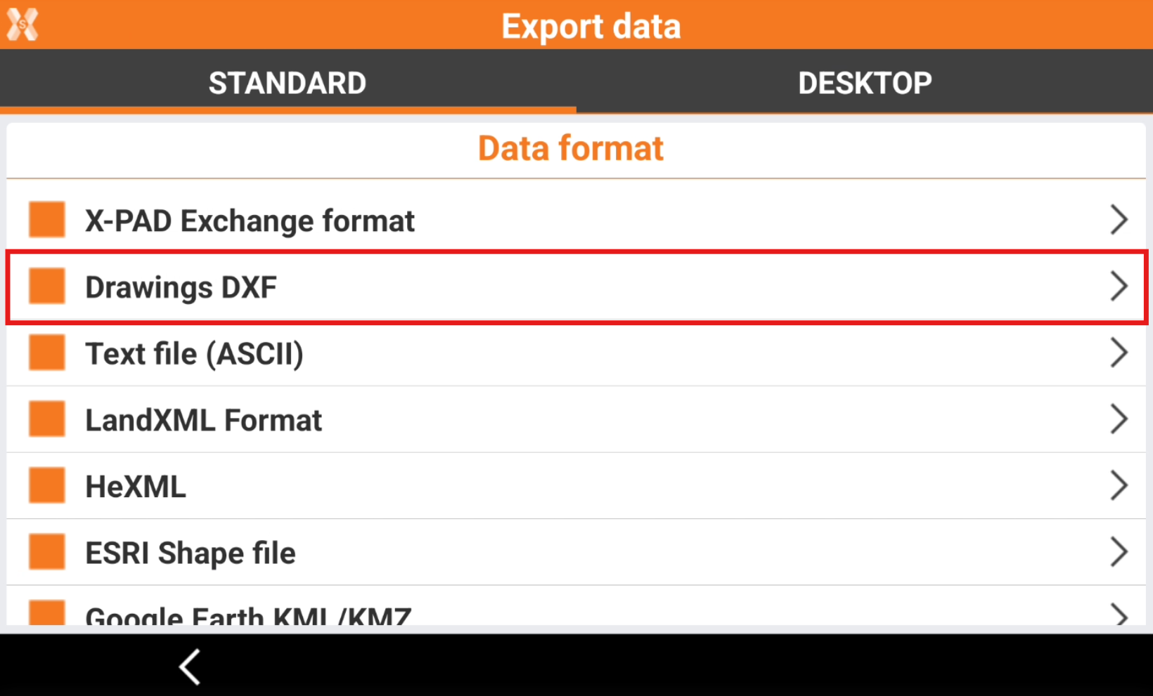
Export a DXF drawing
 |
|  |
| 
The software allows to export in the standard DXF format, exporting points and drawing.
To export the data in DXF select Drawing DXF.
Enter the DXF Export parameters.
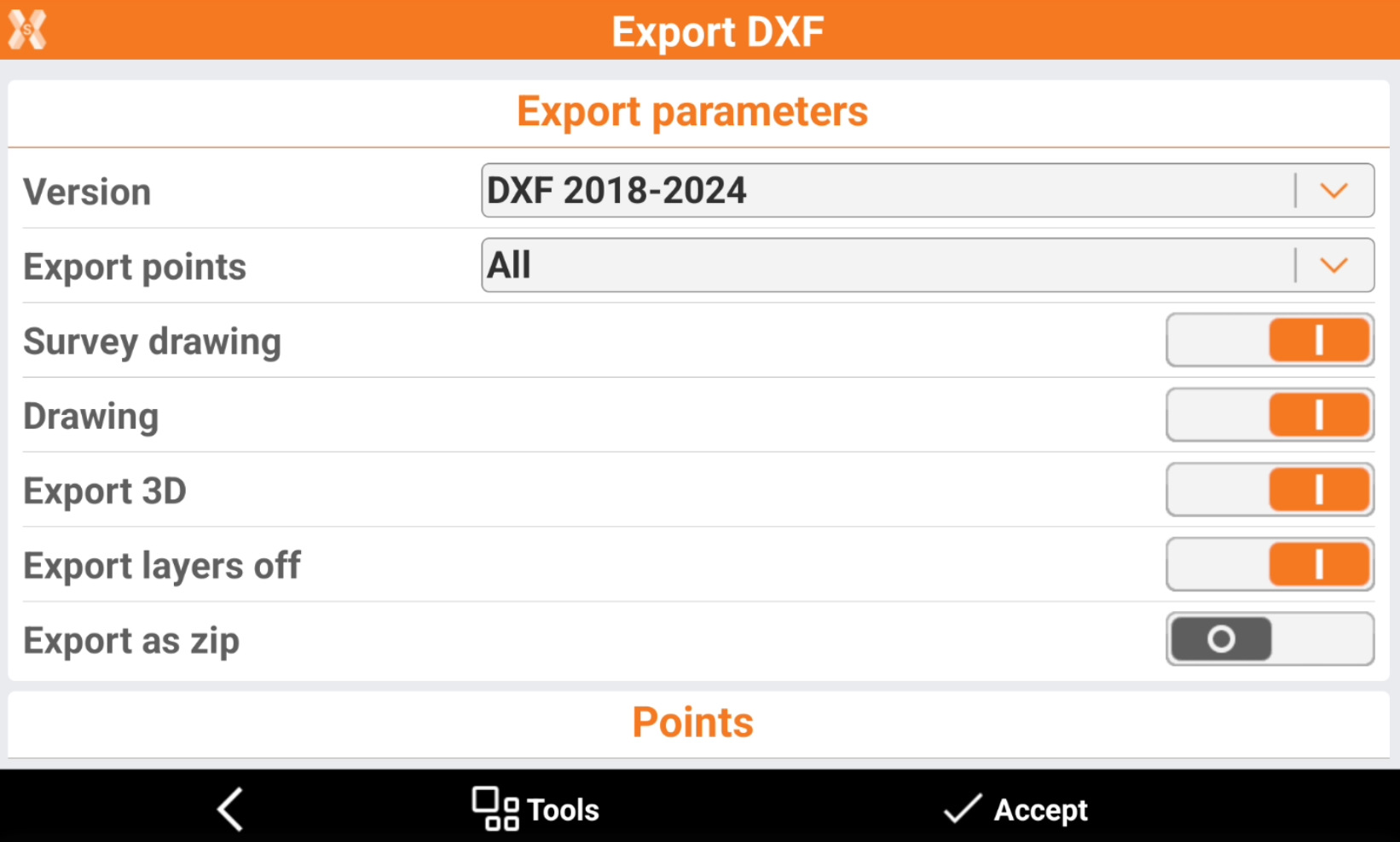
Version: version of the DXF format to create.
Export points:
All: exports all points in the job.
Only measured: exports only points that was measured in the field with an instrument.
Only measured TPS: exports only points that was measured in the field with a total station.
Only measured GNSS: exports only points that was measured in the field with a GNSS.
Selected: exports only selected points. It is possible to select the points to export from point table or from CAD clicking Points to export.
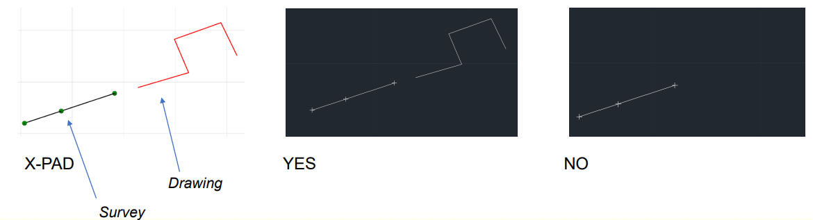
Survey drawing: activates the export of all the drawing elements that were created during the measurement operations with Smart drawing.
Drawing: activates the export of the drawings in the job. These elements was imported or created in CAD.
Export 3D: activates the export of data with elevation.
Export layers off: enables the export of data on layer that are turned off in CAD.
Export as zip: if enabled, the data is compressed in a zip file, including style files.
Add unit suffix to values: allows to specify if numeric labels in DXF export (elevations, distances, …) have to be exported with or without the suffix of the unit (m as meters, if as internation feet, …).
Points style: selects the style of exported points.
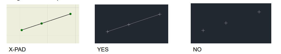
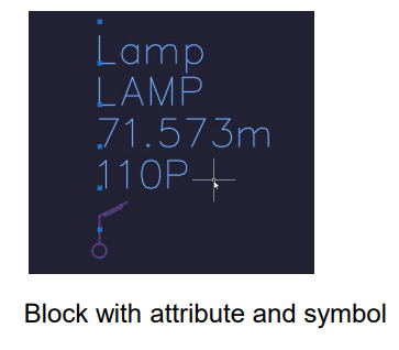
Block with attributes and symbol: point is exported with its point symbol. Attributes and symbol are exported as a block.
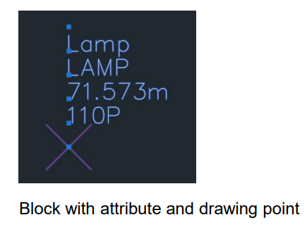
Block with attributes and drawing point: point is exported with drawing point. Attributes and symbol are exported as a block.
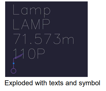
Exploded with texts and symbol: point is exported with its point symbol. Attributes are exported as text.
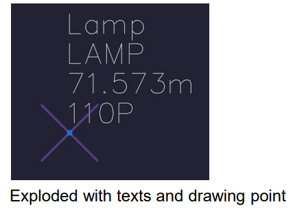
Exploded with texts and drawing point: point is exported with drawing point. Attributes are exported as text.
Label size: size of the text for the labels of the topographic point.

Layer of labels: select the layer for the labels.
Pre-defined layers: the layer for the labels is on the pre-defined layer.
Layer of points (same for all): the layer for the labels is on the same layer for all the points.
Layer of point (specific): the layer for the labels is on the layer of the specific point.
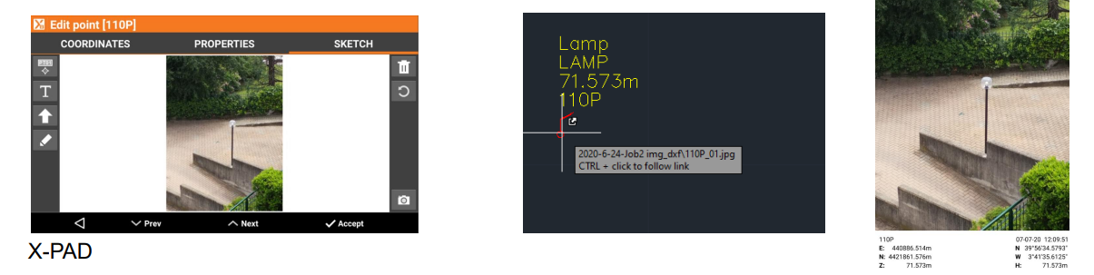
Export sketches: activates the export of the images associated with the points. The images are linked to the points to be opened as a reference (hyperlink) from CAD software.
Export collaborative survey points: activates the export of measured points also by the other members of a collaborative survey session.
The Labels to export options allow to define which labels to export for the topographic points.
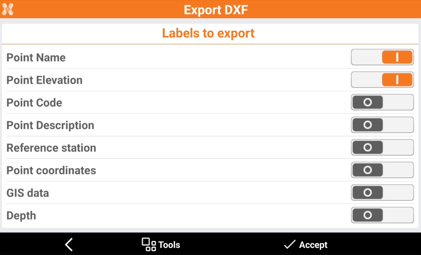
Point name: activates the export of the label with the point name.
Point elevation: activates the export of the label with the point elevation.
Point code: activates the export of the label with the point survey code.
Point description: activates the export of the label with the point description.
Reference station: activates the export of the label with the GNSS reference station.
Point coordinate: activates the export of the label with the point coordinate.
GIS data: activates the export of the label with the GIS attributes stored.
Depth: activates the export of the label with the depth value stored when working with a service locator.
Click Tools to save or load the export parameters. This helps to save a set of customized export parameters.
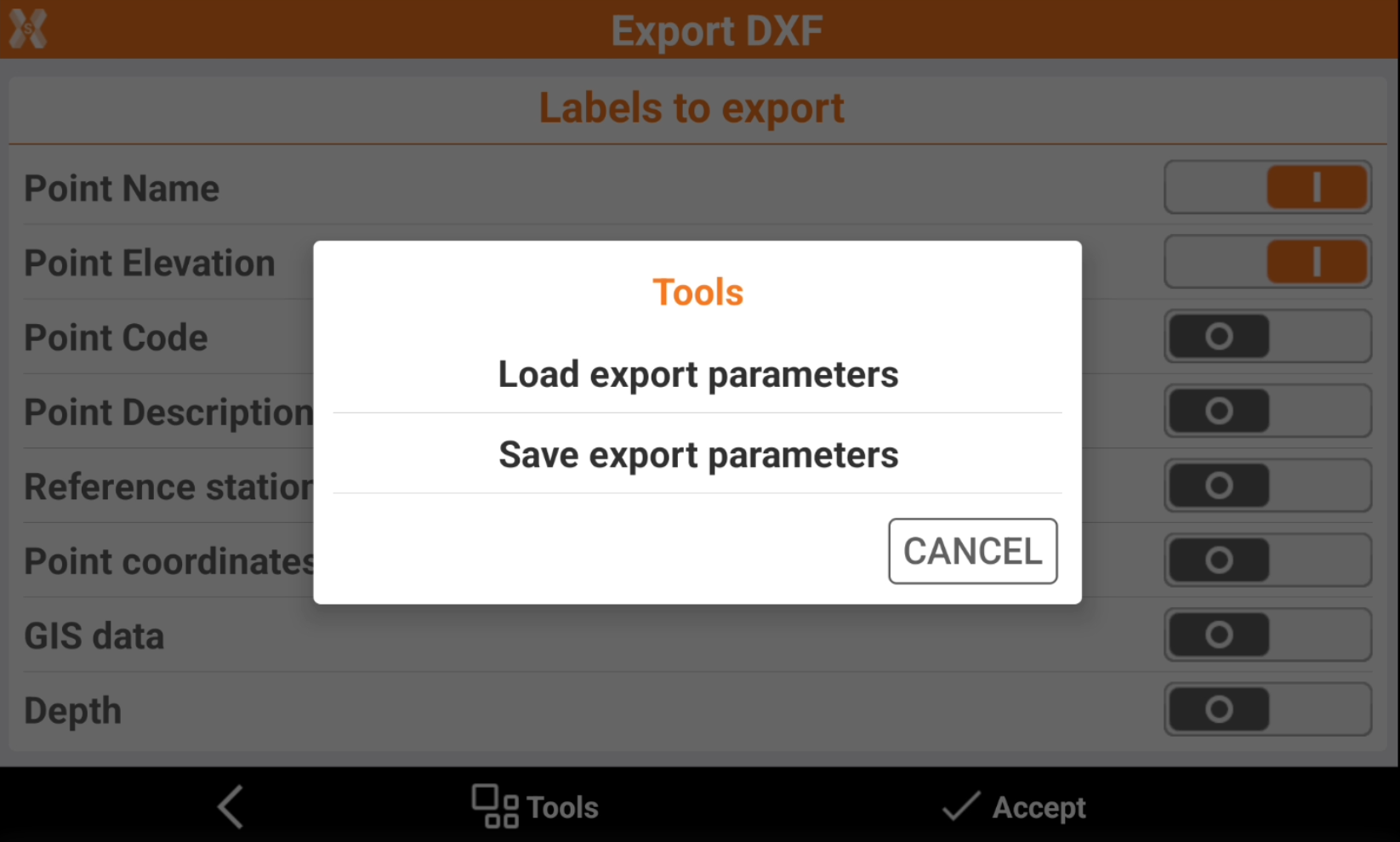
Load export parameters: export the scheme of selected parameters.
Save export parameters: import a saved scheme of selected parameters.
Click Accept to export the file.