Export a ESRI Shape file
 |
|  |
| 
Exports points and lines in ESRI Shape format.
For topographic points which have an photo attached, the points are exported including the name of the photo name as additional attribute. The files of the photos files are included in the final export file. The photos can then be managed within a GIS tool which can import Shape files.
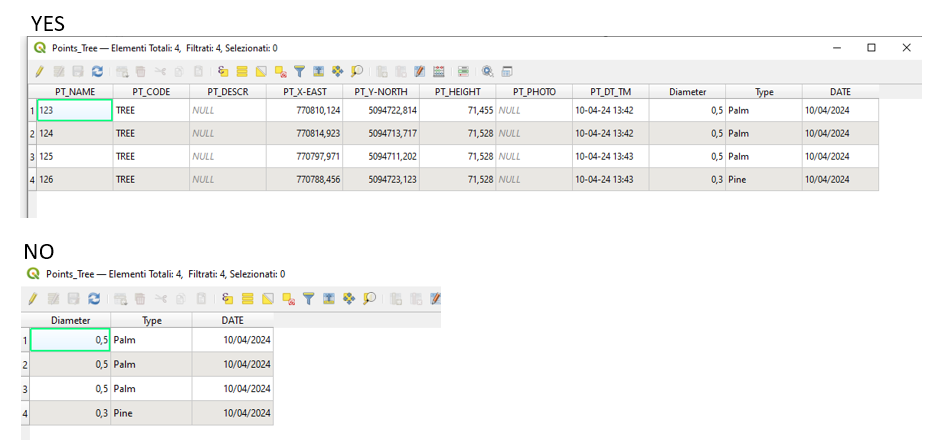
If GIS attributes have been stored for a topographic point, they are exported in the ESRI Shape file.
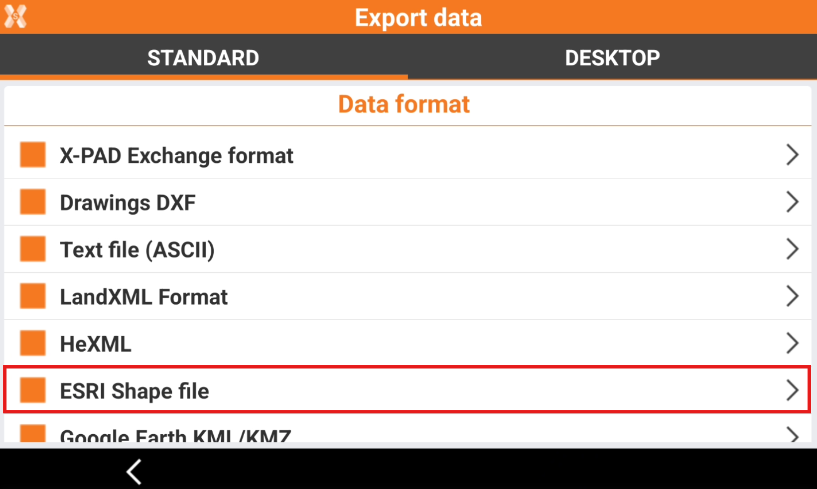
To export the data select ESRI Shape file.
Enter the Export options.
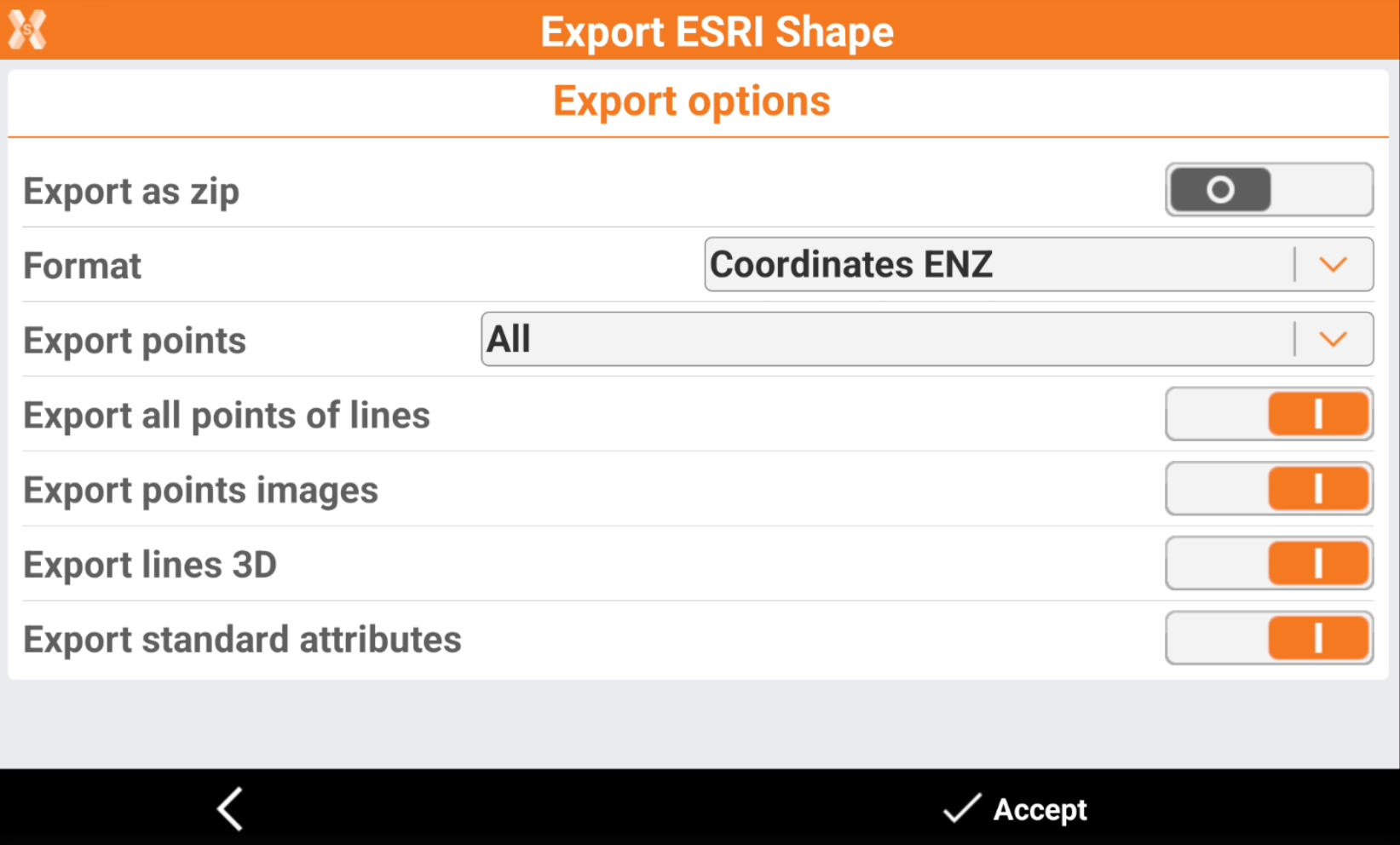
Export as zip: the files exported are compressed in a zip file.
Format: selects how the format of the coordinates.
Coordinates ENZ: the coordinates are exported as East, North and Elevation coordinates.
Coordinates LLH: the coordinates are exported as Latitude, Longitude and Ellipsoidal elevation coordinates.
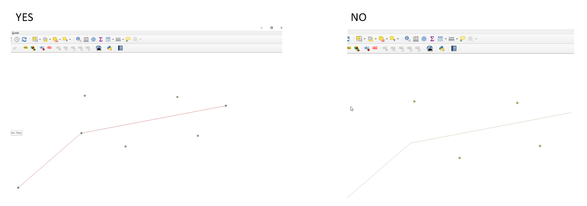
Export all points of lines: enables to export all line vertexes.
Export points images: export images attached to points.
Export lines 3D: enables to export lines in 3D.
Export standard attributes: enables to export standard attributes (coordinates, code, date and time, quality). If disabled exports only entered GIS attributes.
Click Accept to export the file.