Free station
 |
|  |
| 
The position and the orientation of the station are determined by measuring at least two reference points with known coordinates.
Select No. Station position has to be calculated.
Select Free station.
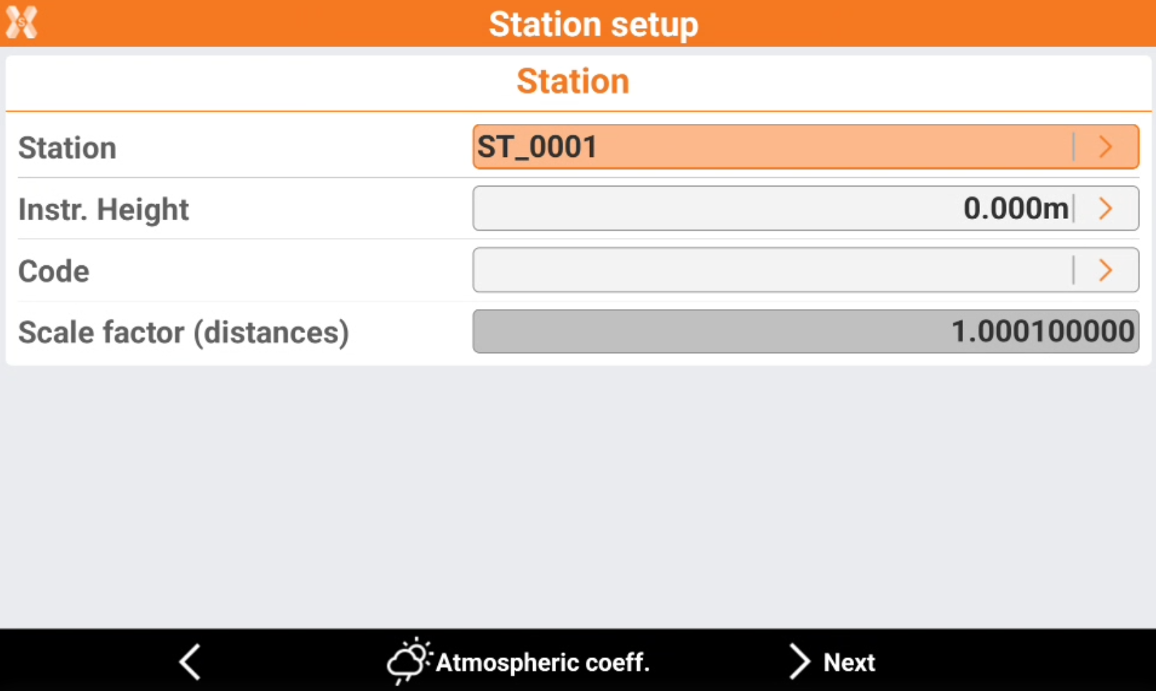
Station: name of the station. Select a point existing in the job.
Instrument height: elevation of the total station from the ground. It is possible to calculate the height of the instrument.
Code: code to assign to the station point in case a new point is created.
Click Atmospheric coeff to change the atmospheric coefficients.
Click Next to proceed with the guided procedure.
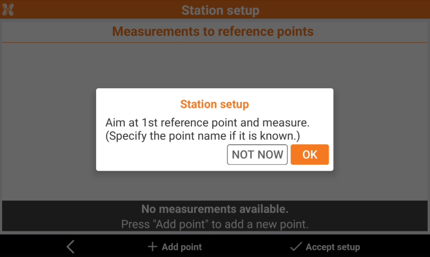
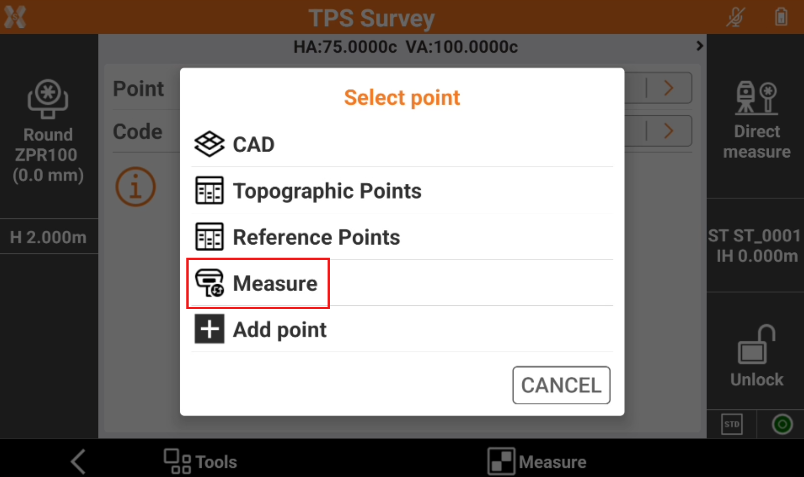
Define the first reference point and perform the corresponding measurement. It is possible to enter the reference name, select it from the list of points, from the list of the reference points or from the graphic window.
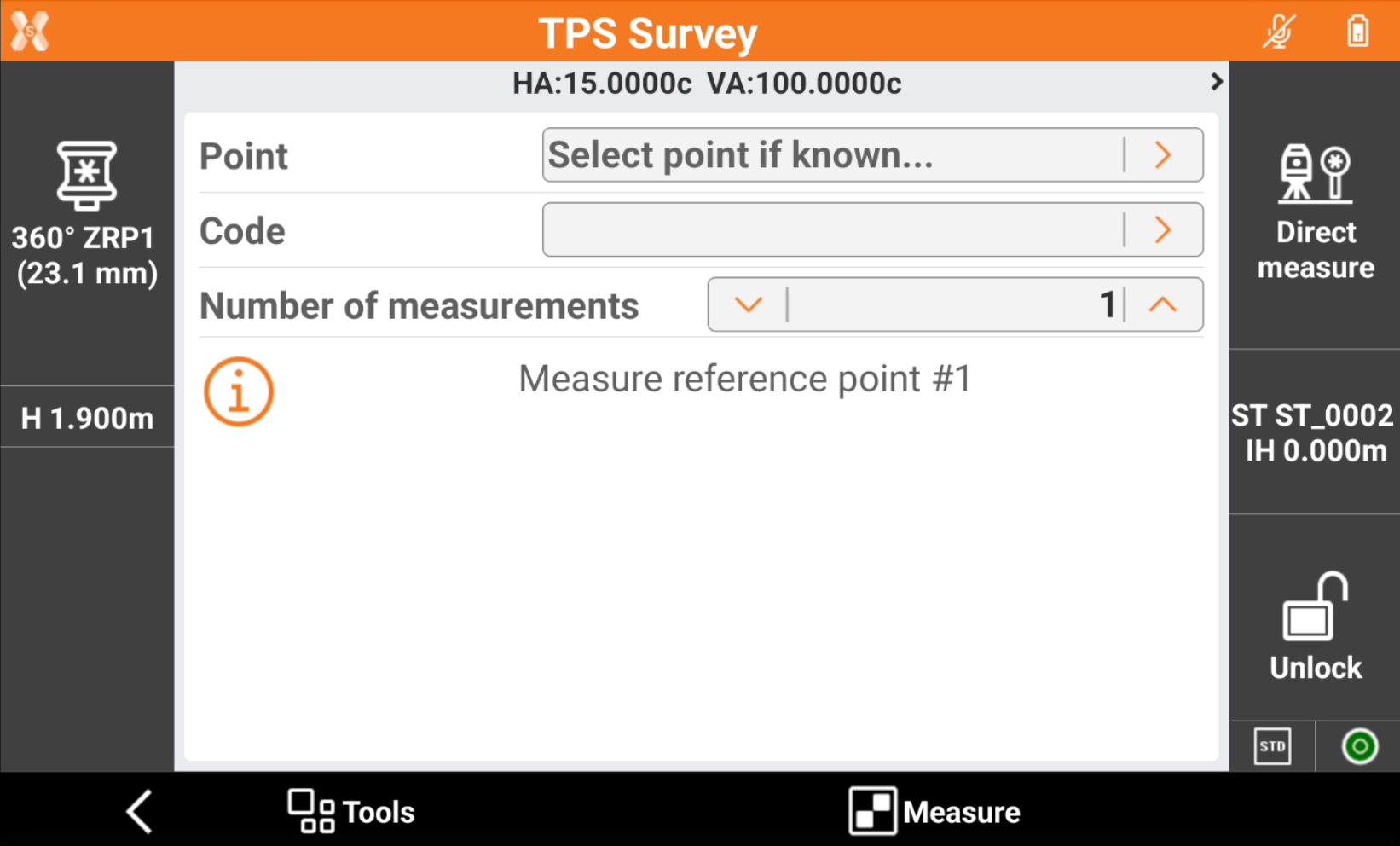
Aim the reference point.
Tap Measure.
After the first reference point has been measured, press OK to continue to add measurements.
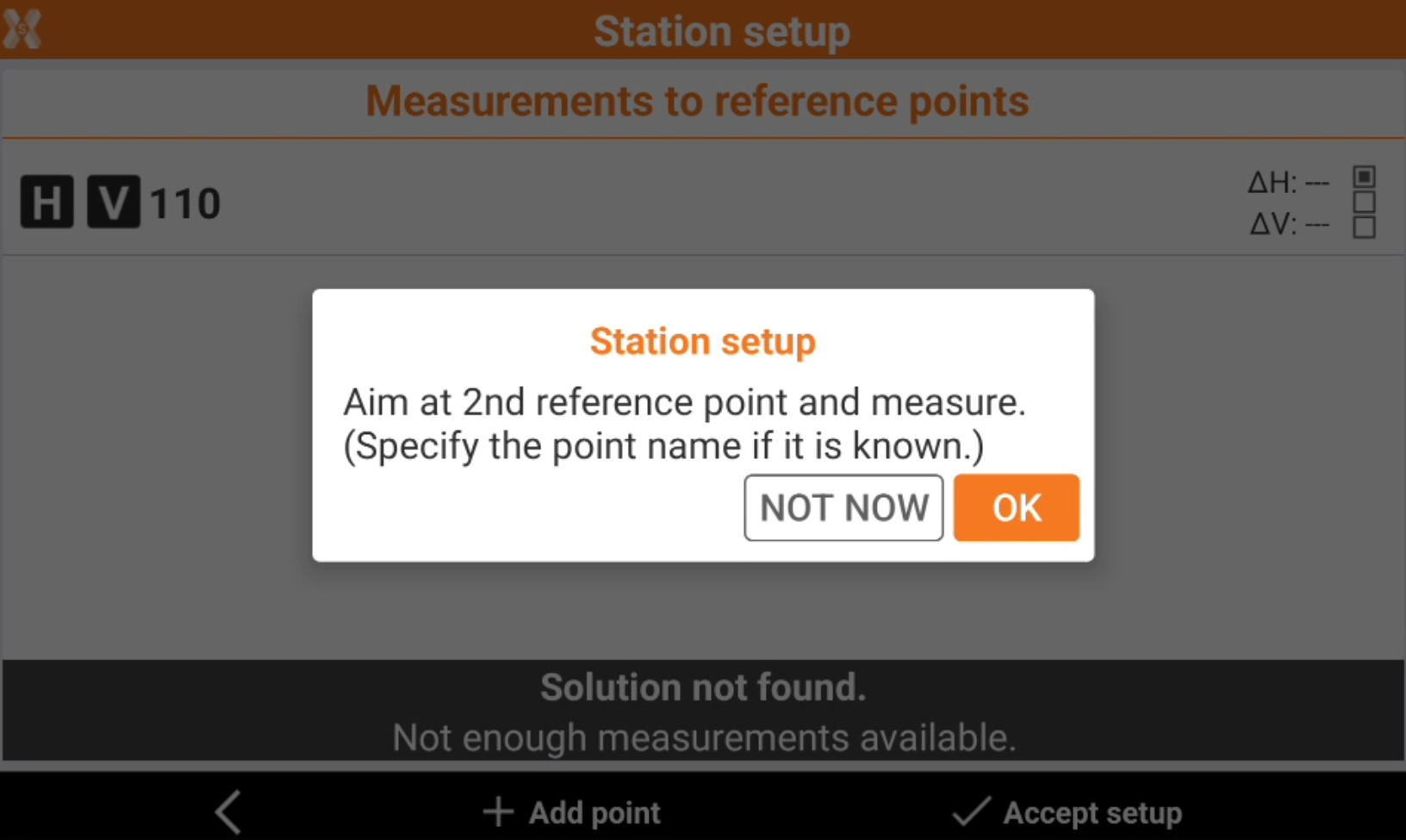
The software shows the list of measured reference points.
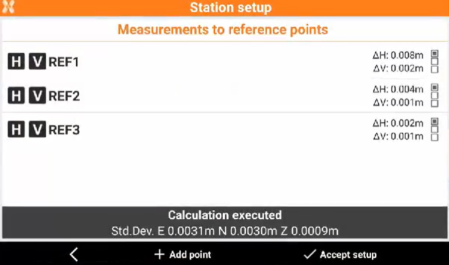
The points measured are displayed in a table. Displayed is:
The calculated standard deviation of every point.
The total standard deviation for the calculated station position.
Click H and V to enables and disables the use of the measurement for the orientation calculation of the station for the horizontal or vertical component.
Click
 to change the types of differences displayed.
Tap Accept setup to confirm set data and complete the procedure.
Click Report to generate and export the calculation report.
The instrument relocks to the prism automatically after the free station results have been accepted.
Free station working with X-POLE
Working with X-POLE allows the use the position provided by the GPS receiver as a known position as station for the total station.
When being asked to indicate the point of known coordinates, choose item Measure.
Measure the point for the free station with the GPS receiver.
The point is added in the list of points and becomes the requested known point.
Measure the same point with total station and complete the measuring procedure of the known point for calculating the station orientation.
Open free station
The procedure of the station setup in Free station mode can be completed at later time, during the survey operation.
However, it is good practice to complete the procedure before starting the point survey, with X-PAD it is not mandatory.
The possibility to leave the free station open, allows to measure the control points when in their proximity, without necessarily having to measure all the control points which could also be very far from each other.
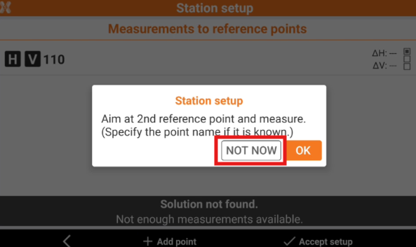
The free station setup requires the measurement of at least two control points. The software asks if you want to proceed with the measurement of control points.. Tap NOT NOW to postpone the measurement of the control points to a later step.
Depending on the measurements there are different scenarios:
starting the free station without measuring any control points: the station assumes arbitrary local coordinates and no orientation.
If only one control point has been measured: the station assumes local coordinates with respect to the control point but without any orientation.
If two or more control points have been measured: the station can already have a correct position and orientation.
To add new control points to a free station which has been left open click on the station data panel to go back to the command Survey points of the station setup procedure.
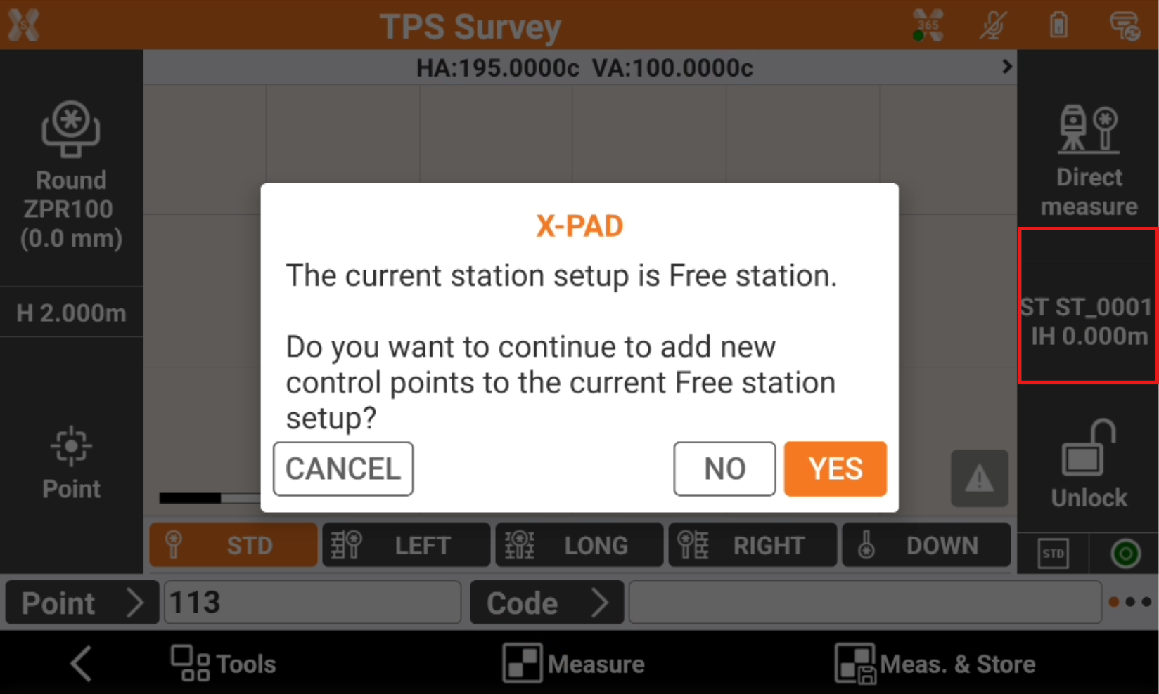
After adding a new control point to the free station:
The position and the orientation of the station are recalculated.
The position of all the points previously measured by the station is recalculated. Free station 3D.