GeoTRAil
 +ROBOTIC |
  + ROBOTIC |
  + ROBOTIC
The GeoTRAil function is used to search the prism using the GNSS position of the field controller.
The function requires a field controller with GNSS capabilities.
The GeoTRAil function, utilized with a Servo total station like Zoom70/75, allows to search the prism in all directions with a single click.
The first step is to active the localization on the controller. Be sure that the controller has the localization enabled.
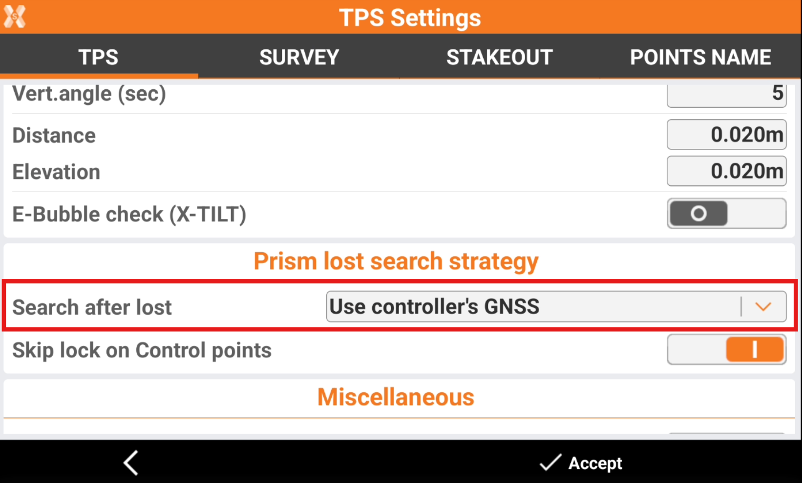
Open the TPS Settings and configure Use controller’s GNSS as Search after lost method.
The system requires some measured points, in order to have the GeoTRAil ready to be used. This is because each time a total station point is measured, the GNSS position from the controller is measured as well. As soon as there are enough pairs to calculate the transformation between local system and GNSS system, the GeoTRAil system is ready.
 : the GeoTRAil system is not ready. It requires to measure more points.
 : the GeoTRAil system is ready. Now it is possible to search the prism using the GNSS position of the controller.
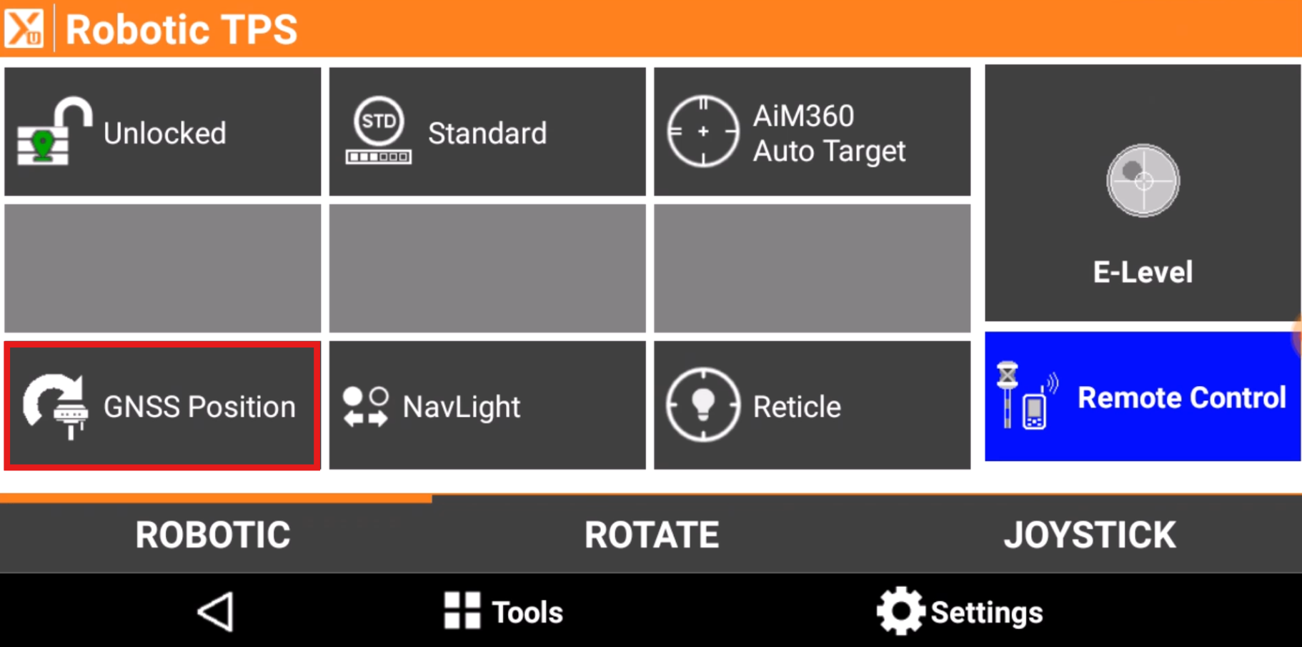
When the GeoTRAil system is ready, and the prism is lost, click GNSS Position to search the prism using the GNSS position of the controller.
Since the GNSS position of the controller is not very accurate, only the 2D position is used.
See below video on how to use GeoTRAil in the field.