Orientation to multi points

The station has been placed on a point of known coordinates and the orientation is determined through the measurement of multiple reference point with known coordinates.
The reference points must available in the list of topographic points or in the list of reference points.
Select Yes. Station position is known.
Select Orientation to multiple points.
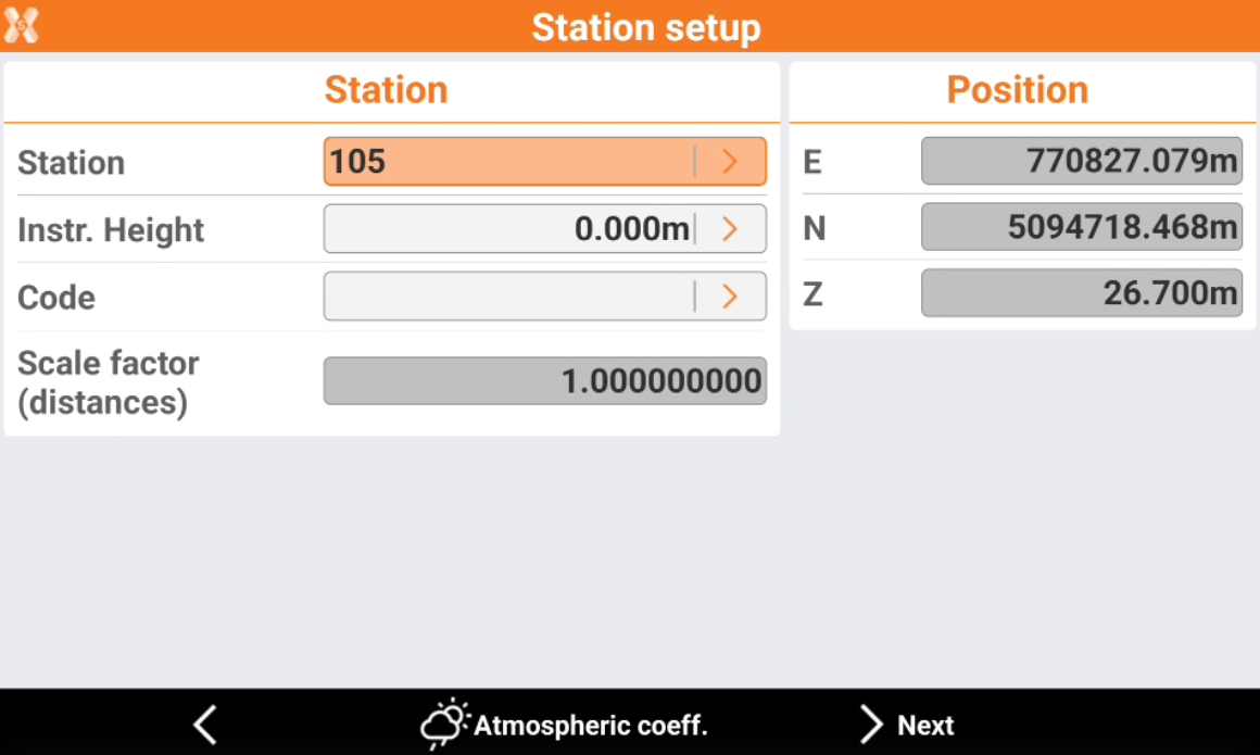
Station: name of the station. Select a point existing in the job.
Instrument height: elevation of the total station from the ground. It is possible to calculate the height of the instrument.
Code: code to assign to the station point in case a new point is created.
E, N, Z: coordinates of the station. When an existing point was selected, the values cannot be edited.
Click Atmospheric coeff to change the atmospheric coefficients.
Press Next to measure the first backsight point.
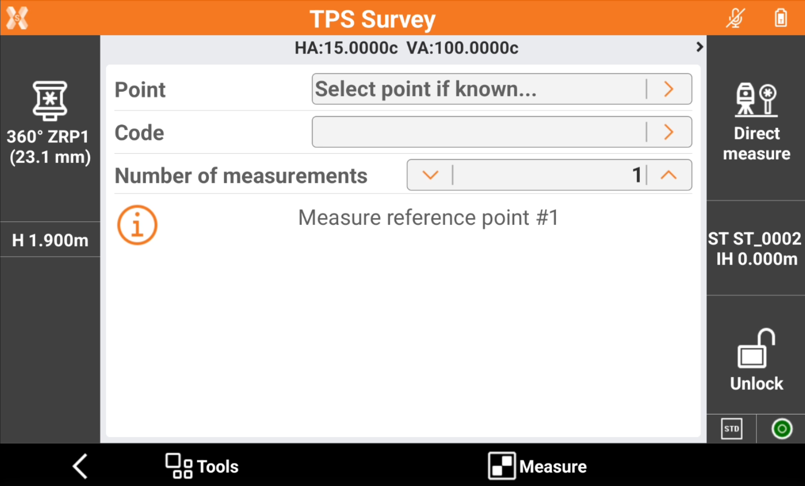
Aim the point of orientation.
Tap Measure.
The first measurement to the reference point is added to the list of measurements.
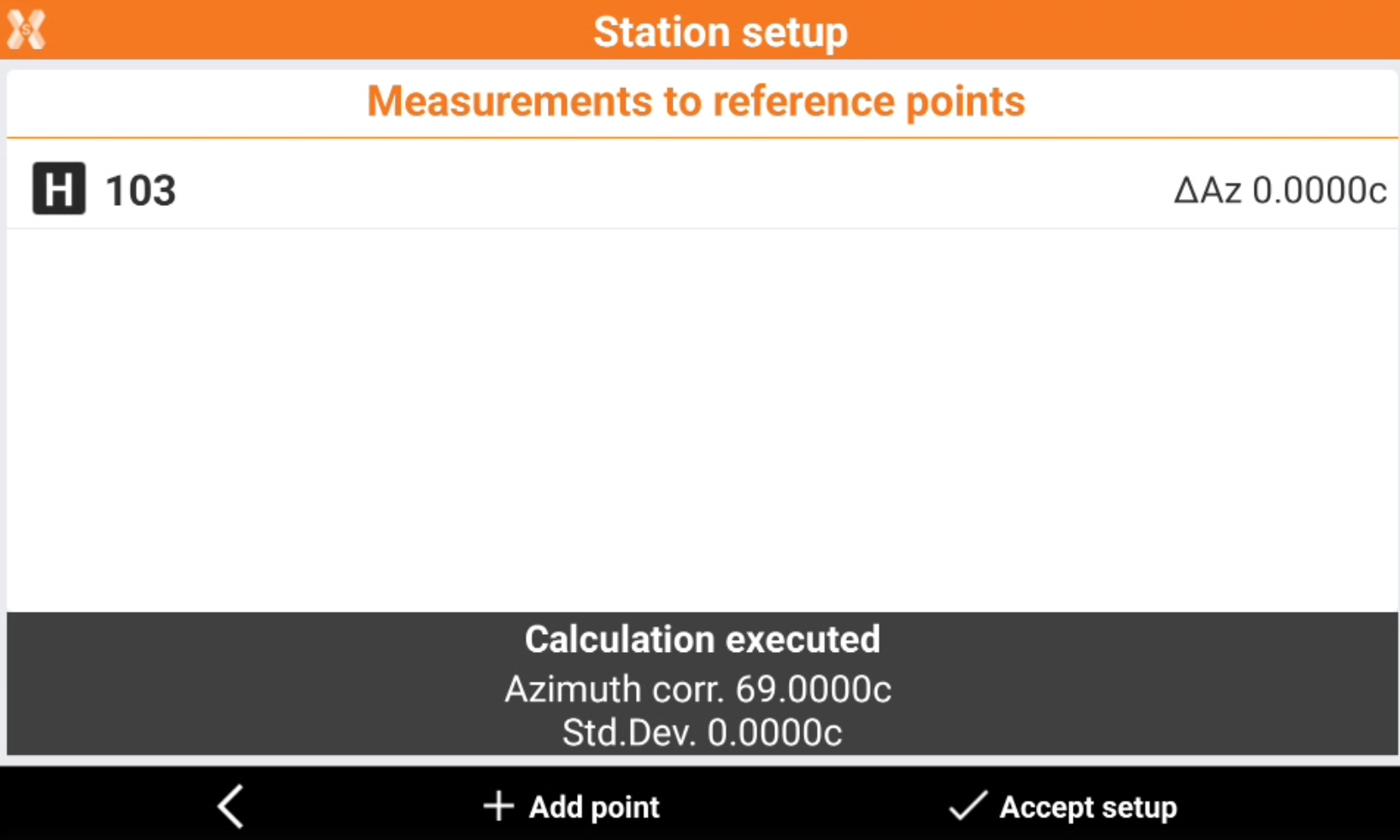
Click Add point to add a measurement to a new reference point.
The measured points are reported in a table showing the differences calculated at each point and the total standard deviation on the orientation calculation.
Press H to enables and disables the use of the measurement for the orientation calculation.
Tap Accept setup to confirm set data and complete procedure.