Web Feature Service (WFS)
 |
| 
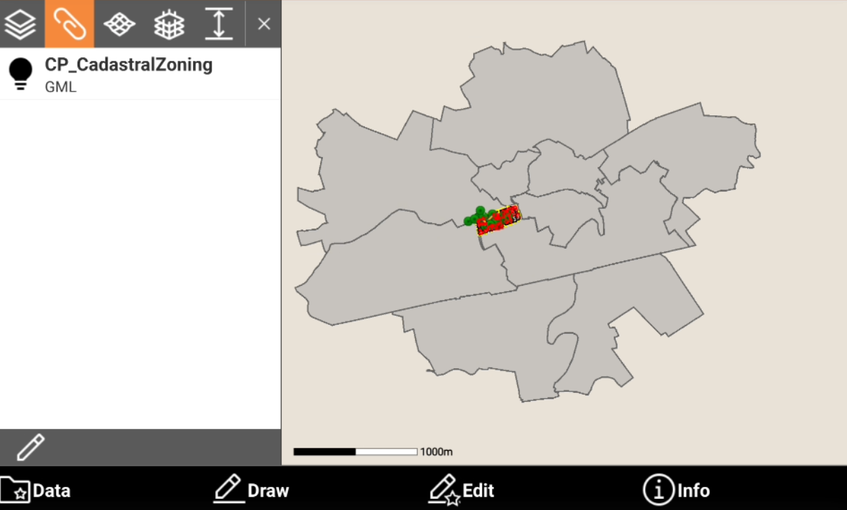
In the WFS is loaded only in External reference.
WFS (Web Feature Service) are cartographic services accessible through internet.
They can provide both spatial (vectorial) and not spatial data on different layers.
Governing entities are increasingly publishing information in this format. Accessing this information is extremely useful in situations where users need to work with public datasets such as cadastral parcels, reference points, utilities, and more.
Once the WFS service has been selected, is possible to choose the interested layer, have a full preview of its content and then define the interested area. All the elements in that area (polylines, polygons, points), can be imported in the current job as external reference GML files.
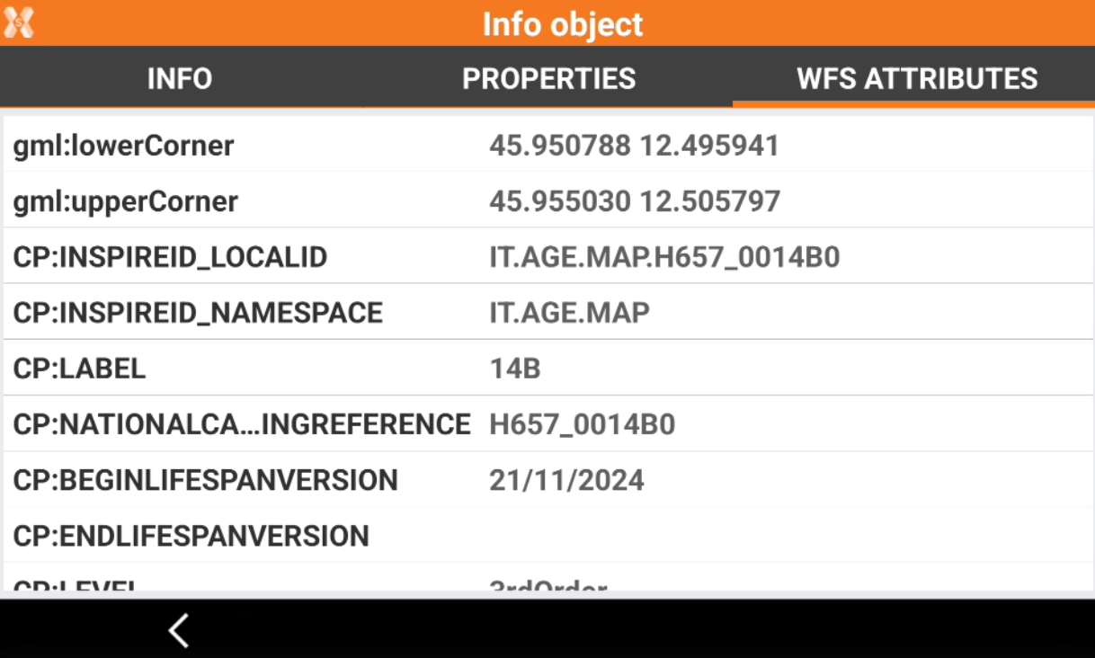
In most of the cases drawing elements have a set of attributes that give more information about each specific object; those attributes are accessible in the information page.
Click Map
 to open the map view.
Click Select map
 to open the setting menu.
Open WFS page.
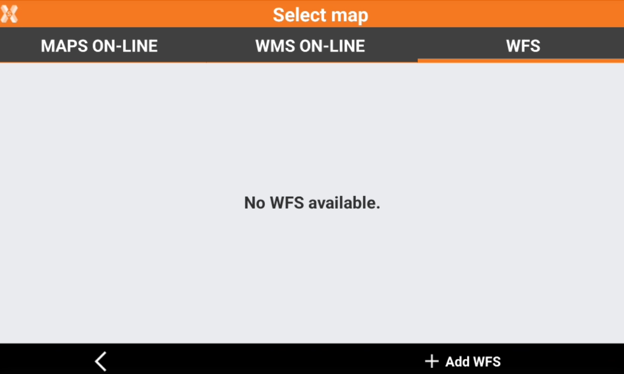
Click Add WFS to add a new WMS.
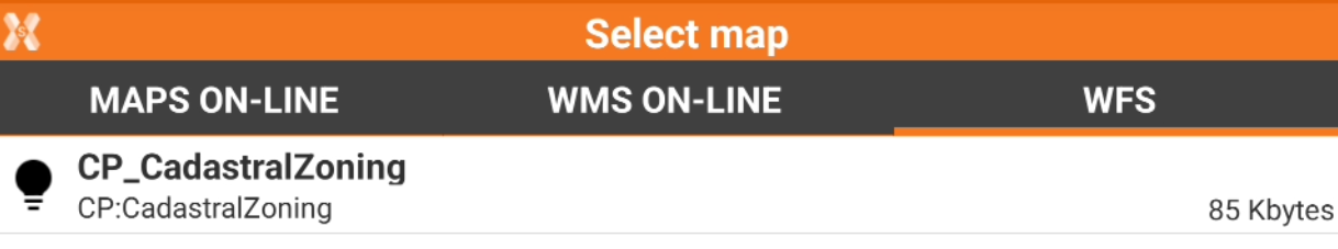
Select the map:
WFS - Online: allows to connect an online WFS.
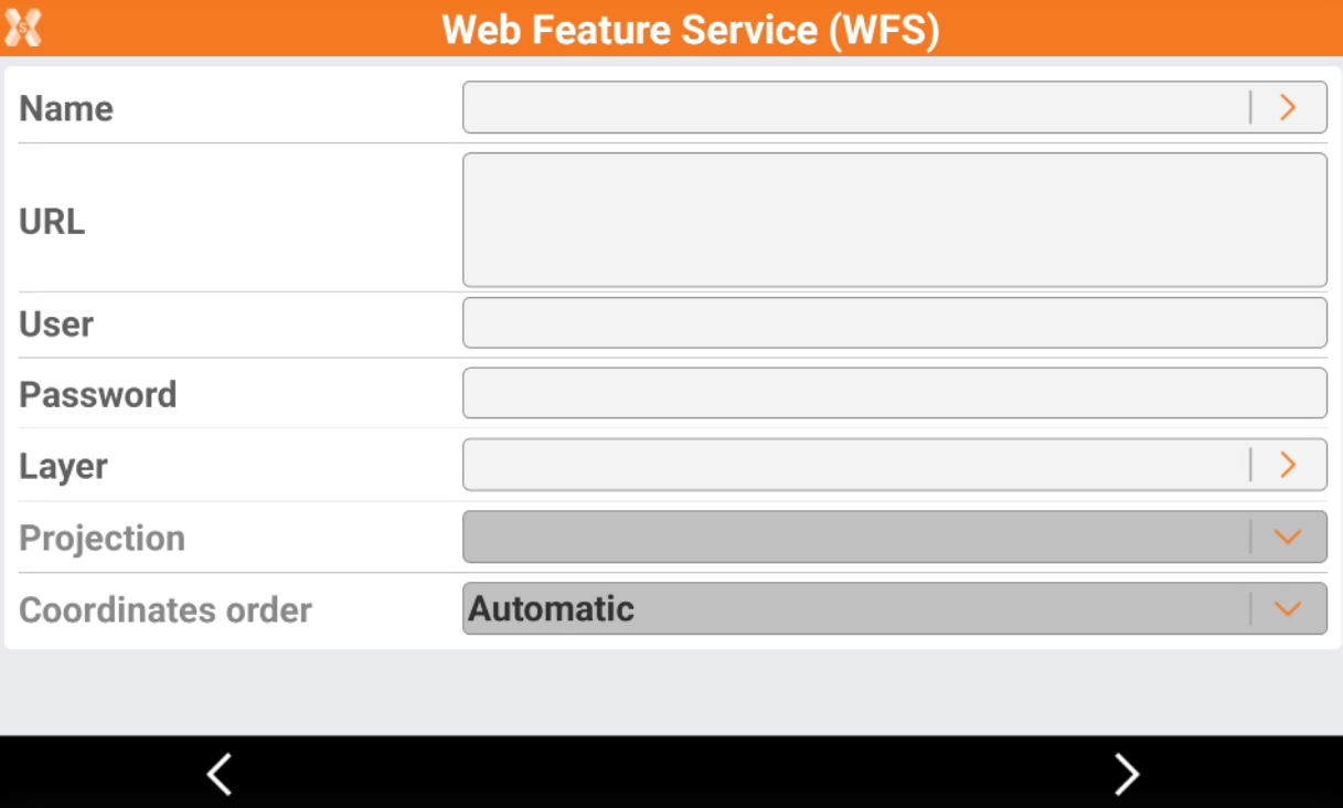
Name: Name to assign to the WFS map. Click the orange arrow to load predefined WFS services.
Url: internet address of the WFS map.
User: user name for accessing the WFS service (optional).
Password: password for accessing the WFS service (optional).
Layer: to select the layer to visualize among the ones available in the server, click the orange arrow to display the available layers.
Projection: projection used by the WFS service.
WFS - Offline/GML: to load a WFS layer from a stored GML (Geography Markup Language).
Click Accept to load the WMS.
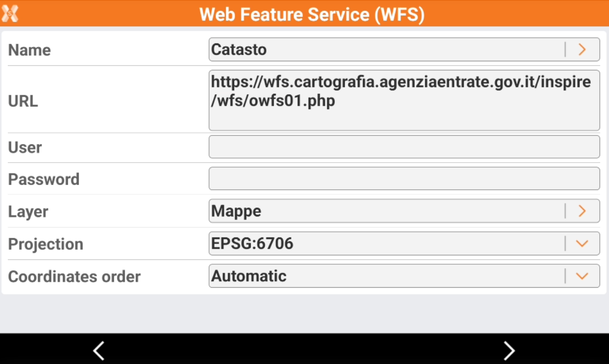
We loaded WFS for some countries. Predefined WFS are available in the country package.
If you cannot load a WFS, try to change the projection.
Click Next. The software shows the WFS extension.
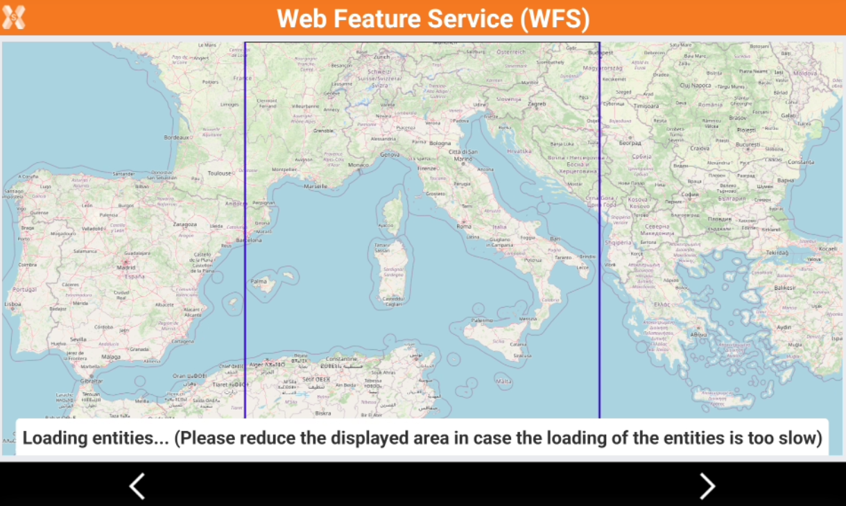
Reduce the displayed area to the zone of interest.
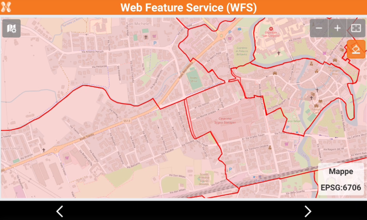
Click Next to save and import the WFS data in a new layer. The data will be recorded as external reference.
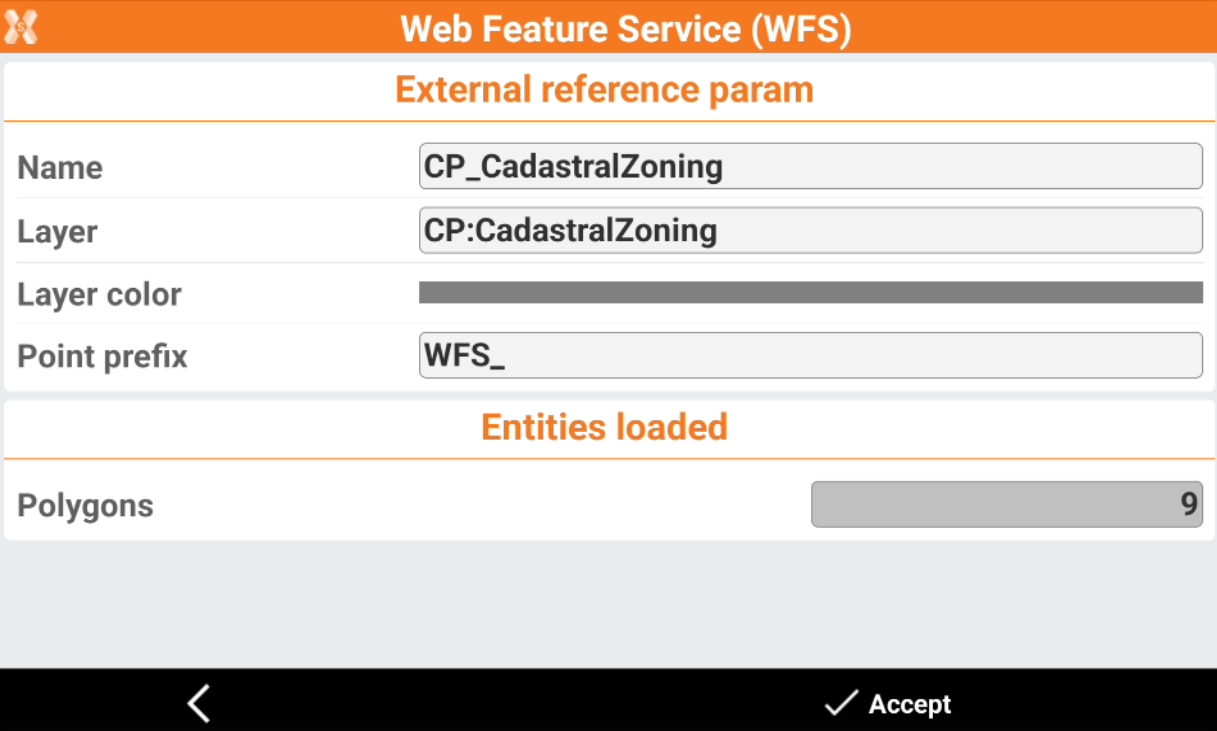
Name: the name of the external reference to save with the WFS data.
Layer: the name of layer where data is saved.
Layer color: the color of the layer where data is saved.
Point prefix: the prefix for points imported from the WFS.
Click Accept to import the data from WFS. The data will be saved as external reference GML file.
Data is visible as external reference in CAD.
Query WFS attributes
In most of the cases drawing elements have a set of attributes that give more information about each specific object; those attributes are accessible in the information page.
Select a WFS element and click Info.
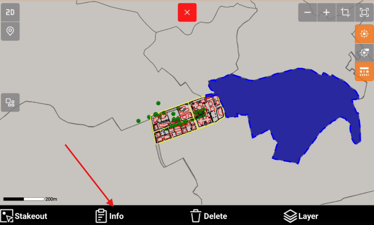
Open the WFS attributes page to read the attributes of the selected element.