
You can export the file data in DWG/DXF format for AutoCAD using the command.
-
Click File.
-
Click Create DXF/DWG file for Autocad.
-
The command opens a window.
-
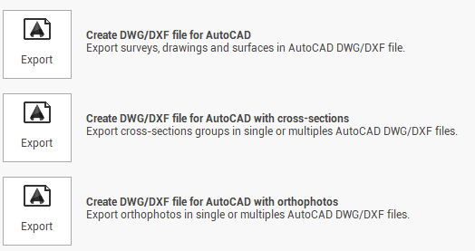
Create DWG/DXF file for AutoCAD: exports surveys, drawings and surfaces.
-
Create DWG/DXF file for AutoCAD with cross-sections: exports the cross sections group in a single file or multiple file.
-
Create DWG/DXF file for AutoCAD with orthophotos: exports orthophotos in a single or multiples files.
To save the file as DXF or DWG, you must rename the export file extension in dxf or dwg.
Create DWG/DXF file for AutoCAD
-
This function exports surveys, drawings and surfaces to format DXF or DWG.
-
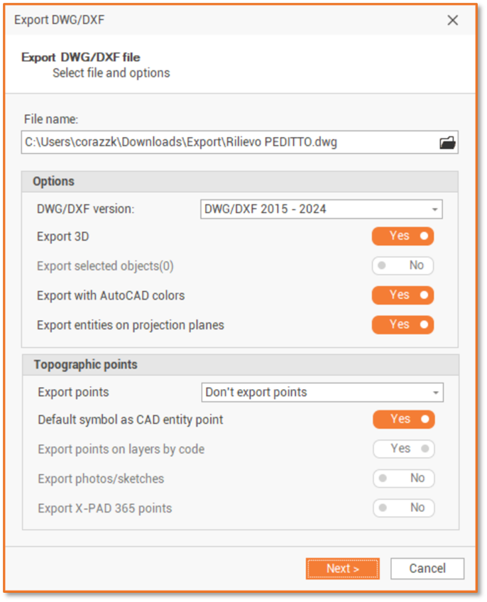
The command requires the following settings:
-
File name: allows to choose the name and the path where you want to save the file and if exported file is in DXF or DWG format.
-
DWG/DXF version: sets the version of the AutoCAD format. This allows the program to perform the operation compatible with the AutoCAD installed.
-
Export 3D: enables/disables the export of data with the elevation. If the option is not active the items will be exported without the z-coordinate.
-
Export selected objects: enables/disables the export of data with the elevation. If the option is not active the items will be exported without the z-coordinate.
-
Export with AutoCAD colors: enables/disables the use of true colors or using AutoCAD colors. If this option is enabled, it remap colors in Fusion to use the 256 Autocad colors.
-
Export entities on projection planes: with this option enabled the software can identify elements belonging to each projection plane and generate a dedicated sub-drawing for each one.
As a result, plans and side elevations are automatically generated in the final DXF/DWG.
-
Export points: enables/disables the export of topographic points.
-
Default symbols as AutoCAD entity point: if enabled the point default symbol is exported as POINT entity, otherwise is exported as block.
-
Export points on layers by code: enables/disables the export of topographic points on the layer defined by the survey code.
-
Export as block: enables/disables the export of topographic points as blocks. In this case, the point data (name, code, description, and quota) will be exported as block attributes.
-
Export Photos/Sketches: export Photos/sketches link to topographical points.
-
-
Then the command prompts you to select the subprojects of which export the data.
Create DWG/DXF file for AutoCAD with cross sections.
-
This function exports the cross sections group in a single file or multiple file.
-
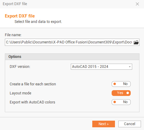
The command requires the following settings:
-
File name: allows to choose the name and the path where you want to save the file and if exported file is in DXF or DWG format.
-
DWG/DXF version: sets the version of the AutoCAD format. This allows the program to perform the operation compatible with the AutoCAD installed.
-
Create a file for each section: enables/disables the creation of a file for each single cross section. If disabled creates a single file that contains all sections or profiles.
-
Layout mode: enables/disables the export of cross sections or profiles in their layout drawing.
-
Export with AutoCAD colors: enables/disables the use of true colors or using AutoCAD colors. If this option is enabled, it remap colors in Fusion to use the 256 Autocad colors.
-
-
In the last step the procedure allows to choose the Section groups to export.
Create DWG/DXF file for AutoCAD with orthophotos.
-
This function exports orthophotos in a single or multiples files.
-
You can export the orthophotos of the project to individual files in DXF/DWG format or in a single file.
-
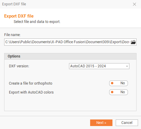
The command requires the following settings:
-
File name: allows to choose the name and the path where you want to save the file and if exported file is in DXF or DWG format.
-
DWG/DXF version: sets the version of the AutoCAD format. This allows the program to perform the operation compatible with the AutoCAD installed.
-
Create a file for orthophoto: enables/disables the creation of a single file for each orthophoto. If disabled it creates a single file that contains all selected orthophotos.
-
Export with AutoCAD colors: enables/disables the use of true colors or using AutoCAD colors. If this option is enabled, it remap colors in Fusion to use the 256 Autocad colors.
-
-
In the last step the procedure allows to choose the data to export.