
You can export data in KML format to be loaded to Google Earth.
-
Click File.
-
Click Create Google Earth KML file.
-
The command opens a window.
-
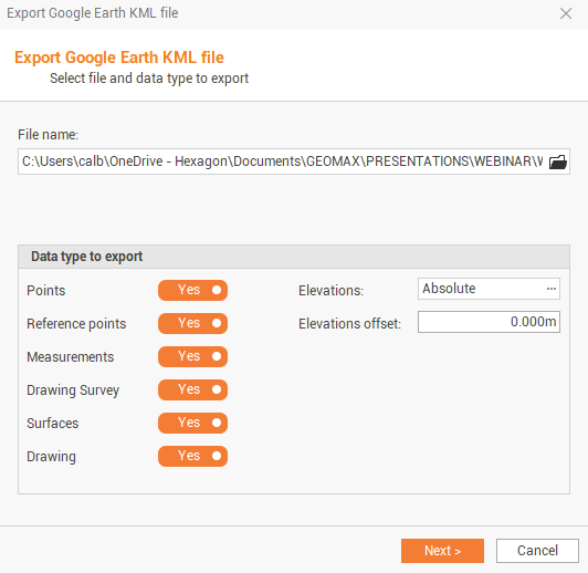
File name: allows to choose the name and the path where you want to save the file.
-
Points: enables/disables export of survey subproject points.
-
Reference points: enable/disable export of reference points.
-
Measurements: enables/disables export of measure drawing.
-
Drawing survey: enables/disables export of survey drawing.
-
Surface: enables/disables export of surface subproject data compatible with the format LandXML.
-
Drawing: enable/Disable the export of drawing data.
-
Elevation: allow to choose whether to export elevations Absolute or the Ground (2D).
-
Elevations offset: allows to apply a vertical offset to the value of the elevation of the elements.
-
-
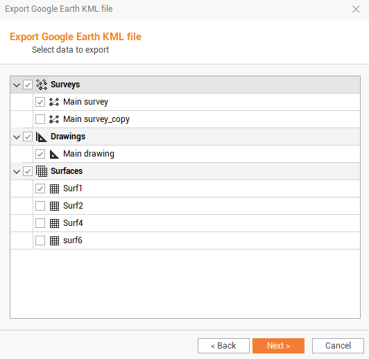
Click Next to select the subproject to export.
-
Click Next to export the data.
-
Click on Start Google Earth to open the application if available on PC, or click End to conclude the export process.
This export can only be used if a coordinate system has been set or if GNSS measures are present in the survey subproject.