3D Reconstruction [Ground]
The workspace of the 3D reconstruction page is organized as follow:
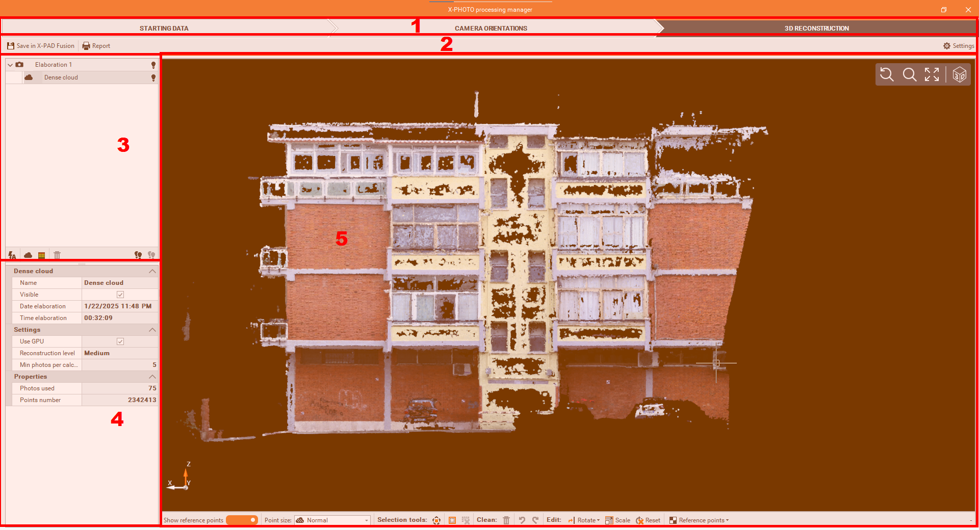
Top bar: the main menus of the X-Photo Processing manager,
Sub-Menu Bar: where you can access the related settings of the current main menu,
Outputs bar: where the elaborations' outputs are listed. Here below are the different functions we have from this panel:
3D reconstruction
 : Allows to execute multiple 3D reconstruction calculations in a single operation.
Dense cloud
 : Generates the dense point cloud,
3D Mesh
 : Generates the 3D mesh with textures,
Delete 3D data
 : Deletes selected result,
All visible
 : Makes visible all the elaborations' results,
All invisible
 : Hides all the elaborations' results.
Properties: to view and modify some properties of the selected elaboration result.
CAD view: is a graphic view where to check the generated dense point cloud, with some editing commands:
Points size
 : changes the point size of the point cloud, from one of these sizes: Small, Normal, Large and Extra large.
Select polygon
: to select points by defining a closed polygon in the screen,
Invert selection
: to invert the current selection,
Cancel selection
: to cancel all the points selected,
Delete selection
 : to delete selected points from the Point Cloud,
Undo
 : to restore previous visibility status of Point Cloud,
Redo
 : to cancel the effect of the previous Undo command,
Rotate
 : to rotate the point cloud by specifying a Horizontal or Vertical direction,
Scale
 : to scale the point cloud by specifying 2 points and the real distance between them,
Reset
 : to cancel the current transformation and restore the original position if the point cloud,
Reference points
 : the position of reference points can be defined and used to georeference the point cloud.
Scale the point cloud
With the ground photo processing it is possible to scale and rotate the point cloud using the commands on the bottom.
If reference points was used, it is possible to use the button Reference Points to recall and use the reference points.
Otherwise click Rotate to rotate horizontally or vertically the point cloud.
Click Scale to scale the point cloud, selecting two points and entering the distance between the two points.
3D reconstruction
After the Calibration, we can run the Dense Cloud process and create the corresponding Points Cloud.
To start the 3D Reconstruction process, click on

From the 3D elaboration settings, you can modify the settings of each single elaboration (dense point cloud, 3D mesh)
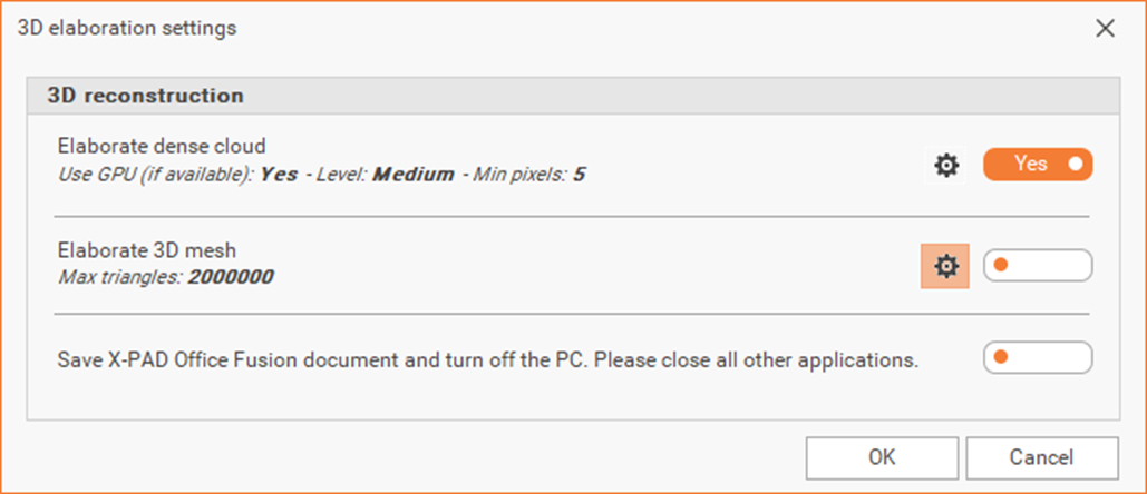
At the end of the elaborations, X-PAD Office Fusion can automatically save the project and turn off the PC