-
Baselines page shows the baselines created after a GNSS processing.
-
Click Baselines.

-
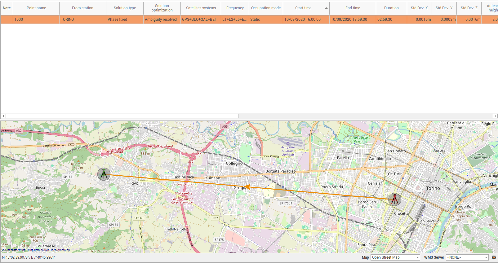
In the central panel the calculated baselines.
-
In the map view the baselines are visualized as arrows.
-
The table shows the calculated baselines.
-
Note: shows notes or errors related to the processing of the selected baseline.
-
Point name: the name of rover in the baseline.
-
From station: the name of reference station in the baseline.
-
Solution type: the type of GNSS solution after the processing.
-
Solution optimization: the calculation strategy used by the software.
-
Satellite systems: the satellite constellations used for the baseline processing.
-
Frequency: the frequencies used for the baseline processing.
-
Occupation mode: the occupation mode if static or kinematic.
-
Start time: the starting date and time of the raw data processing for the selected baseline.
-
End time: the ending date and time of the raw data processing for the selected baseline.
-
Duration: the duration of the observations used for processing the baseline.
-
Std Dev X,Y,Z: the standard deviation of result for X,Y,Z components.
-
Antenna height: the rover antenna height.
-
Antenna name: the rover antenna name.
-
Ephemeris type: the type of ephemeris used, if broadcast or precise.
-
WGS84 latitude, longitude, height: the coordinate of the result as WGS latitude, longitude and height.
-
X,Y,Z: the coordinate of the result as X,Y,Z if a coordinate system has been assigned to the project.
-
dx, dy, dz: the values of the baseline vector.
-
Slope distance: the slope distance of the baseline vector.
-
-
To delete an existing baseline click on Delete or select Delete from the context menu of the baseline.

