GIS features
 + GIS |
  + GIS |
  + GIS
+ GIS
If a GIS feature is associated with a code, a window displays the attributes of the GIS feature that have to be filled in.
The window can be organised in pages, one for every GIS feature, because more than one code can be assigned to a code (composed codes).
On each page, the attributes to be fill in are displayed.
All information associated to points can be exported in different ways. For example as ESRI Shape file, as labels in the DXF export or in an ASCII file.
For more information on how to assign GIS features to survey code see GIS manager.
Enter GIS features
When a point is measured using a code with GIS features, the GIS data page is opened.
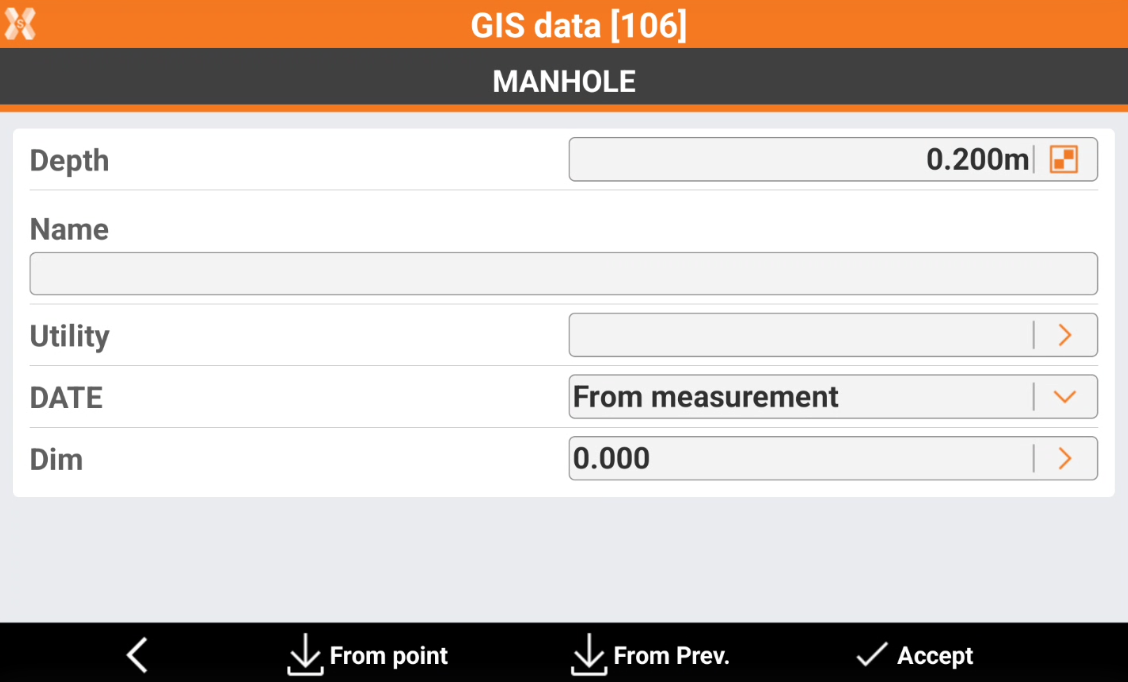
The page allows to enter all GIS attributes configured for the specific survey code.
If attribute is a Free attribute, enter the value or click
 to select the value from a list. When entering a value it is also possible to click on QR code icon
  in the virtual keyboard to read the value from a QR code.
If attribute is a Pre-defined attribute, the field is From measurement and automatically calculated from the software.
If attribute is a Measured attribute, click
 to measure the value.
Click From point to load values of the attributes saved in one of the points in the job. Select the point from which to load values of the attributes.
Click From Prev to Load values of the attributes saved with the previous point.
Click Accept to save the attributes.