
3D Reconstruction [Aerial]

  • The workspace of the 3D recontruction page is organized as follow:
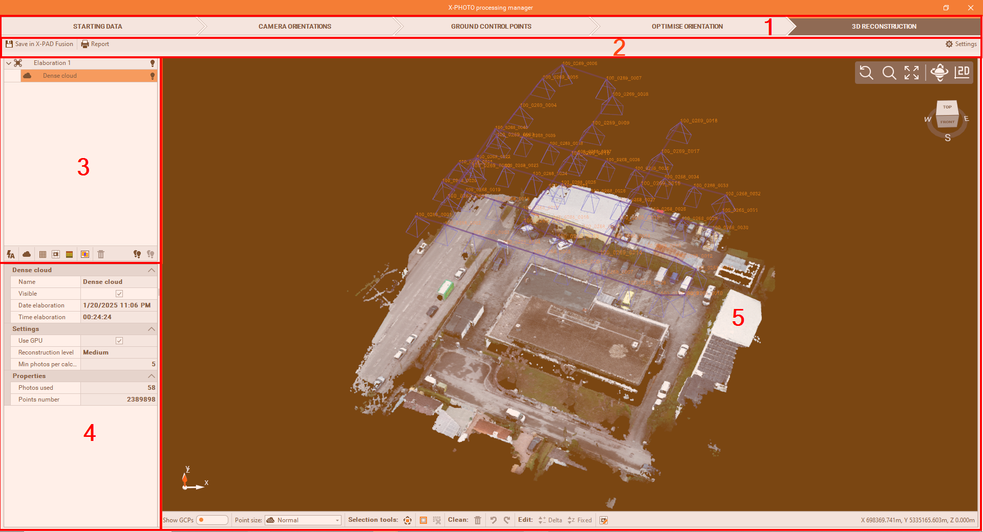
    image-20250120-213909.png
  1. Top bar: the main menus of the X-Photo Processing manager.

  2. Sub-Menu Bar: where you can access the related settings of the current main menu.

  3. Outputs bar: where the elaborations' outputs are listed. Here below are the different functions we have from this panel:

    • 3D reconstruction image-20250120-210608.png : allows to execute multiple 3D reconstruction calculations in a single operation.

    • Dense cloud image-20250120-212035.png : generates the dense point cloud.

    • DSM image-20250120-212106.png : generates the Digital Surface Model.

    • Orthophoto image-20250120-212257.png : generates the Orthophoto.

    • 3D Mesh image-20250120-212342.png : generates the 3D mesh with textures.

    • Photos overlay map image-20250120-212421.png : allows to check the overlap of the photos used for the camera orientation.

    • Delete 3D data image-20250120-212453.png : deletes selected result.

    • All visible image-20250120-212520.png : makes visible all the elaborations' results.

    • All invisible image-20250120-212553.png : hides all the elaborations' results.

  4. Properties: to view and modify some properties of the selected elaboration result.

  5. CAD view: is a graphic view where to check the generated dense point cloud, with some editing commands:

    • Show GCPs image-20250120-214336.png : shows on the graphic view, all the GCPs used.

    • Points size image-20250120-214814.png : changes the point size of the point cloud, from one of these sizes: Small, Normal, Large and Extra large.

    • Select polygon image-20250120-084033.png : to select points by defining a closed polygon in the screen.

    • Invert selection image-20250120-084344.png : to invert the current selection.

    • Cancel selection image-20250120-084505.png : to cancel all the points selected.

    • Delete selection image-20250120-215557.png : to delete selected points from the Point Cloud.

    • Undo image-20250120-220229.png : to restore previous visibility status of Point Cloud.

    • Redo image-20250120-220621.png : to cancel the effect of the previous Undo command.

    • Delta elevation image-20250120-220752.png : to modify the elevation of selected points with a delta elevation.

    • Fixed elevation image-20250120-220847.png : to modify the elevation of selected points with a fixed elevation.

    • Correct orthophoto image-20250120-221630.png : to correct the selected zone of the orthophoto by applying one single photo.

    • Coordinates bar image-20250120-215732.png : displays the cartographic coordinates of the cursor.


3D reconstruction

After the calibration, we can run the Dense Cloud process and create the corresponding Points Cloud.

  • To start the 3D Reconstruction process, click on image-20250120-051155.png

  • From the 3D elaboration settings, you can modify the settings of each single elaboration (dense point cloud, DSM, orthophoto, etc)
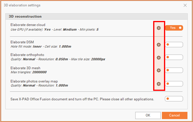
    image-20250120-080309.png

At the end of the elaborations, X-PAD Office Fusion can automatically save the project and turn off the PC


