TPS Survey interface
 |
|  |
| 
The graphic interface when using a Survey function with a GNSS receiver is explained in this chapter.
To record points with a total stationopen Survey page.
Select Survey points.
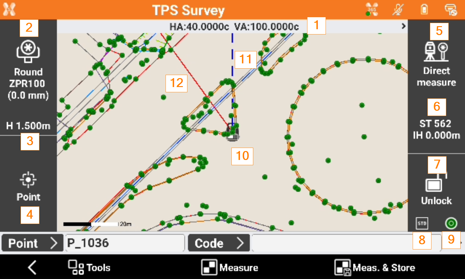
Angles: the current angles of the total station.
Current target: The type of current target. Click on the panel to Set the target type.
Elevation of the target: elevation of the target. Click to modify the elevation.
Smart drawing: displays the current status of the function Smart Drawing. Click to select a tool for drawing or the operation to perform.
Measure mode: visualizes the current measure mode. Click to change TPS measure mode.
Current station: name and elevation of the current station. Click to access a window that allows changing the orientation of the station.
Status of locking of the prism (robotic station): shows the status of the locking of the prism when working with a robotic total station. Click to open the Robotic total station control panel. If the total station is not robotic click to access the Mechanical total station control panel that allows managing the parameters for the functioning of the mechanic total station.
 Prism is unlocked. Tap to lock the prism.
 Prism is locked. Tap to unlock the prism.
 Automatic aiming of prism is deactivated. Tap to activate the automatic aiming.
Mode of measure: the current measurement mode: Standard, Fast, Tracking (continuous measure).
Bubble status: the instrument compensator status. Click to open the e-bubble.
Current position: indicates the current position of the total station. Refer to CAD view in survey and stakeout functions.
Current angle: the blue line represents the direction of the current instrument horizontal angle.
Orientation angle: the red line represents the direction of the orientation angle.