
From ESRI shape format, points, polylines and polygons can be imported.
-
Click File.
-
Click Import.
-
Select Import Esri Shape (SHP) files.
-
Click Import.

-
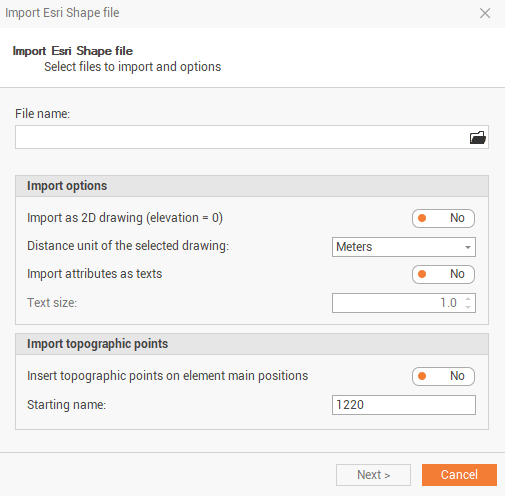
This command opens the following window:
-
File name: selects the file to import.
-
Import as 2D drawing (elevation = 0): the imported shape file is imported considering all elevations = 0.
-
Distance unit of the selected drawing: select the distance unit of the drawing.
-
Import attributes as texts: enables/disables the shape file attributes as texts.
-
Text size: the text size of the attributes imported.
-
Insert topographic points on element main positions: automatically creates topographic points on imported elements main positions.
-
Starting name: the starting point name of created topographic points
-
-
Click Next to import the file.