
Coordinates transformation transform single points, survey subprojects or the entire project between different cartographic or local systems.
-
Click Survey.
-
Click Transform by points.

-
The command opens a new window.
-
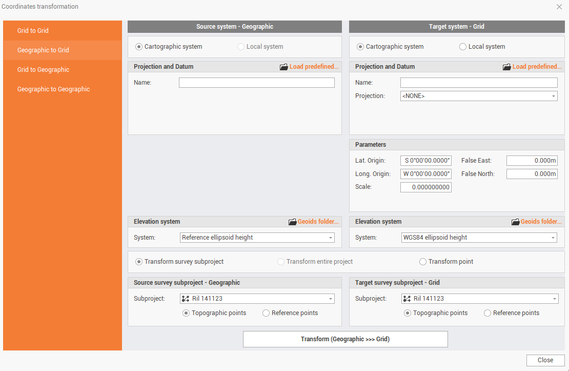
The first step is to define the type of transformation. On the left side of the window it is possible to choose:
-
Grid to Grid: transforms grid coordinates to other grid coordinates.
-
Geographic to Grid: transforms geographic coordinates to grid coordinates.
-
Grid to Geographic: transforms grid coordinates to geographic coordinates.
-
Geographic to Geographic: transform geographic coordinates to other geographic coordinates.
-
-
The main panel shows the source system and the target system. Depending on the transformation mode selected we will have to enter the source and target system grid or geographic.
-
Enter the source and target system. The software enter as default system in source the system applied to the current project.
-
If the selection is a cartographic system, you can manually enter the parameters or click on Load predefined to load a predefined cartographic system.
-
If the selection is local system click Details to open the calibration page to define the local system.
See Coordinate system for more information on the coordinate systems.
-
In the Elevation system part, select the source and target elevation system. Here are listed available geoids.
See Localization package to download geoids from localization packages.
-
At the bottom of the panel select which data to transform:
-
Transform survey subproject: transforms the coordinates of the active survey subproject.

-
Transform entire project: transforms the coordinates of entire project, including drawing, surfaces, etc..

-
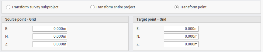
Transform points: transforms a single point, entering the coordinate values.
-
-
Click the Transform buttons to transform the points according to the entered parameters.