
-
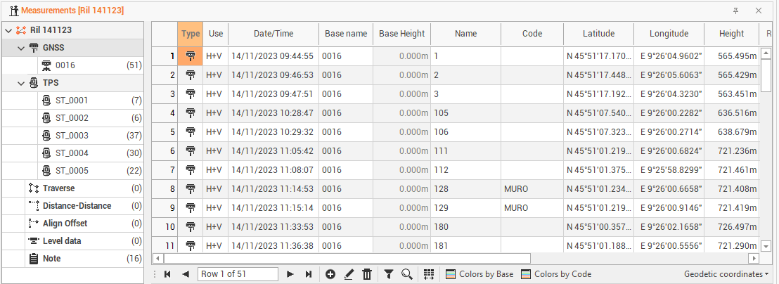
The GNSS measurements are listed in the Measurements table under GNSS. They are grouped by base name.
GNSS measurements table
-
The table contains information on GNSS measurements, grouped by base name.
-
The information available are the following:
-
Type: indicates whether the point is a base or a point measured in rover mode.
-
Use: to set the mode in which the program uses the measurement in the calculation of the survey. The option H + V allows the program to use both the horizontal and vertical component of the measurement. The option Only H or Only V They set the use of the measure only as a horizontal measure or only as a vertical one.
-
Base name: the name of the GNSS base.
-
Base height: the height of the base.
-
Name: the name of the point.
-
Code: the survey code associated with the measured point.
-
Longitude: the point longitude.
-
Latitude: the point latitude.
-
Height: the ellipsoidal height.
-
Rover height: the height of the rover antenna.
-
Description: the point description.
-
Date/time: the date and time when the point was measured.
-
Recording: this box shows if there are voice notes related to the measurement.
-
Image/sketch: this box shows if there is an image associated with the measure.
-
Delta X/Y/Z: the delta of the baseline vector.
-
Epoch: how many epochs was used to measure the point.
-
GDOP/HDOP/PDOP/VDOP: the DOP (diluition of precision) values for the measure.
-
GPS/Glonass/Beidou/Galileo: the number of satellites used for the measure.
-
Solution: the solution type of the measure (RTK fixed, RTK float, autonomous).
-
Tilt: if an IMU receiver is used, this field shows the tilt of the pole when measurement was done.
-
HRMS: horizontal precision.
-
VRMS: vertical precision.
-
XX/XY/XZ/YY/YZ/ZZ: values of the variance/covariance matrix.
-
-
Can change the display layout of the table from the bottom right button, which allows you to view other data related to GPS measurements.

-
The following options are available:
-
Baseline: to enable the display of baseline data (Delta X, Delta Y, Delta Z).
-
Covariance: to enable the display of data in the variance/covariance matrix, this data cannot be modified.
-
Geodetic coordinates: to enable the display of data of longitude, latitude and ellipsoidal height.
-
DOP: to enable the display of data on the accuracy of the GNSS measure (HDOP, VDOP, GDOP, PDOP).
-
Quality: to enable the display of measurement quality data (solution, HRMS, VRMS, Epochs, Tilt).
-
Save Layouts as default: to save table layout as default. It means that the settings applied to the layout (position of columns, display of columns etc...) will be applied as default to open tables later.
-
Restore default Layouts: to allow to undo the changes applied to the table layouts and restore the standard display.
-
-
If there are multiple bases, you can view the measurements of each base by expanding the tree node.
-
The bottom toolbar of the table presents the following commands in addition to the basic commands:

-
Colors by base: to set a color to the baselines according to the base name.
-
Colors by code: to set a color to the baslines according to the survey code.
-
Edit GNSS measurements
-
Double-click on a measure or click on Edit to access a specific window that allows the measurement data changing also displaying the measurement quality data (Epochs, Solutions, DOP, covariance factors, etc.).
-
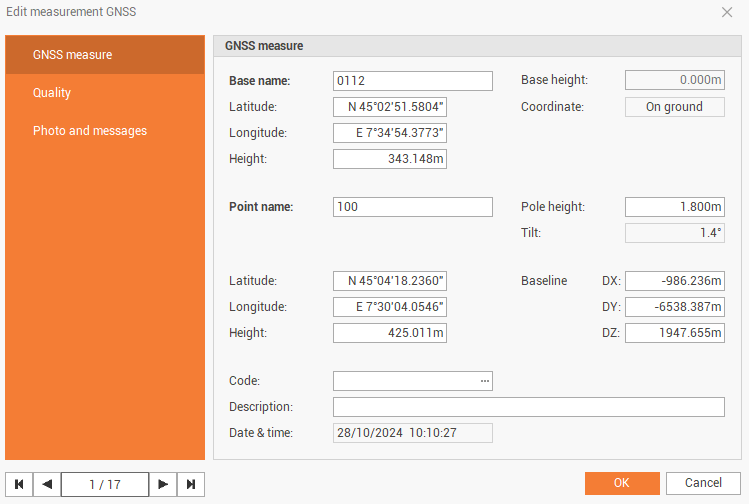
The GNSS measure page shows information on the GNSS measured coordinate and baseline
-
Base name: the name of the GNSS base.
-
Base height: the height of the base.
-
Longitude: the base longitude.
-
Latitude: the base latitude.
-
Height: the base ellipsoidal height.
-
Point name: the name of the point.
-
Pole height: the height of the rover antenna.
-
Tilt: if measure has been done with an IMU receiver, this field shows the tilt of the pole.
-
Longitude: the point longitude.
-
Latitude: the points latitude.
-
Height: the points ellipsoidal height.
-
Baseline DX/DY/DZ: the delta of the baseline vector.
-
Code: the survey code associated with the measured point.
-
Description: the point description.
-
Date/time: the date and time when the point was measured.
-
-
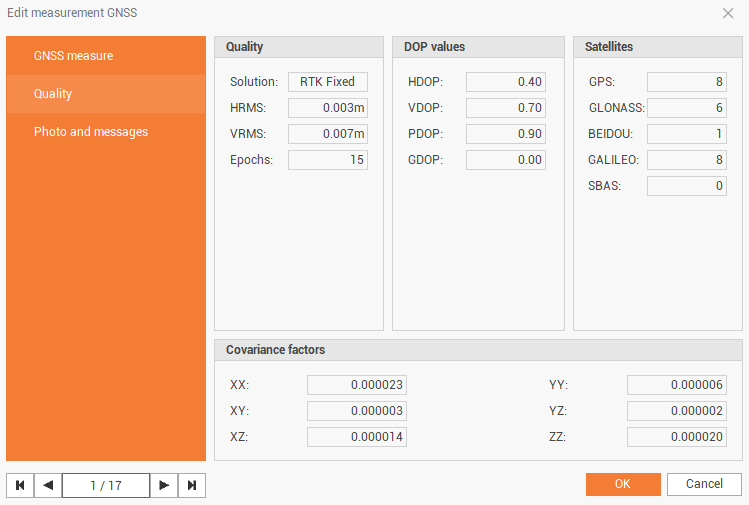
The Quality page shows information on the quality of selected GNSS measure.
-
Solution: the solution type of the measure (RTK fixed, RTK float, autonomous).
-
HRMS: horizontal precision.
-
VRMS: vertical precision.
-
Epoch: how many epochs was used to measure the point.
-
GDOP/HDOP/PDOP/VDOP: the DOP (diluition of precision) values for the measure.
-
GPS/Glonass/Beidou/Galileo/SBAS: the number of satellites used for the measure.
-
XX/XY/XZ/YY/YZ/ZZ: values of the variance/covariance matrix.
-
-
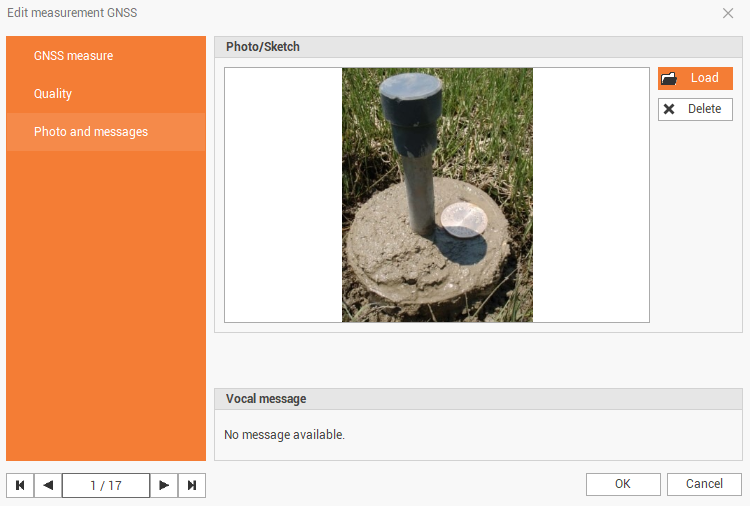
The Photo and messages page shows the photo and vocal message assigned to the point.
-