-
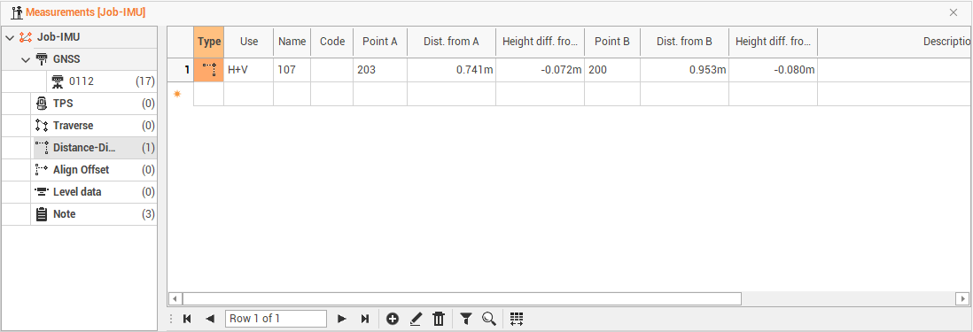
The distance-distance measurements are listed in the Measurements table under Distance-Distance.
Distance-distance measurements table
-
The table shows the values of the GNSS measures surveyed by intersection of distances and its data relative to two reference points. The table shows the following data.
-
The information available are the following:
-
Type: the type of measure.
-
Use: to set the mode in which the program uses the measurement in the calculation of the survey. The option H + V allows the program to use both the horizontal and vertical component of the measurement. The option Only H or Only V They set the use of the measure only as a horizontal measure or only as a vertical one.
-
Name: the name of the point.
-
Code: the survey code associated with the point surveyed.
-
Point A: the name of the first reference point.
-
Distance from A: the distance from the reference point A.
-
Height difference from A: the elevation difference of point to measure from reference point A.
-
Point B: the name of the second reference point.
-
Distance from B: the value of the distance from the reference point B.
-
Height difference from B: the elevation difference of point to measure from reference point B.
-
Description: the point description.
-
Date/time: the date and time when the point was measured.
-
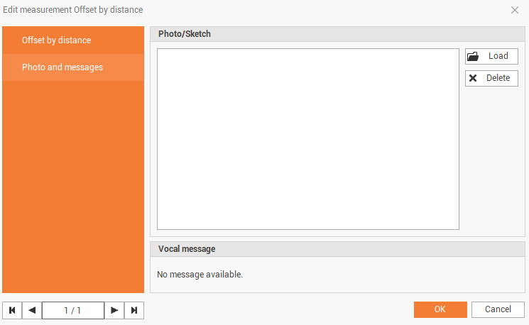
Recording: this box shows if there are voice notes related to the measurement.
-
Photo/Sketch: the photo or sketch related to the measurement.
-
Edit distance-distance measurements
-
Double-click on a measure or click on Edit to access a specific window that allows the measurement data changing.
-
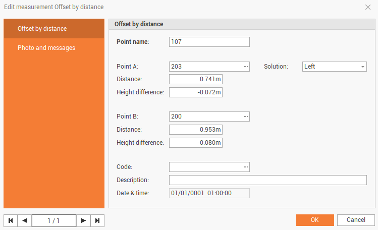
The Offset by distance page shows information on the measurement.
-
Point name: the name of the point.
-
Point A: the name of the first reference point.
-
Solution: if the point solution is on the left or right from the 2 auxiliary points.
-
Distance: the distance from the reference point A.
-
Height difference: the elevation difference of point to measure from reference point A.
-
Point B: the name of the second reference point.
-
Distance: the value of the distance from the reference point B.
-
Height difference: the elevation difference of point to measure from reference point B.
-
Code: the survey code associated with the measured point.
-
Description: the point description.
-
Date/time: the date and time when the point was measured.
-
-
The Photo and messages page shows the photo and vocal message assigned to the point.