
The utility Automatic positioning of point labels is used to position automatically the labels of topographic points to avoid overlapping with other symbols or labels to obtain a survey more readable.
To visualize the labels, the view has to be with Observation mode disabled.
-
Click Survey.
-
Click Tools to open the menu.

-
Click Automatic positioning of point labels.
-
This utility opens a new panel.
-
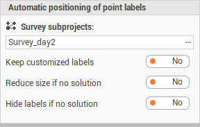
Survey subproject: the survey subproject.
-
Keep customized labels: if a label has been manually modified, enables/disable the new positioning.
-
Reduce size if no solution: enables/disables to reduce the size of the label if software cannot find a new positioning.
-
Hide labels if no solution: enables/disables to hide the label if software cannot find a new positioning.
-
-
Click Apply to continue.
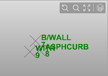
Before the automatic positioning of point labels.
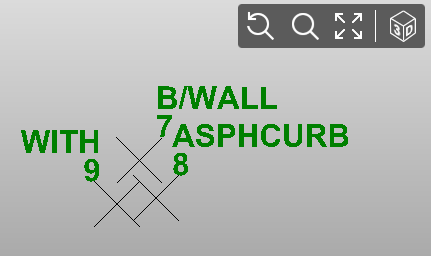
After the automatic positioning of point labels.