



-
Setting the cartographic system is necessary when coordinates of points must refer to a system defined by a reference projection, datum, ellipsoid and transformation parameters.
-
The cartographic system can be used for:
-
The calculation of geographic coordinates of GPS instruments.
-
The calculation of the scale factor to apply to distances measured with total stations
-
-
The software allows to select a predefined system or define a system with specific parameters.
-
Click Job.
-
Click Coordinate System.
-
Click Cartographic system.
Select a predefined system
-
X-PAD includes predefined cartographic systems for most of countries.
-
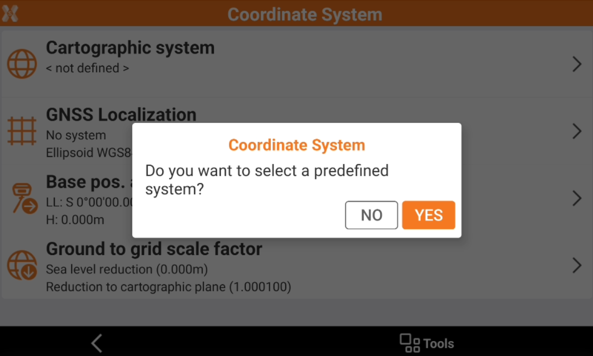
If a cartographic system is not already assigned, clicking Cartographic system shows this message.
-
Click YES to select a predefined system.
-
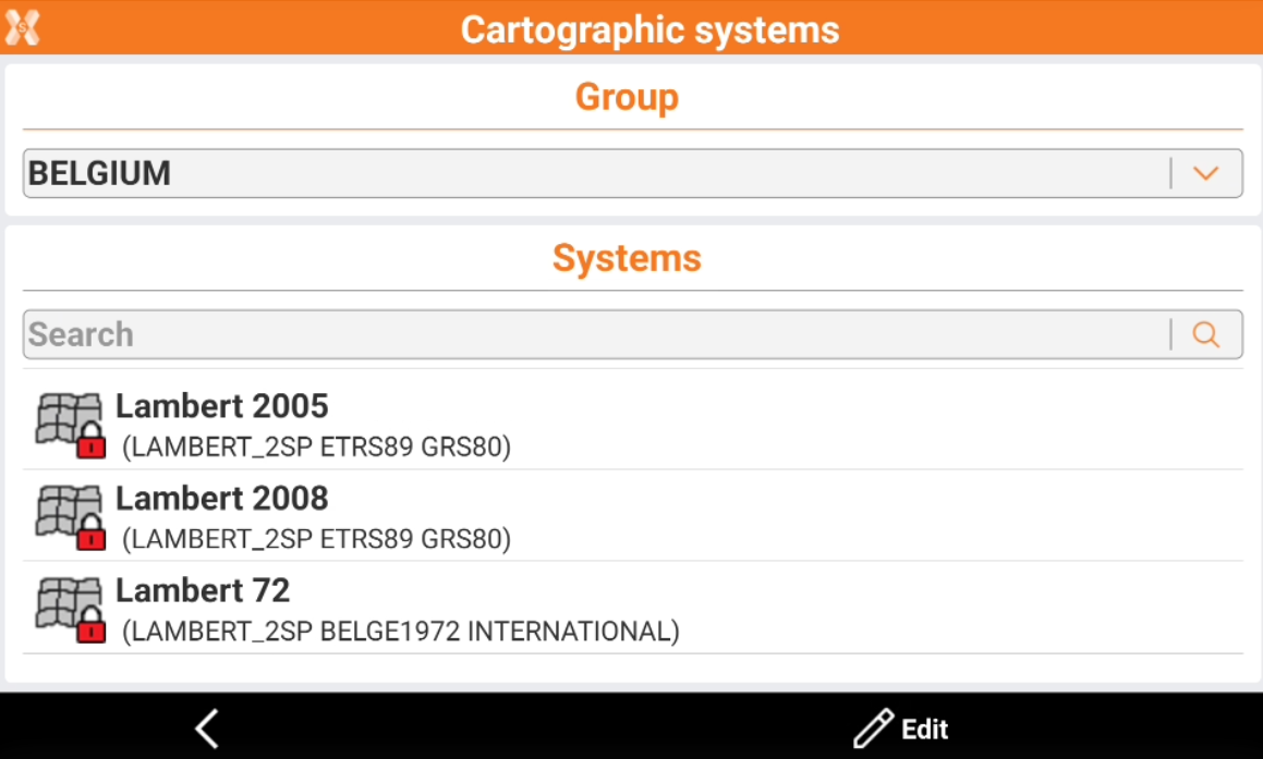
This opens a new window where to select the predefined system for a specific country.
-
Group: select the country or a group of systems (like UTM systems).
-
Systems: shows the available systems for the selected group.
-
-
Select a system to load the parameters.
-
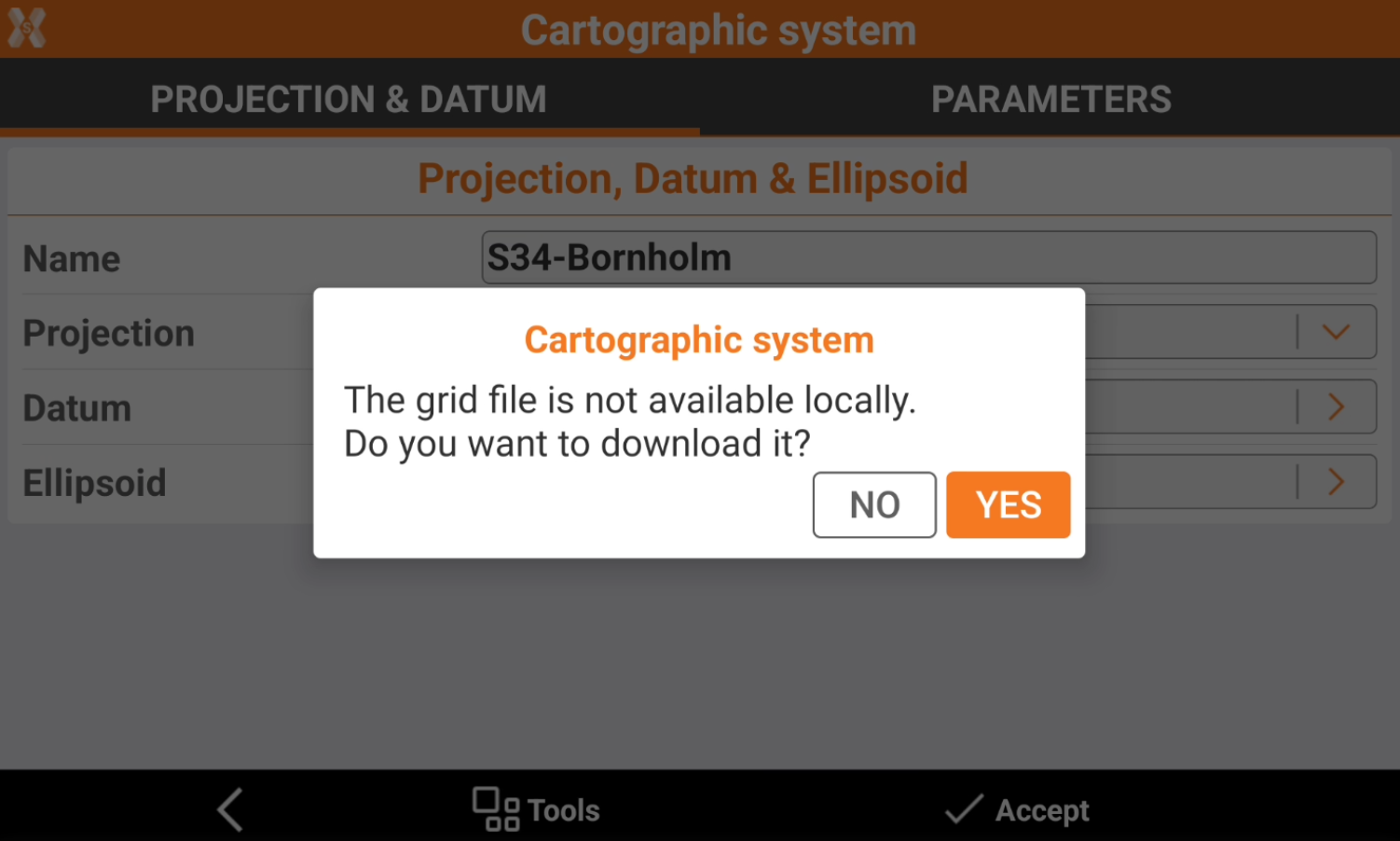
If the selected cartographic system has a grid file, the software prompts to download the corresponding grid file.
-
Click Accept to confirm the selection.
After a cartographic system is selected, it is necessary to select Cartographic system in GNSS Localization.
-
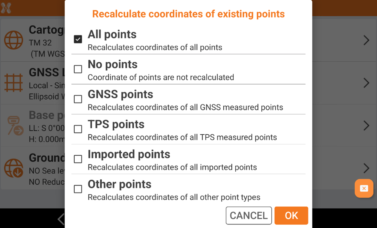
If the cartographic system is changed changed, the software asks if the points already available in the job, with a valid latitude and longitude, have to be recalculated in the new system.
-
All points: recalculates the coordinates for all points in the job with a valid latitude and longitude in the job.
-
No points: coordinate of points are not recalculated in the new system.
-
GNSS points: recalculates the coordinate only for points measured with a GNSS receiver.
-
TPS points: recalculates the coordinate only for points measured with a total station.
-
Imported points: recalculates the coordinate only for points imported in the job.
-
Other points: recalculates the coordinate for points calculated, for example in COGO, or manually entered.
-
Cartographic system parameters
-
Each system, predefined or manually enter, is defined by different parameters.
-
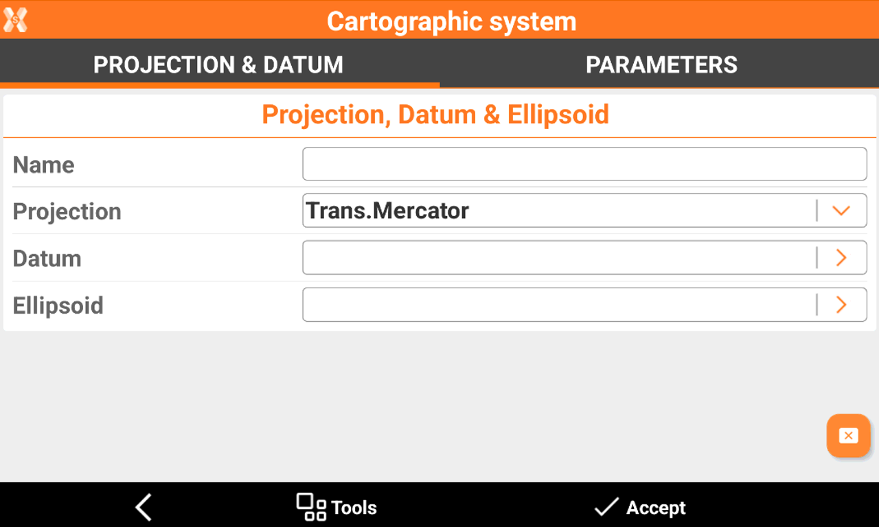
In Projection & Datum page the type of projection, datum and ellipsoid is defined.
-
Name: name to assign to the system.
-
Projection: cartographic projection to use.
-
Datum: datum to use to convert from the WGS84 ellipsoid to the cartographic system ellipsoid. Click the field to access a list of default and user-defined datum.
-
Ellipsoid: ellipsoid of the cartographic system. Click the field to access a list of default and user-defined ellipsoids.
-
-
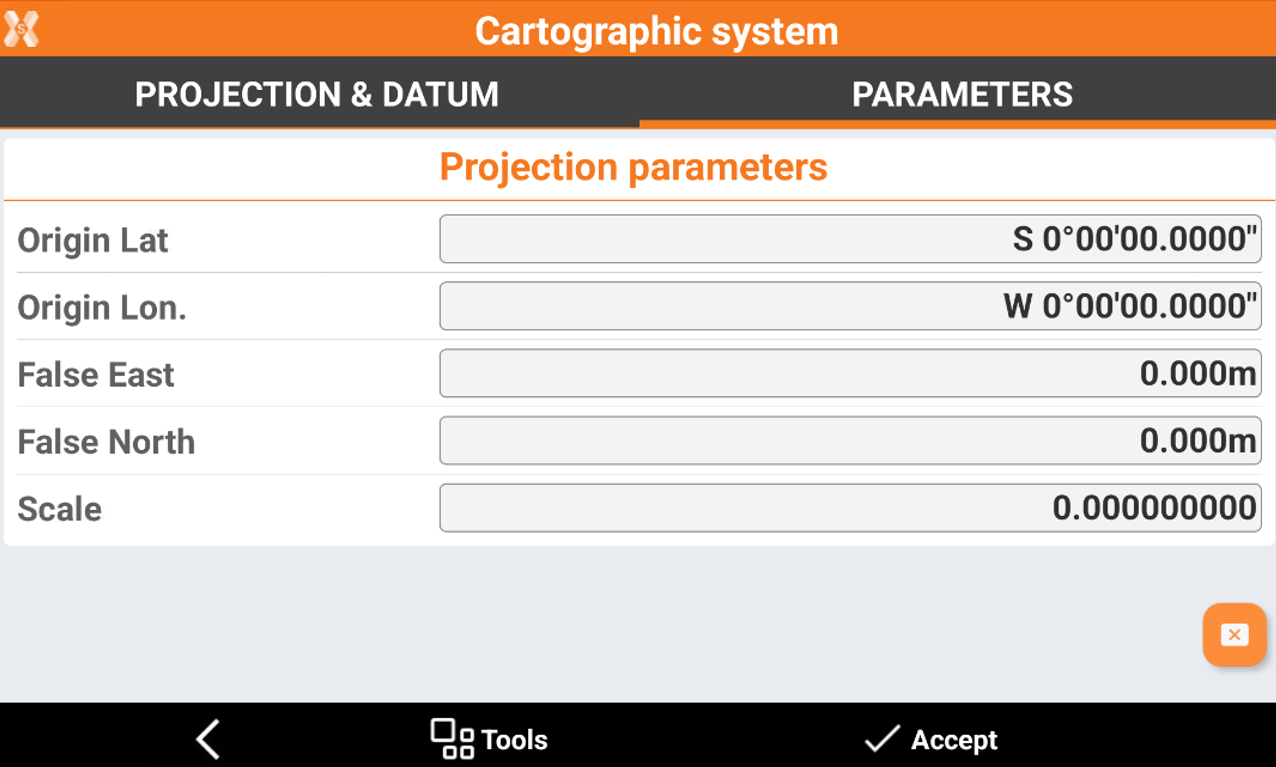
Parameters page lists the parameters of the projection. The parameters in this page depends on the projection selected.
-
Lat. Origin: Defines the latitude of the origin of the coordinate system.
-
Long. Origin: Defines the longitude of the origin of the coordinate system.
-
Parallel 1: Specifies the first parallel for the coordinate system.
-
Parallel 2: Specifies the second parallel for the coordinate system.
-
False East: Defines the coordinate for the false East of the coordinate system.
-
False North: Defines the coordinate for the false North of the coordinate system.
-
Scale: Sets the scale factor of the coordinate system.
-
Save a cartographic system as predefined
-
It is possible to save a cartographic system as predefined for all the jobs.
-
While in the Cartographic system page, click Tools.
-
Click Save as predefined.
-
Save the current system in the User group of the predefined systems. The system can then be used in other jobs.
Cancel current cartographic system
-
This command allows to cancel the current selected cartographic system.
-
While in the Cartographic system page, click Tools.
-
Click Cancel current cartographic system.
-
Now the cartographic system is not defined.
Export in WKT format
-
A cartographic system can be exported in the standard format WKT. Well-known text (WKT) is a standard text format for describing coordinate reference systems. It's used in geographic information systems (GIS) and web mapping APIs and can be used in different software.
-
While in the Cartographic system page, click Tools.
-
Click Export in WKT format.