



-
Define the method to use for transformation of the GPS coordinates in plane coordinates and vice versa.
-
Without an assigned GPS localisation, only the geographic coordinates of the points are recorded. A visualization of the points in the graphic window is impossible.
-
Click Job.
-
Click Coordinate system.
-
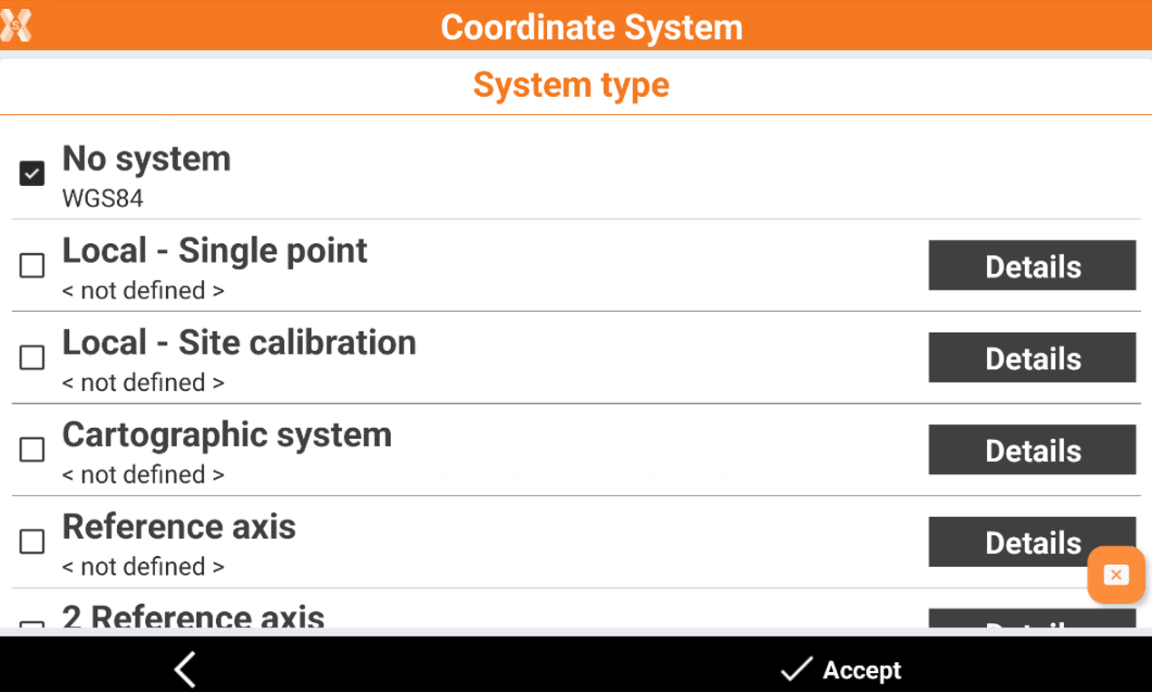
Click GNSS localization to open the page with the method to transform the GPS coordinates.
-
The available methods are:
-
No system: no coordinate system is applied.
-
Local - Single point: a system is created based on a local projection referred to one origin point.
-
Local - Site calibration: a system is created based on several points with known geographic and local plane coordinates.
-
Cartographic system: for the transformation from geographic to plane coordinates a cartographic system is used. The system can be manually entered or selected from a list of predefined systems.
-
Reference axis: a system is created based on the measurement of a point of origin and the measurement of a second point which defines the direction of the axis.
-
2 Reference axis: the position and orientation of the station are determined by measuring four reference points. The points define two axes which, intersecting each other, determine the position of the station.
-
Vertical elevation: after a system has been defined, the software allows to choose what system use to calculate the elevation.
-
-
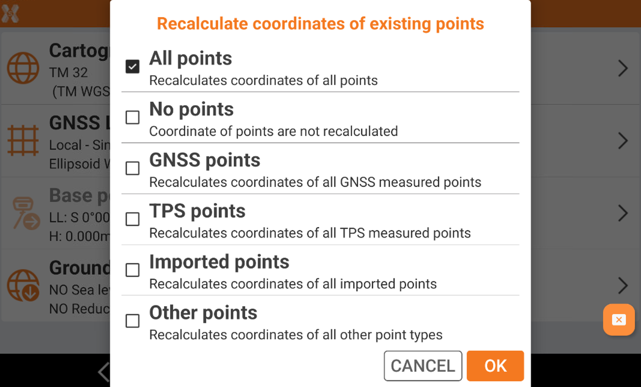
When the GNSS localization is selected or changed, the software asks if the points already available in the job, with a valid latitude and longitude, have to be recalculated in the new system.
-
All points: recalculates the coordinates for all points in the job with a valid latitude and longitude in the job.
-
No points: coordinate of points are not recalculated in the new system.
-
GNSS points: recalculates the coordinate only for points measured with a GNSS receiver.
-
TPS points: recalculates the coordinate only for points measured with a total station.
-
Imported points: recalculates the coordinate only for points imported in the job.
-
Other points: recalculates the coordinate for points calculated, for example in COGO, or manually entered.
-