
-
Jobs are organized in Sites.
-
For each site, the main information required for all jobs associated with that site can be entered:
-
Coordinate system.
-
Survey codes and GIS codes.
-
External references.
-
Position and photo.
-
-
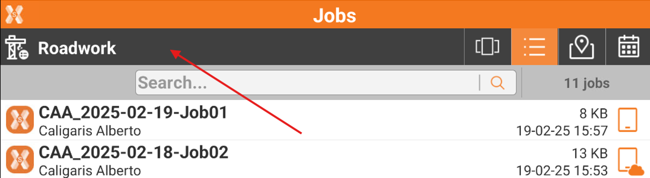
To open the Sites Manager, after application is started, click on Site bar on top of Jobs list.
-
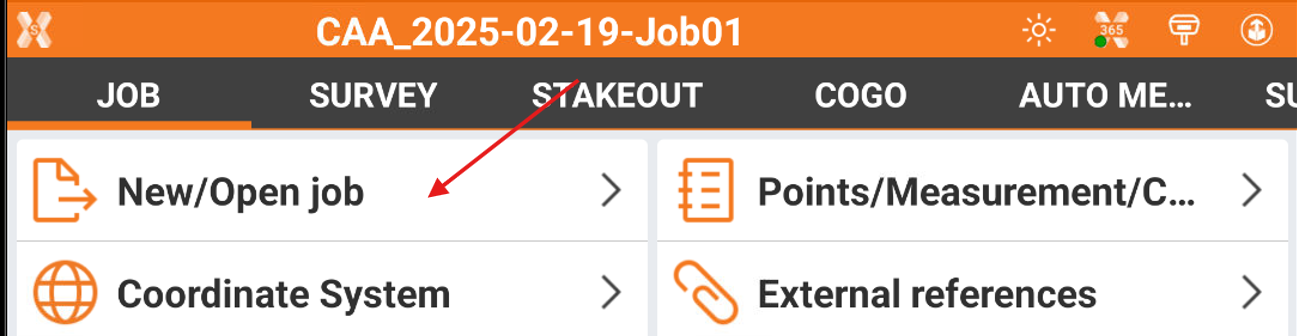
Or, if already inside a job, click Job page.
-
Click New/Open Job.
-
Click Site bar.
-
This opens the Sites list, with list of all available job sites.
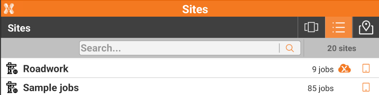
If an X-PAD 365 Professional or Enterprise subscription is available, it is possible to create collaborative sites. A collaborative site is indicated by this icon 
-
To open a site select it from our of the available views.
Create a new site



-
To create a new site, click New site.

-
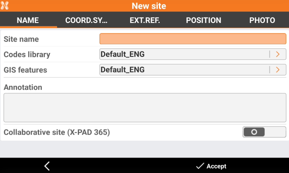
This opens the Name page.
-
Site name: the name of the site.
-
Codes library: to select the code library to be used by default by jobs in this site.
-
GIS features: to select the GIS features library to be used by default by jobs in this site.
-
Annotation: optional notes related to the site.
-
Collaborative site: If an X-PAD 365 Professional or Enterprise subscription is available, it is possible to create collaborative sites. A collborative site is a site where jobs are automatically shared in the cloud.
-
-
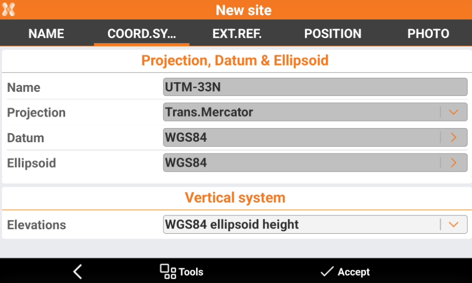
In Coordinate system page it is possible to define the default coordinate system for jobs in this site.
-
Click Tools to load a predefined system or load a coordinate system from a file, for example a saved GNSS localization.
-
Elevations: defines the vertical system to be used.
-
-
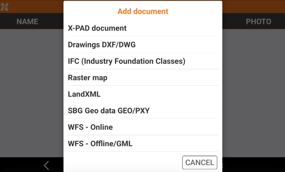
In External reference page it is possible to load external reference files in different formats. These files will be linked to all jobs in this site.
-
Click Add to add an external document.
-
-
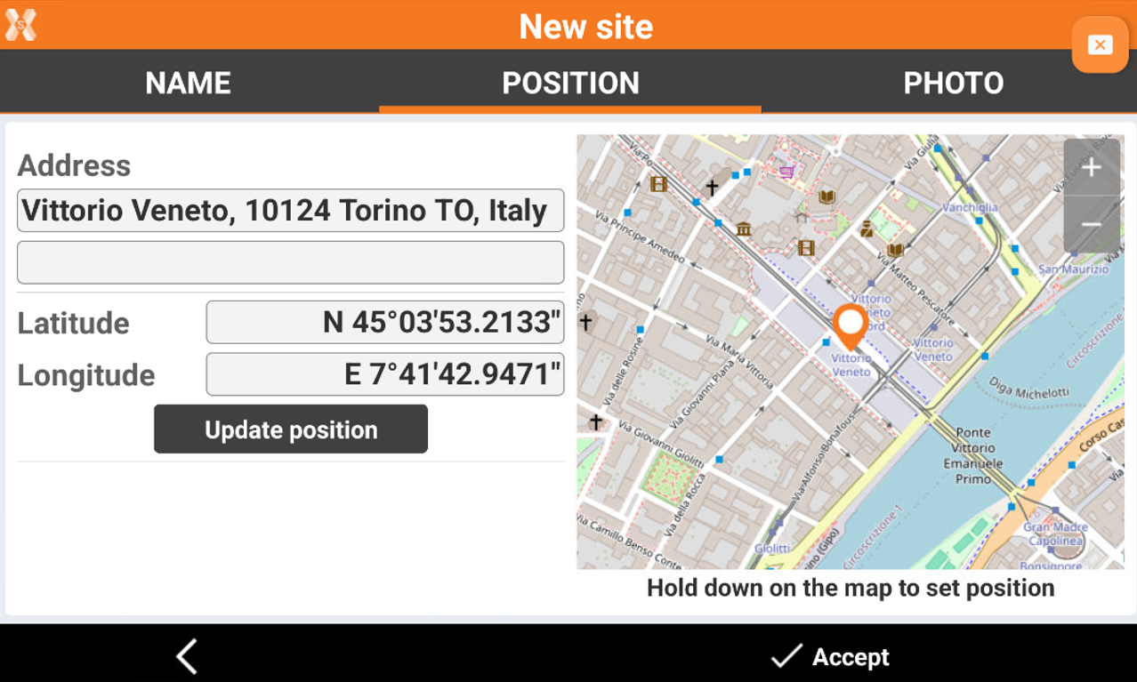
In Position page, it is possible to define the position of the site. If the tablet position is available, the position is automatically provided.
-
Long-press on the map to define a new position.
-
Or click Update position to update the position provided from controller GPS.
-
-
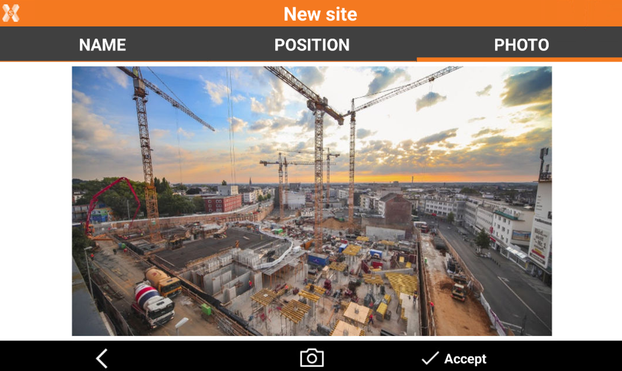
In the Photo page it is possible to load a photo of the site, which will be available in the Carousel view.
-
Click Photo

-
Click Accept to save the site.
-
Sites visualization
-
The software offers different ways to visualize the available sites.

-
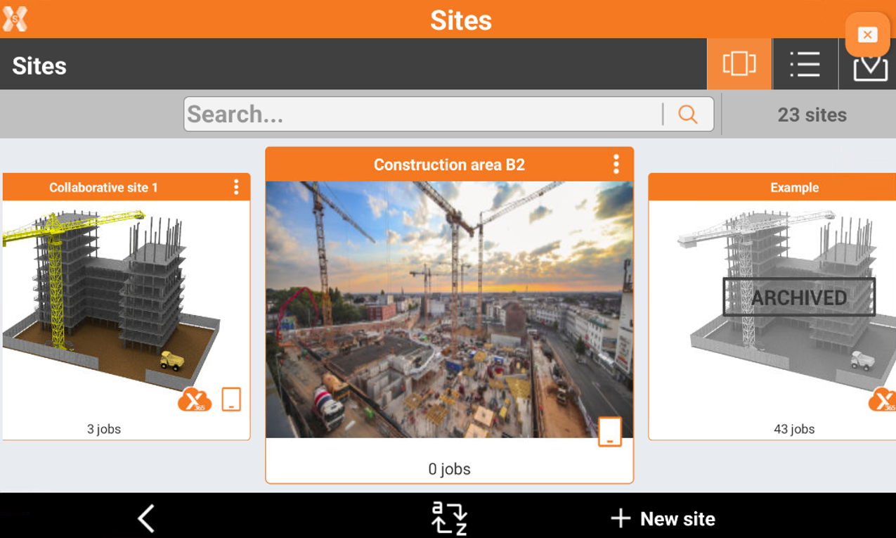
Carousel view: shows the sites in a carousel view with their picture.
-
List view: lists the sites.
-
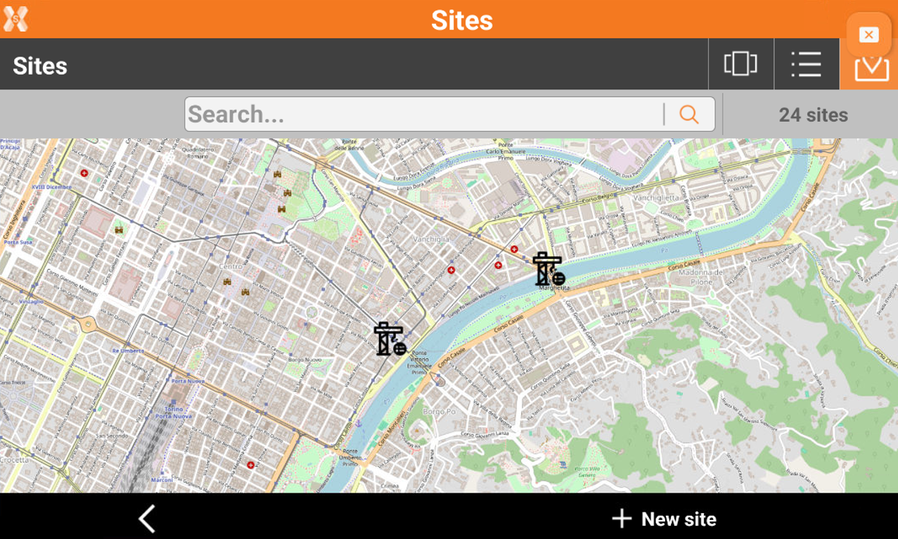
Map view: shows the created sites on a map.
-
Delete a site
-
To delete a site, while in carousel or list view, long press the site.
-
Click Delete to delete the site.
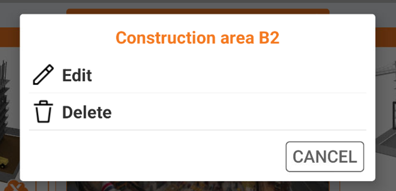
Deleting a site will delete all jobs in the site. The operation is permanent.