

For a bathymetric survey a GNSS receiver profile or a TPS profile and an echosounder profile must be available.
-
Click Survey.
-
Click Bathymetric survey.
-
Before starting acquisition of points, set the functioning parameters and rules.
-
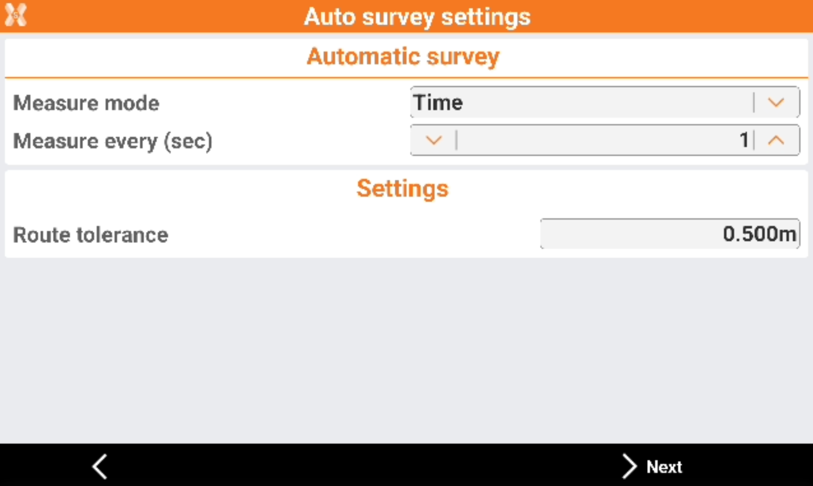
Mode: mode to use for automatic survey of points.
-
Time: position is acquired at preset intervals of time.
-
Distance 2D: position is acquired at preset intervals of horizontal distance.
-
Depth: the position is acquired at fixed intervals of difference in depth.
-
Single positions: the position is acquired manually pressing the Store point.
-
-
Route tolerance: the acceptable distance from the route. A navigation arrow shows the distance from the route. If the value is exceeded, the software shows the direction to come back to the route.
-
Measure every (sec): available for Time mode. Set the interval of time between every automatic acquisition of position.
-
Measure every (sec): available for Distance 2D mode. Set the interval of horizontal distance that must be between position to acquire and previously acquired position.
-
Measure every (sec): available for Depth mode. Set the depth interval that must between the depth to be acquired and the depth acquired previously.
-
-
Click Next to continue to define the settings.
-
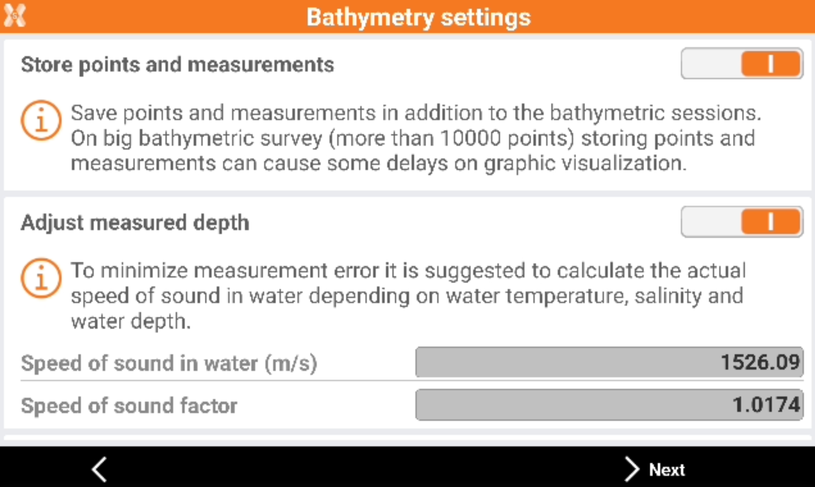
Store points and measurements: enables the saving of points and measurements in addition to the bathymetric sessions.
-
Adjust measured depth: the measured depth is adjusted depending on the speed of sound in water.
-
Water temperature (°C): the water temperature used to calculate the speed.
-
Water salinity (‰): the water salinity used to calculate the speed.
-
Water depth: the average water depth.
-
Speed of sound (m/s): the speed of sound.
-
-
Click Next to start the survey.
-
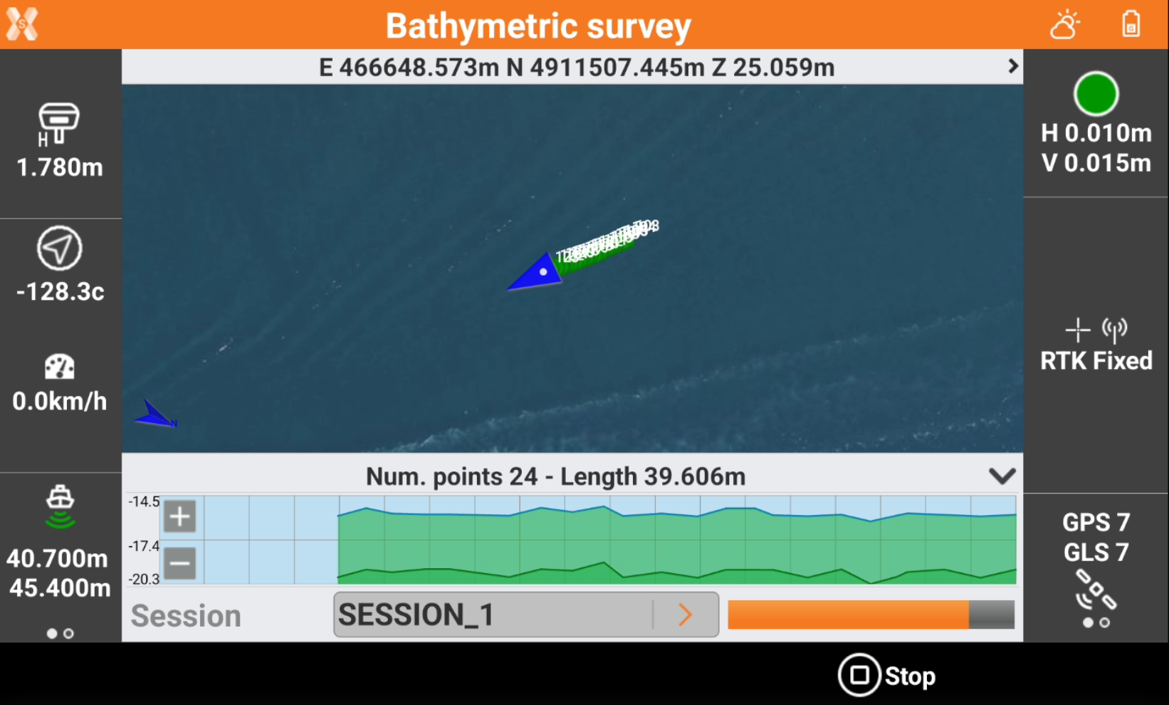
The left bar shows the elevation information:
-

-

-
-
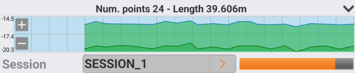
The bottom bar shows the profile measurement.
-
Click Start session to start the session of the bathymetric survey.
-
Click Stop session to stop the session of the bathymetric survey.
If echosounder is a dual beam echosounder, the information are reported for the two received elevations.