



-
Export topographic points, reference points and TPS measurements in ASCII customizable format.
-
Export parameters can be saved in a template which can be loaded for other import and export procedures.
-
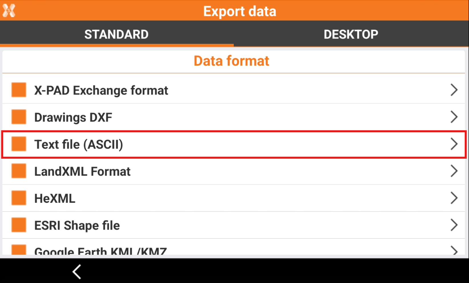
To export an ASCII file select Text file (ASCII).
-
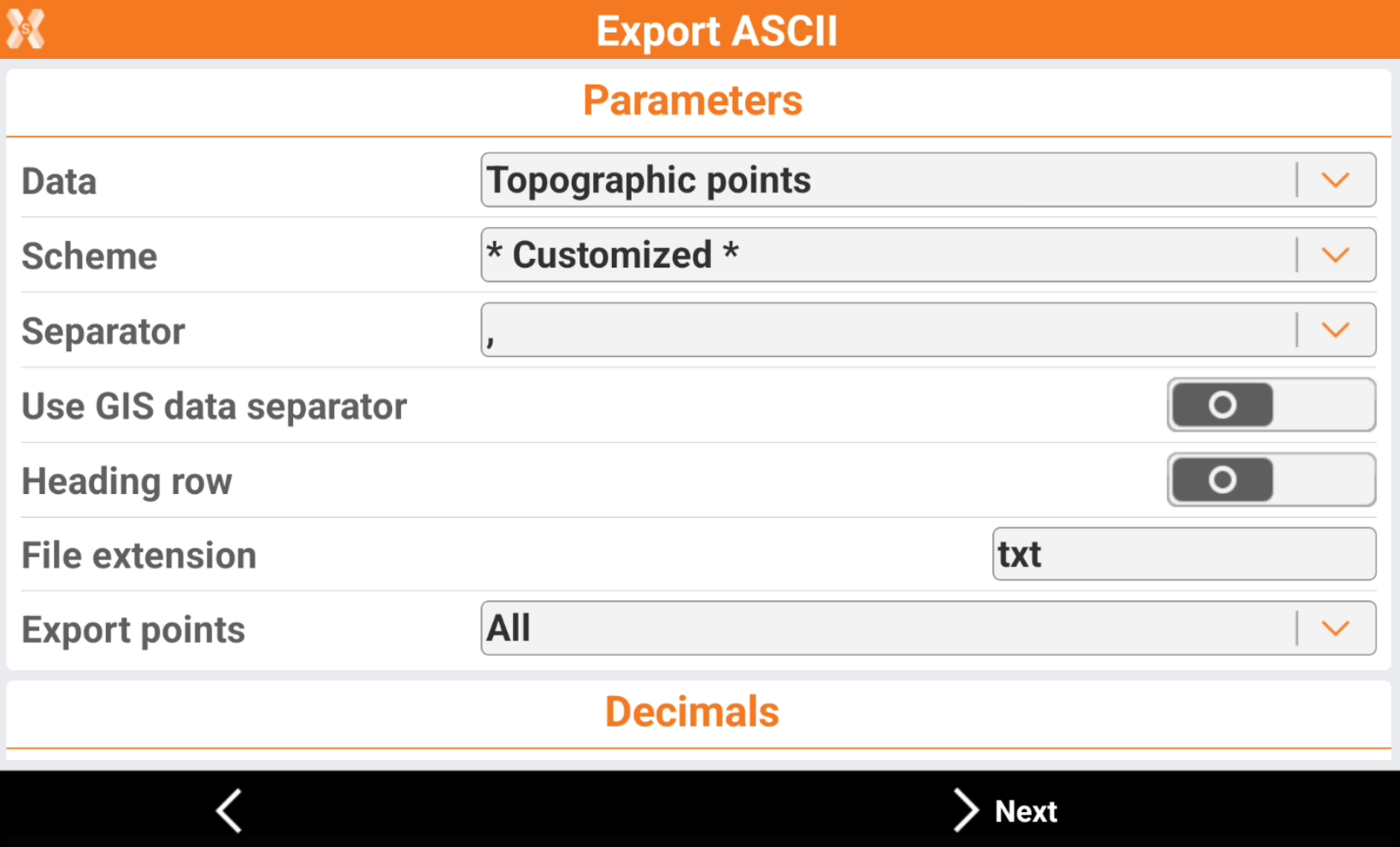
Enter the export parameters.
-
Data: select the data to export.
-
Topographic points: exports the topographic points.
-
Reference points: exports the reference points.
-
All points: exports topographic points and reference points.
-
GNSS Measurements: exports the GNSS measurements.
-
TPS Measurements: export the total station measurements.
-
Bathymetry sessions: exports the bathymetry sessions measured with Bathymetric Survey function.
-
GNSS Measurements and Averaged: exports the detailed GNSS measurements measured with GNSS Advanced and Analysis function.
-
-
Scheme: the currently available export scheme is suggested. Select a scheme or choose * Customized * to create a scheme.
-
Separator: select the character separating fields with content.
-
Use GIS data separator: if GIS data are exported, allows to select a specific character separating GIS data.
-
Heading row: activates the export of a heading row containing the name of the fields.
-
File extension: defined the exported file extension.
-
Export points: when exporting Topographic points, allows to define which points to export.
-
All: exports all points in the job.
-
Only measured: exports only points that was measured in the field with an instrument.
-
Only measured TPS: exports only points that was measured in the field with a total station.
-
Only measured GNSS: exports only points that was measured in the field with a GNSS.
-
Selected: exports only selected points. It is possible to select the points to export from point table or from CAD clicking Points to export.
-
-
Angles: the number of decimals for angle values.
-
Coordinates: the number of decimals for coordinate values.
-
Elevation: the number of decimals for elevation values.
-
Distances: the number of decimals for distance values.
-
Lat.de/Long.de: the number of decimals for latitude and longitude values.
-
Lat.de/Long.de format: the format to use when exporting latitude and longitude values.
-
-
Click Next.
-
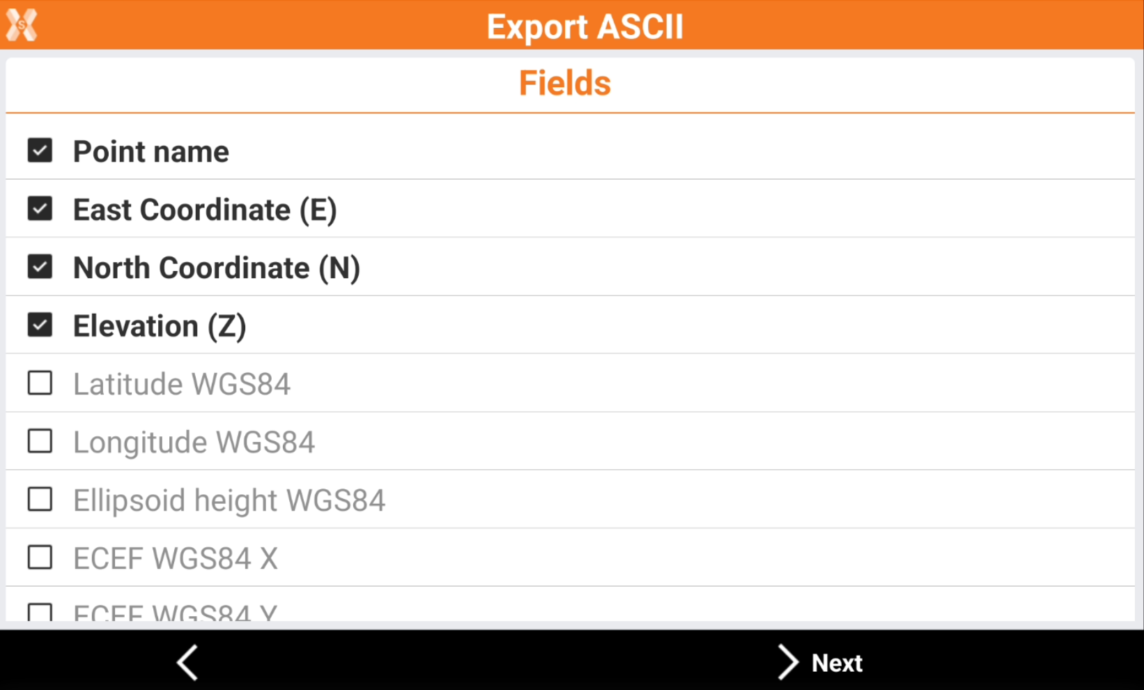
If the Scheme is * Customized * the software allows to select the fields to export and change the fields order.
-

-

-

-
-
Click Next.
-
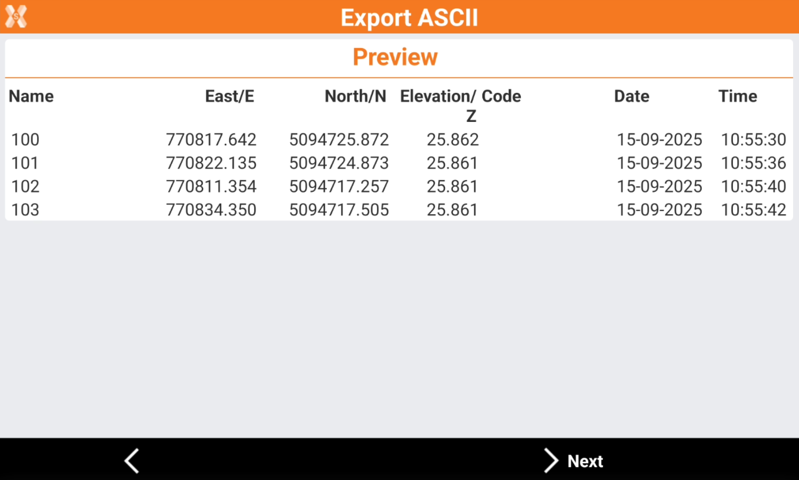
The software shows a preview.
-
Click Next.
-
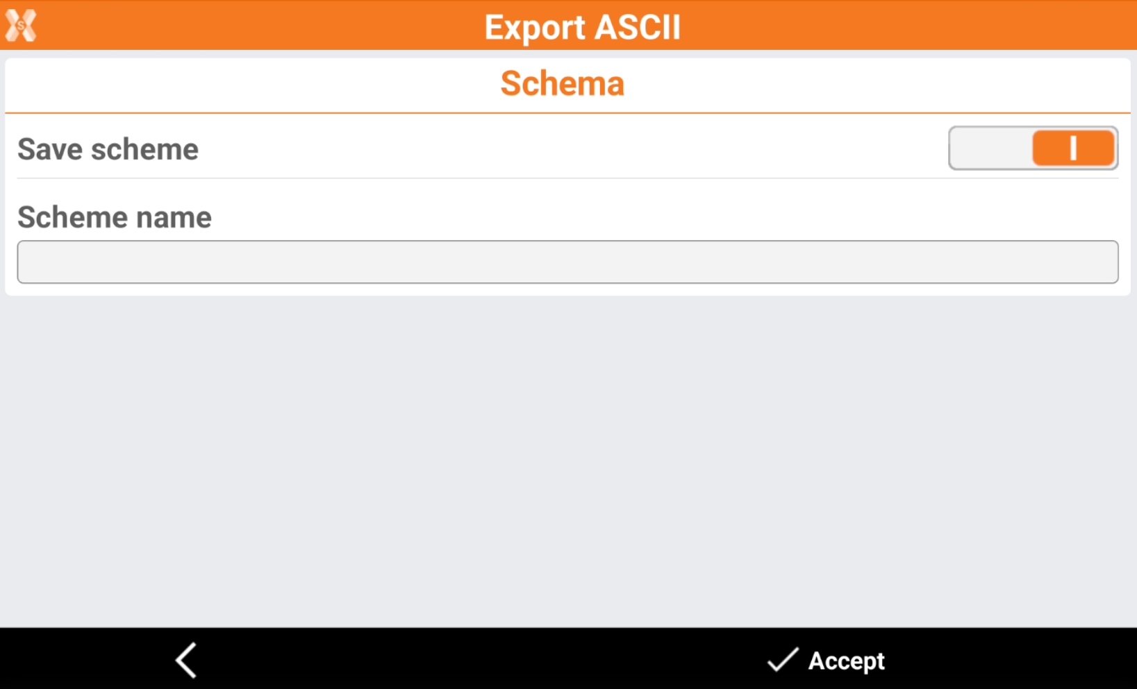
If the Scheme is * Customized * it is possible to save the scheme.
-
Save scheme: enables the saving of the current export scheme.
-
Scheme name: the name of the scheme to save.
-
-
Click Accept to export the data.
-
Select where to export the file.