

-
The GPS Status page allows to display different information on the GNSS receiver connected:
-
Quality of the signal.
-
Number and position of satellites.
-
Current coordinate.
-
Information about the base and the .
-
Position in a map.
-
Quality page
-
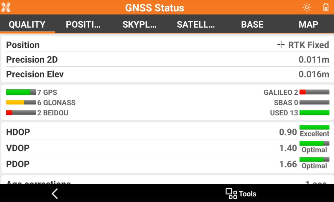
Quality page shows information on the current quality of the GNSS receiver.
-
Position: displays the RTK quality of position.
-
RTK Extra-Safe / RTK SureFix: available for some GNSS receiver models. The receiver gets corrections from a source and has fixed the ambiguities in RTK Extra-Safe / RTK SureFix.
-
RTK Fixed: the receiver gets corrections from a source and has fixed the ambiguities with maximum precision.
-
Quick-Fix: available for some GNSS receiver models. The receiver has fixed the ambiguities but has not reached the maximum precision level yet.
-
RTK Float: the receiver gets corrections from a source but it has not yet fixed ambiguities.
-
DGPS: the receiver gets differential corrections in DGPS mode.
-
Autonomous: the receiver gets positions without receiving corrections from any source in minimum precision.
-
PPP-Fixed: the receiver is receiving corrections using PPP service and ambiguity is fixed.
-
PPP-Float: the receiver is receiving corrections using PPP service and ambiguity is still not fixed.
-
-
Precision 2D: precision of the current position regarding coordinates.
-
Precision Elev: precision of the current position regarding elevation.
-
RTK Extra-Safe / RTK SureFix: available for Zenith 35/Zenith 60/ Zenith 60 Pro. Using this option in environments with signal partially blocked allows to have a solution slower getting the fix status but likely less to be erroneous.
-
Satellites: number of satellites of the different constellations.
-
HDOP: Horizontal Dilution of Precision.
-
VDOP: Vertical Dilution of Precision.
-
PDOP: General Dilution of Precision related to the satellites position.
-
Age corrections: delay in receiving corrections in seconds. A high value indicates missing reception of corrections.
-
GSM Signal: level of GSM signal.
-
NTRIP Server: name of the used NTRIP server.
-
Mountpoint: name of the mountpoint with available access. Click on the mountpoint to change mountpoint.
-
Position page
-
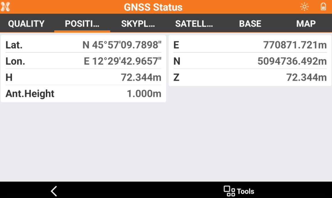
The Position page shows the current GNSS receiver position with its geodetic coordinate and local coordinate based on the defined GNSS localization method.
Skyplot page
-
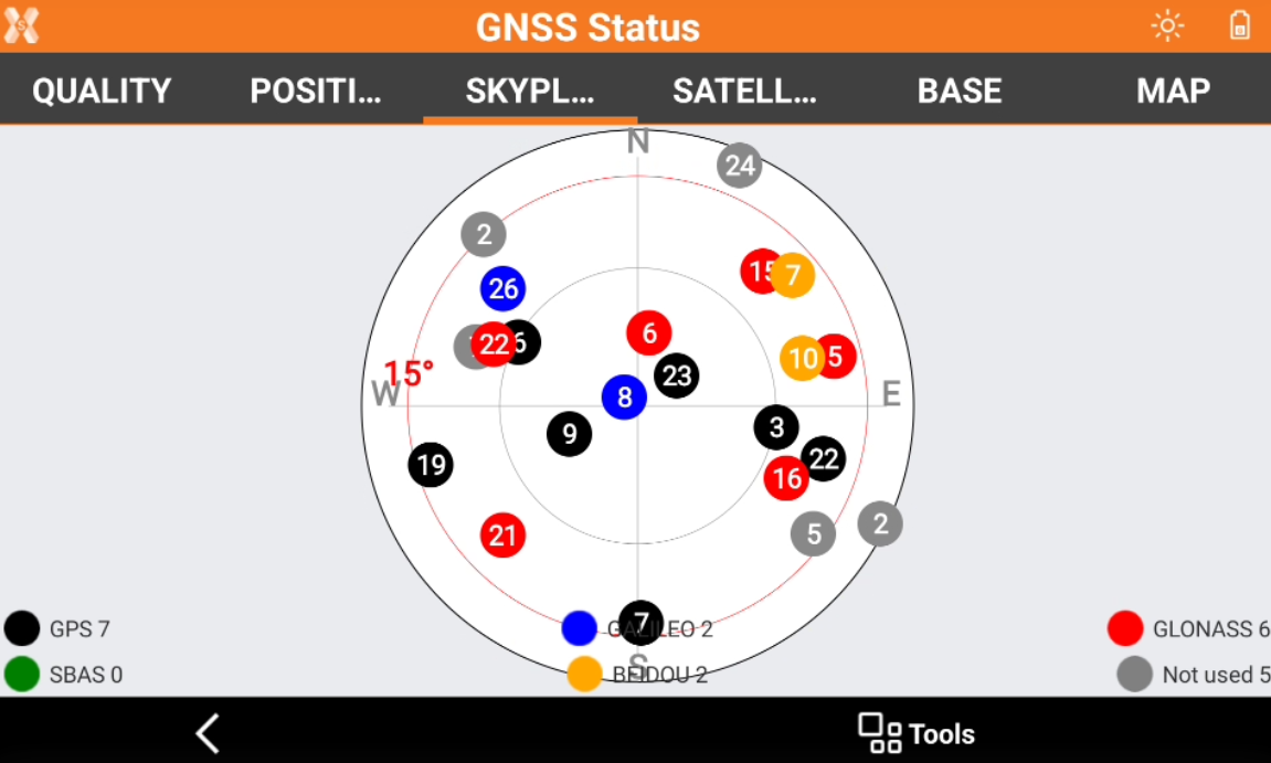
Displays position and elevation of the tracked satellites. Click a satellite open a window showing all related information.
Satellite page
-
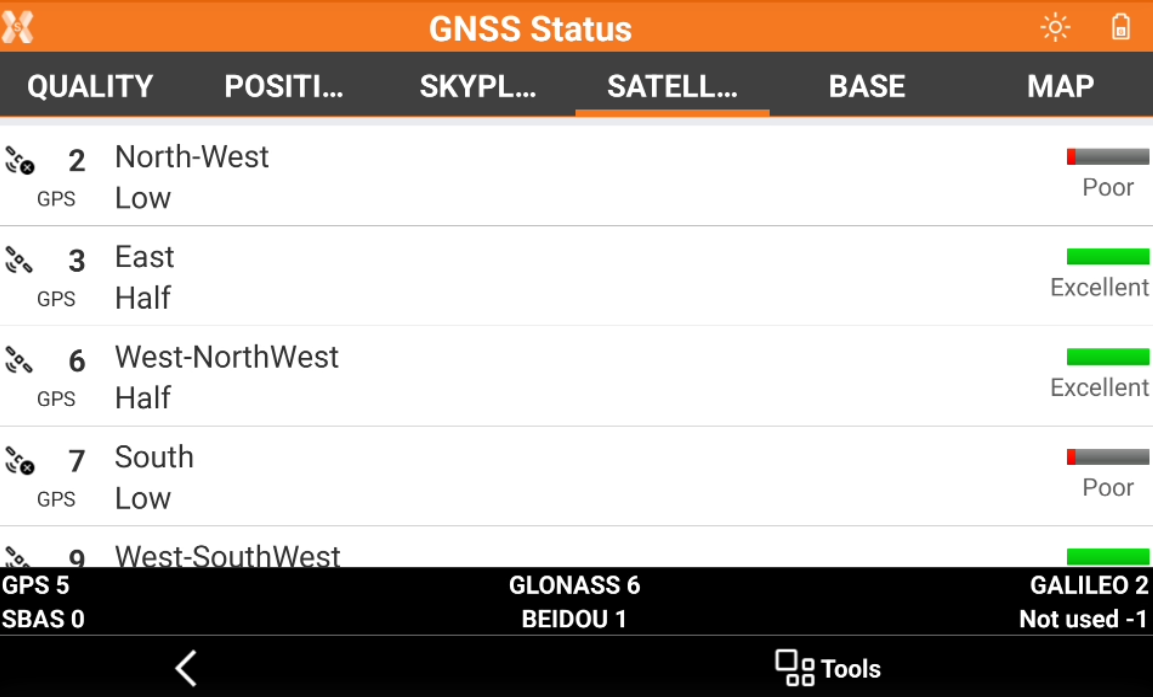
Displays a list of all tracked satellites including related information.
-

-

-
-

-
Base page
-
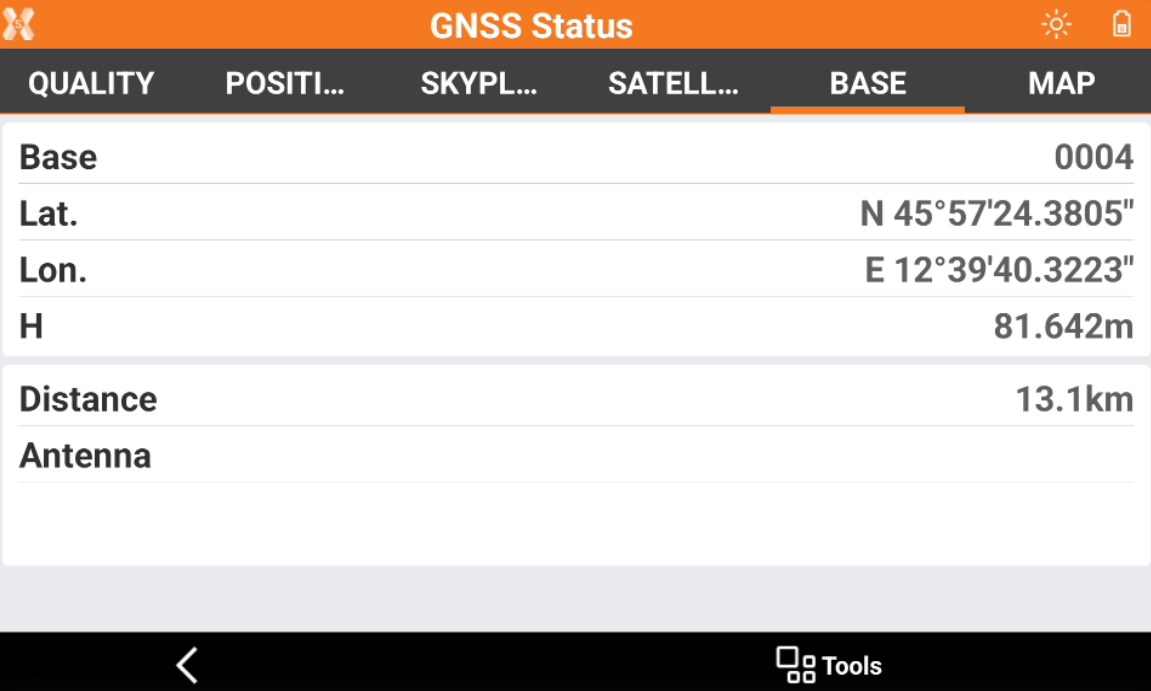
Displays information related to the reference base.
-
Base: name of the base.
-
Lat., Lon., Elevation: coordinates of the base.
-
Distance: distance between base and current position.
-
Antenna: antenna model of the base.
-
Map page
-
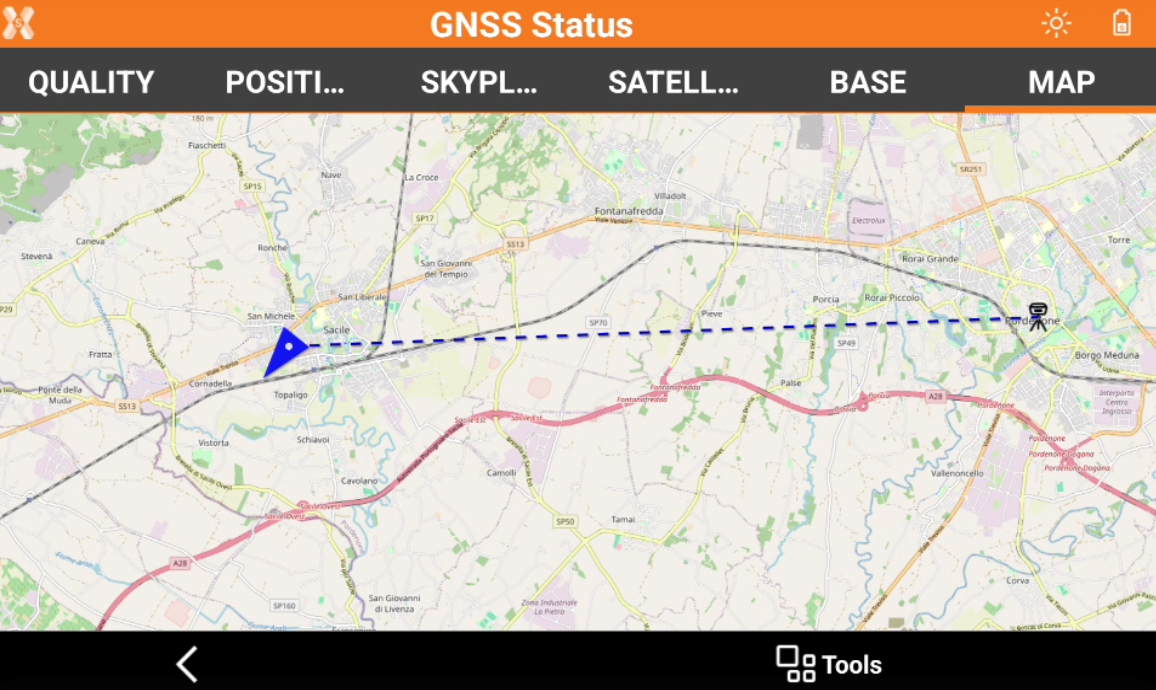
Displays the current position in a map.